Property Record
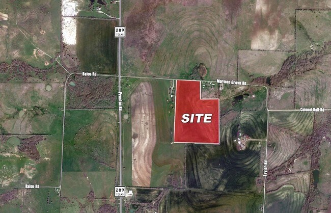
Mormon Grove Rd, Howe, TX 75459

Property Detail
Mormon Grove Rd
Sherman-Denison, TX
G-0488 HERNANDEZ A A-G0488, ACRES 35.267
128587
GRAYSON
Agriculturalland
Texas
B and X Area of moderate flood hazard, usually the area between the limits of the 100-year and 500-year floods.
35.27 AC
2024
Howe
2025
Other Market Areas
001801
NEARBY LISTINGS FOR SALE OR LEASE
-
-
View all Howe listings for sale on LoopNet.com
DEMOGRAPHICS near Mormon Grove Rd
1 mile
3 mile
5 mile
2025 Total Population
80
1,296
6,752
2030 Population
86
1,418
7,401
Pop Growth 2025-2030
+ 7.50%
+ 9.41%
+ 9.61%
Average Age
41
40
39
2025 Total Households
29
462
2,581
HH Growth 2025-2030
+ 6.90%
+ 9.31%
+ 9.69%
Median Household Inc
$114,999
$108,841
$79,350
Avg Household Size
2.70
2.80
2.60
2025 Avg HH Vehicles
2.00
2.00
2.00
Median Home Value
$350,000
$319,333
$305,703
Median Year Built
2010
2002
2001
Nearby Places
Map Layers
Map Styles
 Street
 Aerial
Layers
 Traffic
 Biking
Places
Listings with unknown addresses are not visible on the map
- Restaurants
- Banks
- Shops
- Fitness
- Groceries
SALE & LEASE HISTORY
LISTING DATE
SALE/LEASE

Sep 24, 2016
For Sale
Nearby Properties
Address
Land Use
TOTAL SIZE
Lot Size
Zoning
Address
Land Use
TOTAL SIZE
Lot Size
Zoning
30,704 SF
38.87 AC
Address
Land Use
TOTAL SIZE
Lot Size
Zoning
6,485 SF
240.81 AC
Address
Land Use
TOTAL SIZE
Lot Size
Zoning
6,404 SF
21 AC
Address
Land Use
TOTAL SIZE
Lot Size
Zoning
5,591 SF
70.43 AC
Address
Land Use
TOTAL SIZE
Lot Size
Zoning
3,200 SF
17.32 AC
Address
Land Use
TOTAL SIZE
Lot Size
Zoning
3,084 SF
20 AC
Address
Land Use
TOTAL SIZE
Lot Size
Zoning
3,184 SF
98.36 AC
Address
Land Use
TOTAL SIZE
Lot Size
Zoning
3,693 SF
127.74 AC
Address
Land Use
TOTAL SIZE
Lot Size
Zoning
3,574 SF
30.50 AC
Address
Land Use
TOTAL SIZE
Lot Size
Zoning
15,404 SF
4.93 AC
Address
Land Use
TOTAL SIZE
Lot Size
Zoning
1,600 SF
19.07 AC
Address
Land Use
TOTAL SIZE
Lot Size
Zoning
3,220 SF
7.11 AC
Address
Land Use
TOTAL SIZE
Lot Size
Zoning
5.54 AC
Address
Land Use
TOTAL SIZE
Lot Size
Zoning
2,160 SF
19.98 AC
Address
Land Use
TOTAL SIZE
Lot Size
Zoning
9,872 SF
2.02 AC
Address
Land Use
TOTAL SIZE
Lot Size
Zoning
3,938 SF
145 AC
Address
Land Use
TOTAL SIZE
Lot Size
Zoning
2,510 SF
30.50 AC
Address
Land Use
TOTAL SIZE
Lot Size
Zoning
4,200 SF
0.26 AC
Address
Land Use
TOTAL SIZE
Lot Size
Zoning
1,924 SF
100 AC
Address
Land Use
TOTAL SIZE
Lot Size
Zoning
33.98 AC
Address
Land Use
TOTAL SIZE
Lot Size
Zoning
64 SF
1.50 AC
Address
Land Use
TOTAL SIZE
Lot Size
Zoning
4.12 AC
Address
Land Use
TOTAL SIZE
Lot Size
Zoning
1,920 SF
2 AC
Address
Land Use
TOTAL SIZE
Lot Size
Zoning
2,432 SF
3.90 AC
Address
Land Use
TOTAL SIZE
Lot Size
Zoning
10 AC
Address
Land Use
TOTAL SIZE
Lot Size
Zoning
4.60 AC
Address
Land Use
TOTAL SIZE
Lot Size
Zoning
2,230 SF
3.03 AC
Address
Land Use
TOTAL SIZE
Lot Size
Zoning
Address
Land Use
TOTAL SIZE
Lot Size
Zoning
2.98 AC
Address
Land Use
TOTAL SIZE
Lot Size
Zoning
1,204 SF
60 AC
The World's #1 Commercial Real Estate Marketplace
Connect with us
© 2026 CoStar Group
The information above has been obtained from sources believed reliable. While we do not doubt its accuracy we have not verified it and make no guarantee, warranty or representation about it. It is your responsibility to independently confirm its accuracy and completeness. Any projections, opinions, assumptions, or estimates used are for example only and do not represent the current or future performance of the property. The value of this transaction to you depends on tax and other factors which should be evaluated by your tax, financial, and legal advisors. You and your advisors should conduct a careful, independent investigation of the property to determine to your satisfaction the suitability of the property for your needs.