Property Record
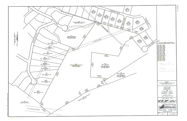
15 Deer Path, Natick, MA 01760

This Property Is For Sale
NEARBY LISTINGS FOR SALE OR LEASE
Property Detail
15 Deer Path
Sfr
Middlesex
AE
Massachusetts
25021C0014F
5.06 AC
2025
Framingham/Natick
2025
Boston
382300
Boston-Cambridge-Newton, MA-NH
4,510 SF
NATI-000061-000000-000059
DEMOGRAPHICS near 15 Deer Path
1 mile
3 mile
5 mile
2024 Total Population
5,062
42,188
127,551
2029 Population
5,023
41,609
127,194
Pop Growth 2024-2029
(0.77%)
(1.37%)
(0.28%)
Average Age
43
41
40
2024 Total Households
1,933
15,690
46,469
HH Growth 2024-2029
(0.98%)
(1.68%)
(0.45%)
Median Household Inc
$183,756
$144,432
$126,158
Avg Household Size
2.60
2.50
2.60
2024 Avg HH Vehicles
2.00
2.00
2.00
Median Home Value
$810,498
$809,387
$827,452
Median Year Built
1973
1963
1963
Nearby Places
Map Layers
Map Styles
 Street
 Aerial
Transit
 Traffic
 Biking
Places
Listings with unknown addresses are not visible on the map
- Restaurants
- Banks
- Shops
- Fitness
- Groceries
PUBLIC TRANSPORTATION
COMMUTER RAIL
Natick (Framingham/Worcester Line - Massachusetts Bay Transportation Authority Commuter Rail (Purple Line))
Drive
Walk
Distance
Natick (Framingham/Worcester Line - Massachusetts Bay Transportation Authority Commuter Rail (Purple Line))
4 min
1.8 mi
West Natick (Framingham/Worcester Line - Massachusetts Bay Transportation Authority Commuter Rail (Purple Line))
Drive
Walk
Distance
West Natick (Framingham/Worcester Line - Massachusetts Bay Transportation Authority Commuter Rail (Purple Line))
8 min
3.9 mi
AIRPORT
General Edward Lawrence Logan International
Drive
Walk
Distance
General Edward Lawrence Logan International
38 min
22.4 mi
Worcester Regional
Drive
Walk
Distance
Worcester Regional
54 min
31.3 mi
Freight Ports
Port of Boston
Drive
Walk
Distance
Port of Boston
37 min
20.7 mi
Nearby Properties
Address
Land Use
TOTAL SIZE
Lot Size
Zoning
Address
Land Use
TOTAL SIZE
Lot Size
Zoning
509,007 SF
22.27 AC
HM-I
Address
Land Use
TOTAL SIZE
Lot Size
Zoning
94,545 SF
11.70 AC
RSA
Address
Land Use
TOTAL SIZE
Lot Size
Zoning
188,746 SF
46.90 AC
RSA
Address
Land Use
TOTAL SIZE
Lot Size
Zoning
15,974 SF
2.45 AC
ED
Address
Land Use
TOTAL SIZE
Lot Size
Zoning
20,704 SF
13.36 AC
PCD
Address
Land Use
TOTAL SIZE
Lot Size
Zoning
165,382 SF
12.46 AC
HPU
Address
Land Use
TOTAL SIZE
Lot Size
Zoning
1,683 SF
46.10 AC
SR15
Address
Land Use
TOTAL SIZE
Lot Size
Zoning
122,748 SF
16.90 AC
HPU
Address
Land Use
TOTAL SIZE
Lot Size
Zoning
79.30 AC
RSA
Address
Land Use
TOTAL SIZE
Lot Size
Zoning
80.85 AC
SR40
Address
Land Use
TOTAL SIZE
Lot Size
Zoning
199,320 SF
16.65 AC
RSA
Address
Land Use
TOTAL SIZE
Lot Size
Zoning
29,022 SF
4.89 AC
RG
Address
Land Use
TOTAL SIZE
Lot Size
Zoning
73,257 SF
10.23 AC
RSA
Address
Land Use
TOTAL SIZE
Lot Size
Zoning
1,592 SF
10.65 AC
ED
Address
Land Use
TOTAL SIZE
Lot Size
Zoning
7.85 AC
SR10
Address
Land Use
TOTAL SIZE
Lot Size
Zoning
182.10 AC
O
Address
Land Use
TOTAL SIZE
Lot Size
Zoning
119,139 SF
6.86 AC
RSA
Address
Land Use
TOTAL SIZE
Lot Size
Zoning
184,086 SF
7.96 AC
RM
Address
Land Use
TOTAL SIZE
Lot Size
Zoning
81,685 SF
5.53 AC
RSC
Address
Land Use
TOTAL SIZE
Lot Size
Zoning
147,999 SF
7.73 AC
HM-II
Address
Land Use
TOTAL SIZE
Lot Size
Zoning
1.55 AC
Address
Land Use
TOTAL SIZE
Lot Size
Zoning
25,846 SF
16.67 AC
RSC
Address
Land Use
TOTAL SIZE
Lot Size
Zoning
64,225 SF
5.19 AC
RSC
Address
Land Use
TOTAL SIZE
Lot Size
Zoning
4,508 SF
87.96 AC
SR20
Address
Land Use
TOTAL SIZE
Lot Size
Zoning
88,314 SF
7.23 AC
CII
Address
Land Use
TOTAL SIZE
Lot Size
Zoning
8.95 AC
SR10
Address
Land Use
TOTAL SIZE
Lot Size
Zoning
71,696 SF
5.45 AC
CII
Address
Land Use
TOTAL SIZE
Lot Size
Zoning
30.60 AC
SR15
Address
Land Use
TOTAL SIZE
Lot Size
Zoning
48,004 SF
6.88 AC
RSA
Address
Land Use
TOTAL SIZE
Lot Size
Zoning
53,878 SF
24.98 AC
RSB
The World's #1 Commercial Real Estate Marketplace
Connect with us
© 2026 CoStar Group
The information above has been obtained from sources believed reliable. While we do not doubt its accuracy we have not verified it and make no guarantee, warranty or representation about it. It is your responsibility to independently confirm its accuracy and completeness. Any projections, opinions, assumptions, or estimates used are for example only and do not represent the current or future performance of the property. The value of this transaction to you depends on tax and other factors which should be evaluated by your tax, financial, and legal advisors. You and your advisors should conduct a careful, independent investigation of the property to determine to your satisfaction the suitability of the property for your needs.