Property Record
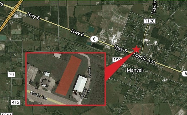
Morris Ave, Manvel, TX 77578

Property Detail
Morris Ave
Houston-Pasadena-The Woodlands, TX
MANVEL LOT OL 86A1 ACRES 0.6618
6398-0164-110
BRAZORIA
Vacantlandnec
Texas
0231
86a1
AO River or stream flood hazard areas, and areas with a 1% or greater chance of shallow flooding each year. These areas have a 26% chance of flooding over the life of a 30-year mortgage.
0.66 AC
2024
South
2025
Houston
660708
NEARBY LISTINGS FOR SALE OR LEASE
DEMOGRAPHICS near Morris Ave
1 mile
3 mile
5 mile
2025 Total Population
1,810
10,140
44,917
2030 Population
2,025
11,451
50,392
Pop Growth 2025-2030
+ 11.88%
+ 12.93%
+ 12.19%
Average Age
39
39
37
2025 Total Households
618
3,469
14,583
HH Growth 2025-2030
+ 11.97%
+ 13.17%
+ 12.46%
Median Household Inc
$91,118
$111,856
$116,031
Avg Household Size
2.90
2.90
3.00
2025 Avg HH Vehicles
2.00
2.00
2.00
Median Home Value
$341,007
$383,480
$369,380
Median Year Built
2003
2009
2008
Nearby Places
Map Layers
Map Styles
 Street
 Aerial
Layers
 Traffic
 Biking
Places
Listings with unknown addresses are not visible on the map
- Restaurants
- Banks
- Shops
- Fitness
- Groceries
PUBLIC TRANSPORTATION
AIRPORT
William P Hobby
Drive
Walk
Distance
William P Hobby
31 min
15.9 mi
Freight Ports
Port of Houston
Drive
Walk
Distance
Port of Houston
39 min
27.4 mi
Nearby Properties
Address
Land Use
TOTAL SIZE
Lot Size
Zoning
Address
Land Use
TOTAL SIZE
Lot Size
Zoning
114.04 AC
Address
Land Use
TOTAL SIZE
Lot Size
Zoning
125,750 SF
28.32 AC
Address
Land Use
TOTAL SIZE
Lot Size
Zoning
120,380 SF
15.56 AC
Address
Land Use
TOTAL SIZE
Lot Size
Zoning
93,990 SF
15.73 AC
Address
Land Use
TOTAL SIZE
Lot Size
Zoning
21.99 AC
0258
Address
Land Use
TOTAL SIZE
Lot Size
Zoning
65,012 SF
13 AC
Address
Land Use
TOTAL SIZE
Lot Size
Zoning
172,015 SF
18.36 AC
Address
Land Use
TOTAL SIZE
Lot Size
Zoning
17.17 AC
Address
Land Use
TOTAL SIZE
Lot Size
Zoning
28,708 SF
9.57 AC
Address
Land Use
TOTAL SIZE
Lot Size
Zoning
46,732 SF
8.64 AC
0752
Address
Land Use
TOTAL SIZE
Lot Size
Zoning
28,143 SF
13.08 AC
Address
Land Use
TOTAL SIZE
Lot Size
Zoning
3,159 SF
64.95 AC
0227
Address
Land Use
TOTAL SIZE
Lot Size
Zoning
21,300 SF
12.92 AC
Address
Land Use
TOTAL SIZE
Lot Size
Zoning
11,628 SF
1.86 AC
0009
Address
Land Use
TOTAL SIZE
Lot Size
Zoning
48,750 SF
2.82 AC
Address
Land Use
TOTAL SIZE
Lot Size
Zoning
50,400 SF
8.40 AC
0013
Address
Land Use
TOTAL SIZE
Lot Size
Zoning
14,768 SF
1.30 AC
Address
Land Use
TOTAL SIZE
Lot Size
Zoning
12,240 SF
1.46 AC
0240
Address
Land Use
TOTAL SIZE
Lot Size
Zoning
136.01 AC
0003
Address
Land Use
TOTAL SIZE
Lot Size
Zoning
34,368 SF
4.32 AC
Address
Land Use
TOTAL SIZE
Lot Size
Zoning
3,504 SF
187.33 AC
0027
Address
Land Use
TOTAL SIZE
Lot Size
Zoning
9,020 SF
3.12 AC
Address
Land Use
TOTAL SIZE
Lot Size
Zoning
3,257 SF
105.55 AC
0428
Address
Land Use
TOTAL SIZE
Lot Size
Zoning
25,200 SF
5.08 AC
Address
Land Use
TOTAL SIZE
Lot Size
Zoning
36,684 SF
1.47 AC
Address
Land Use
TOTAL SIZE
Lot Size
Zoning
9,298 SF
3.22 AC
Address
Land Use
TOTAL SIZE
Lot Size
Zoning
50,958 SF
10.33 AC
Address
Land Use
TOTAL SIZE
Lot Size
Zoning
14,360 SF
1.99 AC
Address
Land Use
TOTAL SIZE
Lot Size
Zoning
14,771 SF
4.18 AC
Address
Land Use
TOTAL SIZE
Lot Size
Zoning
7,662 SF
1.11 AC
The World's #1 Commercial Real Estate Marketplace
Connect with us
© 2026 CoStar Group
The information above has been obtained from sources believed reliable. While we do not doubt its accuracy we have not verified it and make no guarantee, warranty or representation about it. It is your responsibility to independently confirm its accuracy and completeness. Any projections, opinions, assumptions, or estimates used are for example only and do not represent the current or future performance of the property. The value of this transaction to you depends on tax and other factors which should be evaluated by your tax, financial, and legal advisors. You and your advisors should conduct a careful, independent investigation of the property to determine to your satisfaction the suitability of the property for your needs.