Property Record
Morse Rd, Pataskala, OH 43062
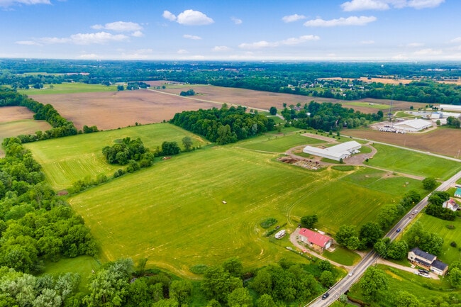
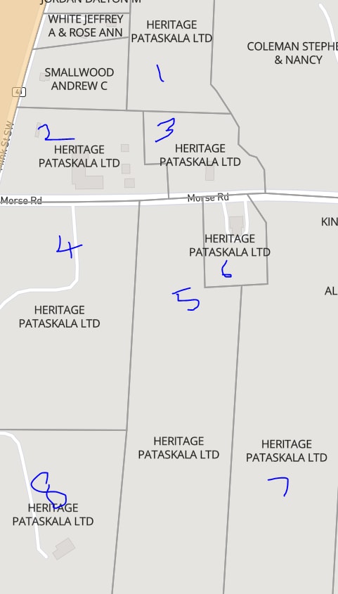
Property Detail
Morse Rd
Columbus, OH
14.983 AC SEC 24 R15 T2 Q3
082-107466-05.002
LICKING
Agriculturalland
Ohio
C and X Area of minimal flood hazard, usually depicted on FIRMs as above the 500-year flood level.
14.98 AC
2025
Licking County
2025
Columbus
756500
NEARBY LISTINGS FOR SALE OR LEASE
DEMOGRAPHICS near Morse Rd
1 mile
3 mile
5 mile
2025 Total Population
539
4,195
44,973
2030 Population
549
4,333
46,235
Pop Growth 2025-2030
+ 1.86%
+ 3.29%
+ 2.81%
Average Age
44
42
38
2025 Total Households
218
1,597
15,512
HH Growth 2025-2030
+ 1.83%
+ 3.26%
+ 2.92%
Median Household Inc
$100,543
$110,328
$112,099
Avg Household Size
2.50
2.60
2.80
2025 Avg HH Vehicles
3.00
2.00
2.00
Median Home Value
$353,571
$405,534
$366,340
Median Year Built
1972
1978
2000
Nearby Places
Map Layers
Map Styles
 Street
 Aerial
Transit
 Traffic
 Biking
Places
Listings with unknown addresses are not visible on the map
- Restaurants
- Banks
- Shops
- Fitness
- Groceries
PUBLIC TRANSPORTATION
AIRPORT
John Glenn Columbus International
Drive
Walk
Distance
John Glenn Columbus International
22 min
13.3 mi
Rickenbacker International
Drive
Walk
Distance
Rickenbacker International
37 min
24.8 mi
Freight Ports
Port of Toledo
Drive
Walk
Distance
Port of Toledo
188 min
150.7 mi
SALE & LEASE HISTORY
LISTING DATE
SALE/LEASE

Sep 27, 2023
For Sale
Feb 14, 2022
For Sale
Nearby Properties
Address
Land Use
TOTAL SIZE
Lot Size
Zoning
Address
Land Use
TOTAL SIZE
Lot Size
Zoning
46,000 SF
214.46 AC
Address
Land Use
TOTAL SIZE
Lot Size
Zoning
14,120 SF
92.69 AC
Address
Land Use
TOTAL SIZE
Lot Size
Zoning
624,564 SF
104.45 AC
Address
Land Use
TOTAL SIZE
Lot Size
Zoning
141,988 SF
219.25 AC
Address
Land Use
TOTAL SIZE
Lot Size
Zoning
772,217 SF
98.64 AC
Address
Land Use
TOTAL SIZE
Lot Size
Zoning
811,338 SF
222.09 AC
Address
Land Use
TOTAL SIZE
Lot Size
Zoning
271,758 SF
131.45 AC
Address
Land Use
TOTAL SIZE
Lot Size
Zoning
340,656 SF
279.62 AC
Address
Land Use
TOTAL SIZE
Lot Size
Zoning
16,016 SF
154.52 AC
Address
Land Use
TOTAL SIZE
Lot Size
Zoning
163,020 SF
35 AC
Address
Land Use
TOTAL SIZE
Lot Size
Zoning
446,500 SF
37.26 AC
Address
Land Use
TOTAL SIZE
Lot Size
Zoning
173,661 SF
40.94 AC
Address
Land Use
TOTAL SIZE
Lot Size
Zoning
506,879 SF
142.43 AC
Address
Land Use
TOTAL SIZE
Lot Size
Zoning
260,064 SF
18.10 AC
Address
Land Use
TOTAL SIZE
Lot Size
Zoning
524,527 SF
27.49 AC
Address
Land Use
TOTAL SIZE
Lot Size
Zoning
351,846 SF
33.05 AC
Address
Land Use
TOTAL SIZE
Lot Size
Zoning
416,945 SF
15.01 AC
Address
Land Use
TOTAL SIZE
Lot Size
Zoning
188,356 SF
18.85 AC
Address
Land Use
TOTAL SIZE
Lot Size
Zoning
372,683 SF
18.14 AC
Address
Land Use
TOTAL SIZE
Lot Size
Zoning
280,800 SF
18.07 AC
Address
Land Use
TOTAL SIZE
Lot Size
Zoning
322,252 SF
22.40 AC
Address
Land Use
TOTAL SIZE
Lot Size
Zoning
303,001 SF
21.34 AC
Address
Land Use
TOTAL SIZE
Lot Size
Zoning
134,309 SF
83.45 AC
Address
Land Use
TOTAL SIZE
Lot Size
Zoning
1,569 SF
175.11 AC
Address
Land Use
TOTAL SIZE
Lot Size
Zoning
303,000 SF
11.49 AC
Address
Land Use
TOTAL SIZE
Lot Size
Zoning
1,809 SF
134.92 AC
Address
Land Use
TOTAL SIZE
Lot Size
Zoning
267,500 SF
10.32 AC
Address
Land Use
TOTAL SIZE
Lot Size
Zoning
206,152 SF
9.61 AC
Address
Land Use
TOTAL SIZE
Lot Size
Zoning
263,356 SF
12.27 AC
Address
Land Use
TOTAL SIZE
Lot Size
Zoning
124,736 SF
24.14 AC
The World's #1 Commercial Real Estate Marketplace
Connect with us
© 2026 CoStar Group
The information above has been obtained from sources believed reliable. While we do not doubt its accuracy we have not verified it and make no guarantee, warranty or representation about it. It is your responsibility to independently confirm its accuracy and completeness. Any projections, opinions, assumptions, or estimates used are for example only and do not represent the current or future performance of the property. The value of this transaction to you depends on tax and other factors which should be evaluated by your tax, financial, and legal advisors. You and your advisors should conduct a careful, independent investigation of the property to determine to your satisfaction the suitability of the property for your needs.