Property Record
Mountain View Rd, King, NC 27021
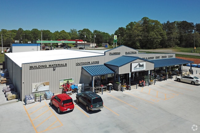

Property Detail
Mountain View Rd
Conveniencestore
STOKES
B-2
North Carolina
B and X Area of moderate flood hazard, usually the area between the limits of the 100-year and 500-year floods.
2.23 AC
2025
Stokes County
2025
Greensboro/Winston-Salem
070503
Winston-Salem, NC
2,680 SF
690304812145
NEARBY LISTINGS FOR SALE OR LEASE
DEMOGRAPHICS near Mountain View Rd
1 mile
3 mile
5 mile
2025 Total Population
1,922
12,580
22,175
2030 Population
1,978
12,929
22,831
Pop Growth 2025-2030
+ 2.91%
+ 2.77%
+ 2.96%
Average Age
43
43
44
2025 Total Households
767
5,147
9,259
HH Growth 2025-2030
+ 3.00%
+ 2.88%
+ 3.03%
Median Household Inc
$69,937
$67,584
$66,229
Avg Household Size
2.50
2.40
2.30
2025 Avg HH Vehicles
2.00
2.00
2.00
Median Home Value
$233,430
$233,485
$224,811
Median Year Built
1985
1986
1985
Nearby Places
Map Layers
Map Styles
 Street
 Aerial
Layers
 Traffic
 Biking
Places
Listings with unknown addresses are not visible on the map
- Restaurants
- Banks
- Shops
- Fitness
- Groceries
PUBLIC TRANSPORTATION
AIRPORT
Piedmont Triad International
Drive
Walk
Distance
Piedmont Triad International
50 min
35.9 mi
Nearby Properties
Address
Land Use
TOTAL SIZE
Lot Size
Zoning
Address
Land Use
TOTAL SIZE
Lot Size
Zoning
70,969 SF
63.74 AC
R-20
Address
Land Use
TOTAL SIZE
Lot Size
Zoning
34,444 SF
44.38 AC
B-2,R-MF-T
Address
Land Use
TOTAL SIZE
Lot Size
Zoning
34,444 SF
44.12 AC
B-2,R-MF-T
Address
Land Use
TOTAL SIZE
Lot Size
Zoning
17,714 SF
5.39 AC
R-15
Address
Land Use
TOTAL SIZE
Lot Size
Zoning
30,836 SF
9.33 AC
L-I
Address
Land Use
TOTAL SIZE
Lot Size
Zoning
34,510 SF
13.74 AC
B-2
Address
Land Use
TOTAL SIZE
Lot Size
Zoning
43,423 SF
9.86 AC
B-2-CU
Address
Land Use
TOTAL SIZE
Lot Size
Zoning
33,170 SF
4.76 AC
R-R
Address
Land Use
TOTAL SIZE
Lot Size
Zoning
48,042 SF
14.98 AC
R-20
Address
Land Use
TOTAL SIZE
Lot Size
Zoning
32,160 SF
8.30 AC
O-I
Address
Land Use
TOTAL SIZE
Lot Size
Zoning
18,930 SF
2.20 AC
L-I
Address
Land Use
TOTAL SIZE
Lot Size
Zoning
12,244 SF
18.58 AC
B-2
Address
Land Use
TOTAL SIZE
Lot Size
Zoning
26,334 SF
22 AC
R-20
Address
Land Use
TOTAL SIZE
Lot Size
Zoning
37,604 SF
4.82 AC
R-MF
Address
Land Use
TOTAL SIZE
Lot Size
Zoning
5,250 SF
2.74 AC
B-2
Address
Land Use
TOTAL SIZE
Lot Size
Zoning
13,516 SF
16.65 AC
R-A
Address
Land Use
TOTAL SIZE
Lot Size
Zoning
126.47 AC
R-A
Address
Land Use
TOTAL SIZE
Lot Size
Zoning
12,523 SF
2 AC
R-15
Address
Land Use
TOTAL SIZE
Lot Size
Zoning
9,312 SF
3 AC
L-I
Address
Land Use
TOTAL SIZE
Lot Size
Zoning
9,236 SF
2.50 AC
B-2
Address
Land Use
TOTAL SIZE
Lot Size
Zoning
8,943 SF
1.59 AC
B-2
Address
Land Use
TOTAL SIZE
Lot Size
Zoning
44,744 SF
1.81 AC
B-2
Address
Land Use
TOTAL SIZE
Lot Size
Zoning
21.98 AC
R-15
Address
Land Use
TOTAL SIZE
Lot Size
Zoning
5,982 SF
2.09 AC
B-2
Address
Land Use
TOTAL SIZE
Lot Size
Zoning
110,049 SF
11.51 AC
H-I
Address
Land Use
TOTAL SIZE
Lot Size
Zoning
5,040 SF
0.98 AC
B-2
Address
Land Use
TOTAL SIZE
Lot Size
Zoning
7,920 SF
17.25 AC
R-20
Address
Land Use
TOTAL SIZE
Lot Size
Zoning
4,414 SF
1.89 AC
B-2
Address
Land Use
TOTAL SIZE
Lot Size
Zoning
11,880 SF
1.74 AC
B-2-CU
The World's #1 Commercial Real Estate Marketplace
Connect with us
© 2026 CoStar Group
The information above has been obtained from sources believed reliable. While we do not doubt its accuracy we have not verified it and make no guarantee, warranty or representation about it. It is your responsibility to independently confirm its accuracy and completeness. Any projections, opinions, assumptions, or estimates used are for example only and do not represent the current or future performance of the property. The value of this transaction to you depends on tax and other factors which should be evaluated by your tax, financial, and legal advisors. You and your advisors should conduct a careful, independent investigation of the property to determine to your satisfaction the suitability of the property for your needs.