Property Record
Mt Carmel Rd, Cincinnati, OH 45244
Property Detail
Mt Carmel Rd
Cincinnati, OH-KY-IN
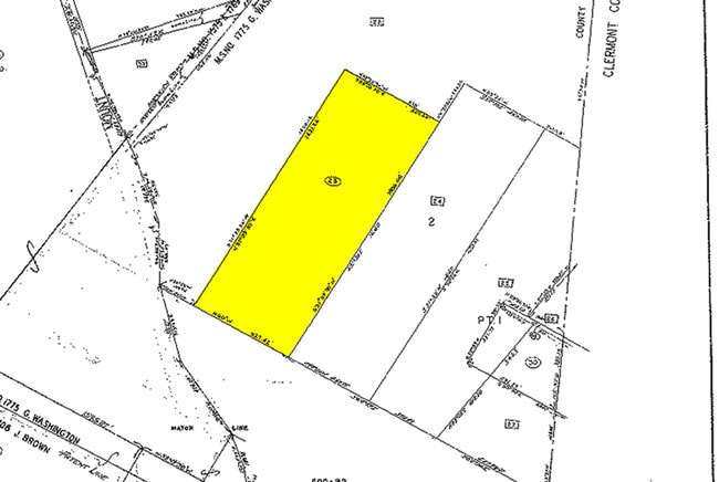
NS MT CARMEL RD 10.0751 ACS SUR 1775 SE G WASHINGTON LITTLE MIAMI SUB
500-0090-0057
HAMILTON
Residentialacreage
Ohio
B and X Area of moderate flood hazard, usually the area between the limits of the 100-year and 500-year floods.
7.03 AC
2025
Eastgate/Anderson Twp
2025
Cincinnati/Dayton
024901
NEARBY LISTINGS FOR SALE OR LEASE
DEMOGRAPHICS near Mt Carmel Rd
1 mile
3 mile
5 mile
2025 Total Population
1,118
26,708
110,265
2030 Population
1,144
27,212
111,714
Pop Growth 2025-2030
+ 2.33%
+ 1.89%
+ 1.31%
Average Age
42
42
41
2025 Total Households
405
10,922
43,965
HH Growth 2025-2030
+ 2.47%
+ 2.23%
+ 1.56%
Median Household Inc
$135,465
$84,238
$92,488
Avg Household Size
2.80
2.40
2.40
2025 Avg HH Vehicles
2.00
2.00
2.00
Median Home Value
$379,999
$344,161
$329,532
Median Year Built
1983
1975
1974
Nearby Places
Map Layers
Map Styles
 Street
 Aerial
Transit
 Traffic
 Biking
Places
Listings with unknown addresses are not visible on the map
- Restaurants
- Banks
- Shops
- Fitness
- Groceries
PUBLIC TRANSPORTATION
AIRPORT
Cincinnati/Northern Kentucky International
Drive
Walk
Distance
Cincinnati/Northern Kentucky International
49 min
29.7 mi
Freight Ports
Port of Toledo
Drive
Walk
Distance
Port of Toledo
250 min
209.9 mi
Nearby Properties
Address
Land Use
TOTAL SIZE
Lot Size
Zoning
Address
Land Use
TOTAL SIZE
Lot Size
Zoning
2,555 SF
23.68 AC
Address
Land Use
TOTAL SIZE
Lot Size
Zoning
1,205 SF
41.47 AC
Address
Land Use
TOTAL SIZE
Lot Size
Zoning
4,938 SF
18.99 AC
Address
Land Use
TOTAL SIZE
Lot Size
Zoning
49.27 AC
Address
Land Use
TOTAL SIZE
Lot Size
Zoning
10.89 AC
Address
Land Use
TOTAL SIZE
Lot Size
Zoning
27.01 AC
Address
Land Use
TOTAL SIZE
Lot Size
Zoning
220,050 SF
33 AC
Address
Land Use
TOTAL SIZE
Lot Size
Zoning
221,360 SF
34.62 AC
Address
Land Use
TOTAL SIZE
Lot Size
Zoning
49.66 AC
Address
Land Use
TOTAL SIZE
Lot Size
Zoning
62,823 SF
8.24 AC
Address
Land Use
TOTAL SIZE
Lot Size
Zoning
9.59 AC
Address
Land Use
TOTAL SIZE
Lot Size
Zoning
75,944 SF
4.09 AC
Address
Land Use
TOTAL SIZE
Lot Size
Zoning
13.89 AC
Address
Land Use
TOTAL SIZE
Lot Size
Zoning
4,800 SF
3.41 AC
Address
Land Use
TOTAL SIZE
Lot Size
Zoning
19,843 SF
4 AC
Address
Land Use
TOTAL SIZE
Lot Size
Zoning
32,024 SF
3.24 AC
Address
Land Use
TOTAL SIZE
Lot Size
Zoning
74,252 SF
20.47 AC
Address
Land Use
TOTAL SIZE
Lot Size
Zoning
36,380 SF
5.45 AC
Address
Land Use
TOTAL SIZE
Lot Size
Zoning
102,891 SF
20.87 AC
Address
Land Use
TOTAL SIZE
Lot Size
Zoning
15,560 SF
37.03 AC
Address
Land Use
TOTAL SIZE
Lot Size
Zoning
14,223 SF
7.22 AC
Address
Land Use
TOTAL SIZE
Lot Size
Zoning
27,957 SF
29.54 AC
Address
Land Use
TOTAL SIZE
Lot Size
Zoning
14.28 AC
DD
Address
Land Use
TOTAL SIZE
Lot Size
Zoning
3,282 SF
1.47 AC
B
Address
Land Use
TOTAL SIZE
Lot Size
Zoning
70.36 AC
A
Address
Land Use
TOTAL SIZE
Lot Size
Zoning
17,485 SF
24.29 AC
Address
Land Use
TOTAL SIZE
Lot Size
Zoning
29,852 SF
6.39 AC
Address
Land Use
TOTAL SIZE
Lot Size
Zoning
5.97 AC
EPUDSPI
Address
Land Use
TOTAL SIZE
Lot Size
Zoning
11,706 SF
1.96 AC
Address
Land Use
TOTAL SIZE
Lot Size
Zoning
3,225 SF
69.98 AC
The World's #1 Commercial Real Estate Marketplace
Connect with us
© 2026 CoStar Group
The information above has been obtained from sources believed reliable. While we do not doubt its accuracy we have not verified it and make no guarantee, warranty or representation about it. It is your responsibility to independently confirm its accuracy and completeness. Any projections, opinions, assumptions, or estimates used are for example only and do not represent the current or future performance of the property. The value of this transaction to you depends on tax and other factors which should be evaluated by your tax, financial, and legal advisors. You and your advisors should conduct a careful, independent investigation of the property to determine to your satisfaction the suitability of the property for your needs.