Property Record
Mt Carmel Rd, Upperco, MD 21155

Save to a Folder
{{folder.Name}}
{{folder.ListingIds.length}} Properties
{{folder.ListingIds.length}} Property
Create a New Folder
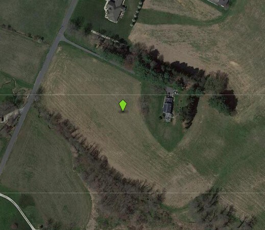
Property Detail
Mt Carmel Rd
Baltimore-Columbia-Towson, MD
11.75 AC
05-0516000381
BALTIMORE
Agriculturalland
Maryland
A Areas with a 1% annual chance of flooding and a 26% chance of flooding over the life of a 30-year mortgage.
11.75 AC
2024
Route 83 Corridor North
2025
Baltimore
405000
NEARBY LISTINGS FOR SALE OR LEASE
DEMOGRAPHICS near Mt Carmel Rd
1 mile
3 mile
5 mile
2025 Total Population
154
6,438
17,868
2030 Population
150
6,457
17,989
Pop Growth 2025-2030
(2.60%)
+ 0.30%
+ 0.68%
Average Age
46
41
42
2025 Total Households
58
2,522
6,832
HH Growth 2025-2030
(1.72%)
+ 0.36%
+ 0.69%
Median Household Inc
$110,714
$104,224
$110,393
Avg Household Size
2.60
2.50
2.60
2025 Avg HH Vehicles
3.00
2.00
2.00
Median Home Value
$560,000
$365,452
$396,336
Median Year Built
1973
1983
1981
Nearby Places
Map Layers
Map Styles
 Street
 Aerial
Layers
 Traffic
 Biking
Places
Listings with unknown addresses are not visible on the map
- Restaurants
- Banks
- Shops
- Fitness
- Groceries
Nearby Properties
Address
Land Use
TOTAL SIZE
Lot Size
Zoning
Address
Land Use
TOTAL SIZE
Lot Size
Zoning
842,295 SF
134.68 AC
RESTR
Address
Land Use
TOTAL SIZE
Lot Size
Zoning
58,095 SF
19.95 AC
Address
Land Use
TOTAL SIZE
Lot Size
Zoning
52,728 SF
13.88 AC
GENER
Address
Land Use
TOTAL SIZE
Lot Size
Zoning
210,288 SF
38.44 AC
RESTR
Address
Land Use
TOTAL SIZE
Lot Size
Zoning
32,220 SF
0.01 AC
Address
Land Use
TOTAL SIZE
Lot Size
Zoning
10,642 SF
2.30 AC
LOCAL
Address
Land Use
TOTAL SIZE
Lot Size
Zoning
7,696 SF
2.84 AC
GENER
Address
Land Use
TOTAL SIZE
Lot Size
Zoning
20,705 SF
182.66 AC
RC2
Address
Land Use
TOTAL SIZE
Lot Size
Zoning
11,860 SF
1.64 AC
LOCAL
Address
Land Use
TOTAL SIZE
Lot Size
Zoning
13,657 SF
4.05 AC
PRIVA
Address
Land Use
TOTAL SIZE
Lot Size
Zoning
33,350 SF
3.50 AC
HISTO
Address
Land Use
TOTAL SIZE
Lot Size
Zoning
9,832 SF
65.67 AC
Address
Land Use
TOTAL SIZE
Lot Size
Zoning
3,864 SF
4.87 AC
C-2
Address
Land Use
TOTAL SIZE
Lot Size
Zoning
9,100 SF
0.85 AC
GENER
Address
Land Use
TOTAL SIZE
Lot Size
Zoning
1,892 SF
36.10 AC
RESTR
Address
Land Use
TOTAL SIZE
Lot Size
Zoning
6,932 SF
68.29 AC
Address
Land Use
TOTAL SIZE
Lot Size
Zoning
7,182 SF
110.50 AC
Address
Land Use
TOTAL SIZE
Lot Size
Zoning
3,008 SF
0.69 AC
HISTO
Address
Land Use
TOTAL SIZE
Lot Size
Zoning
6,495 SF
40 AC
Address
Land Use
TOTAL SIZE
Lot Size
Zoning
6,050 SF
81.19 AC
Address
Land Use
TOTAL SIZE
Lot Size
Zoning
5,873 SF
10 AC
R-200
Address
Land Use
TOTAL SIZE
Lot Size
Zoning
12.01 AC
RESTR
Address
Land Use
TOTAL SIZE
Lot Size
Zoning
1,120 SF
28.76 AC
CONSE
Address
Land Use
TOTAL SIZE
Lot Size
Zoning
6,269 SF
81.38 AC
Address
Land Use
TOTAL SIZE
Lot Size
Zoning
5,362 SF
1.29 AC
GENER
Address
Land Use
TOTAL SIZE
Lot Size
Zoning
5,600 SF
2.50 AC
LOCAL
Address
Land Use
TOTAL SIZE
Lot Size
Zoning
4,764 SF
3.54 AC
R-100
Address
Land Use
TOTAL SIZE
Lot Size
Zoning
8,100 SF
2.71 AC
I-1
Address
Land Use
TOTAL SIZE
Lot Size
Zoning
2,940 SF
1.84 AC
C-2
Address
Land Use
TOTAL SIZE
Lot Size
Zoning
8,135 SF
50.44 AC
The World's #1 Commercial Real Estate Marketplace
Connect with us
© 2026 CoStar Group
The information above has been obtained from sources believed reliable. While we do not doubt its accuracy we have not verified it and make no guarantee, warranty or representation about it. It is your responsibility to independently confirm its accuracy and completeness. Any projections, opinions, assumptions, or estimates used are for example only and do not represent the current or future performance of the property. The value of this transaction to you depends on tax and other factors which should be evaluated by your tax, financial, and legal advisors. You and your advisors should conduct a careful, independent investigation of the property to determine to your satisfaction the suitability of the property for your needs.