Property Record
Mt Vernon Dr, Baltimore, MD 21207
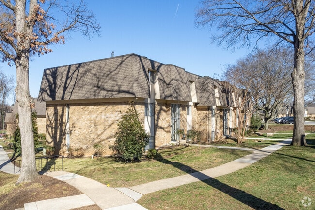


Property Detail
Mt Vernon Dr
01-0101500403
13.9659 AC SS
Apartment
BALTIMORE
DR16
Maryland
B and X Area of moderate flood hazard, usually the area between the limits of the 100-year and 500-year floods.
13.97 AC
2024
Outer W Baltimore County
2025
Baltimore
401200
Baltimore-Columbia-Towson, MD
NEARBY LISTINGS FOR SALE OR LEASE
DEMOGRAPHICS near Mt Vernon Dr
1 mile
3 mile
5 mile
2025 Total Population
14,643
153,150
396,514
2030 Population
14,605
151,834
395,542
Pop Growth 2025-2030
(0.26%)
(0.86%)
(0.25%)
Average Age
41
41
40
2025 Total Households
6,282
61,083
159,665
HH Growth 2025-2030
(0.32%)
(1.02%)
(0.41%)
Median Household Inc
$63,667
$63,588
$62,000
Avg Household Size
2.30
2.40
2.40
2025 Avg HH Vehicles
1.00
1.00
1.00
Median Home Value
$237,321
$257,843
$268,788
Median Year Built
1959
1956
1956
Nearby Places
Map Layers
Map Styles
 Street
 Aerial
Layers
 Traffic
 Biking
Places
Listings with unknown addresses are not visible on the map
- Restaurants
- Banks
- Shops
- Fitness
- Groceries
PUBLIC TRANSPORTATION
COMMUTER RAIL
West Baltimore Marc Sb (PENN - WASHINGTON - Maryland Transit Administration)
Drive
Walk
Distance
West Baltimore Marc Sb (PENN - WASHINGTON - Maryland Transit Administration)
11 min
4.2 mi
Halethorpe Marc Sb (PENN - WASHINGTON - Maryland Transit Administration)
Drive
Walk
Distance
Halethorpe Marc Sb (PENN - WASHINGTON - Maryland Transit Administration)
13 min
7.2 mi
AIRPORT
Baltimore/Washington International Thurgood Marshall
Drive
Walk
Distance
Baltimore/Washington International Thurgood Marshall
19 min
10.9 mi
Freight Ports
Port of Baltimore
Drive
Walk
Distance
Port of Baltimore
22 min
12.3 mi
Nearby Properties
Address
Land Use
TOTAL SIZE
Lot Size
Zoning
Address
Land Use
TOTAL SIZE
Lot Size
Zoning
2,182,087 SF
95.52 AC
DR5.5
Address
Land Use
TOTAL SIZE
Lot Size
Zoning
1,809,709 SF
50 AC
DR3.5
Address
Land Use
TOTAL SIZE
Lot Size
Zoning
883,140 SF
57.77 AC
MLR
Address
Land Use
TOTAL SIZE
Lot Size
Zoning
608,642 SF
56.37 AC
DR3.5
Address
Land Use
TOTAL SIZE
Lot Size
Zoning
98,318 SF
175.16 AC
OT
Address
Land Use
TOTAL SIZE
Lot Size
Zoning
271,096 SF
6 AC
02
Address
Land Use
TOTAL SIZE
Lot Size
Zoning
278,271 SF
55.16 AC
DR5.5
Address
Land Use
TOTAL SIZE
Lot Size
Zoning
233,082 SF
10.98 AC
Address
Land Use
TOTAL SIZE
Lot Size
Zoning
29.11 AC
DR16
Address
Land Use
TOTAL SIZE
Lot Size
Zoning
26.14 AC
DR16
Address
Land Use
TOTAL SIZE
Lot Size
Zoning
27.75 AC
DR16
Address
Land Use
TOTAL SIZE
Lot Size
Zoning
184,320 SF
13.37 AC
DR5.5
Address
Land Use
TOTAL SIZE
Lot Size
Zoning
16.75 AC
MLR02
Address
Land Use
TOTAL SIZE
Lot Size
Zoning
29.14 AC
DR16
Address
Land Use
TOTAL SIZE
Lot Size
Zoning
312,231 SF
11.23 AC
R-5
Address
Land Use
TOTAL SIZE
Lot Size
Zoning
325,851 SF
19 AC
EC-2
Address
Land Use
TOTAL SIZE
Lot Size
Zoning
3,032 SF
87 SF
H
Address
Land Use
TOTAL SIZE
Lot Size
Zoning
131,176 SF
33.97 AC
BMCT
Address
Land Use
TOTAL SIZE
Lot Size
Zoning
23,962 SF
17.31 AC
BRCS2
Address
Land Use
TOTAL SIZE
Lot Size
Zoning
156,834 SF
10.26 AC
DR5.5
Address
Land Use
TOTAL SIZE
Lot Size
Zoning
23.78 AC
DR5.5
Address
Land Use
TOTAL SIZE
Lot Size
Zoning
22.99 AC
DR16
Address
Land Use
TOTAL SIZE
Lot Size
Zoning
197,754 SF
12.63 AC
DR5.5
Address
Land Use
TOTAL SIZE
Lot Size
Zoning
330,025 SF
13.16 AC
R-3
Address
Land Use
TOTAL SIZE
Lot Size
Zoning
194,844 SF
14.33 AC
ML
Address
Land Use
TOTAL SIZE
Lot Size
Zoning
15.29 AC
BLCCL
Address
Land Use
TOTAL SIZE
Lot Size
Zoning
19.35 AC
DR16
Address
Land Use
TOTAL SIZE
Lot Size
Zoning
12.07 AC
DR16
Address
Land Use
TOTAL SIZE
Lot Size
Zoning
15.08 AC
DR105
Address
Land Use
TOTAL SIZE
Lot Size
Zoning
11.01 AC
DR16
The World's #1 Commercial Real Estate Marketplace
Connect with us
© 2026 CoStar Group
The information above has been obtained from sources believed reliable. While we do not doubt its accuracy we have not verified it and make no guarantee, warranty or representation about it. It is your responsibility to independently confirm its accuracy and completeness. Any projections, opinions, assumptions, or estimates used are for example only and do not represent the current or future performance of the property. The value of this transaction to you depends on tax and other factors which should be evaluated by your tax, financial, and legal advisors. You and your advisors should conduct a careful, independent investigation of the property to determine to your satisfaction the suitability of the property for your needs.