Property Record
Mullica Hill Rd, Harrison, NJ 07029

Save to a Folder
{{folder.Name}}
{{folder.ListingIds.length}} Properties
{{folder.ListingIds.length}} Property
Create a New Folder
Property Detail
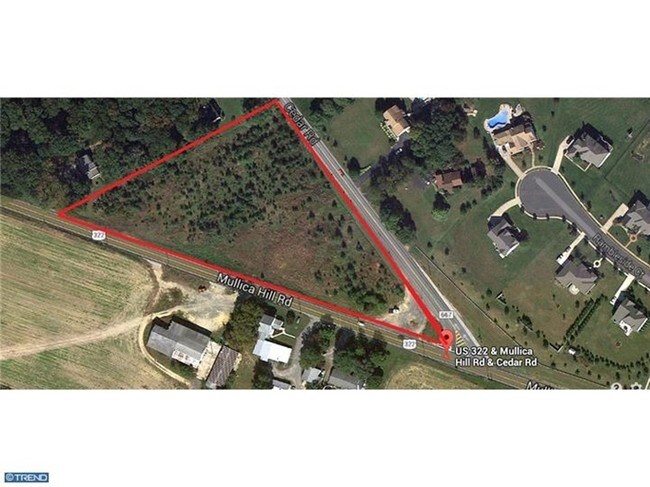
Mullica Hill Rd
08-00032-0000-00004
GLOUCESTER
Vacantlandnec
New Jersey
PO
4
B and X Area of moderate flood hazard, usually the area between the limits of the 100-year and 500-year floods.
4.05 AC
2025
Gloucester County
2026
Philadelphia
013600
Philadelphia-Camden-Wilmington, PA-NJ-DE-MD
NEARBY LISTINGS FOR SALE OR LEASE
DEMOGRAPHICS near Mullica Hill Rd
1 mile
3 mile
5 mile
2025 Total Population
2,236
23,971
81,989
2030 Population
2,306
24,623
84,569
Pop Growth 2025-2030
+ 3.13%
+ 2.72%
+ 3.15%
Average Age
38
41
40
2025 Total Households
656
8,713
28,509
HH Growth 2025-2030
+ 3.20%
+ 2.82%
+ 3.43%
Median Household Inc
$218,560
$114,674
$107,486
Avg Household Size
3.30
2.70
2.60
2025 Avg HH Vehicles
3.00
2.00
2.00
Median Home Value
$638,235
$425,196
$364,762
Median Year Built
1998
1987
1985
Nearby Places
Map Layers
Map Styles
 Street
 Aerial
Layers
 Traffic
 Biking
Places
Listings with unknown addresses are not visible on the map
- Restaurants
- Banks
- Shops
- Fitness
- Groceries
PUBLIC TRANSPORTATION
AIRPORT
Philadelphia International
Drive
Walk
Distance
Philadelphia International
40 min
23.2 mi
Atlantic City International
Drive
Walk
Distance
Atlantic City International
79 min
45.4 mi
Freight Ports
Broadway Terminal - Pier 5
Drive
Walk
Distance
Broadway Terminal - Pier 5
25 min
17.1 mi
SALE & LEASE HISTORY
LISTING DATE
SALE/LEASE

Sep 24, 2016
For Sale
Nearby Properties
Address
Land Use
TOTAL SIZE
Lot Size
Zoning
Address
Land Use
TOTAL SIZE
Lot Size
Zoning
2,302 SF
61.32 AC
C55
Address
Land Use
TOTAL SIZE
Lot Size
Zoning
80.26 AC
INS
Address
Land Use
TOTAL SIZE
Lot Size
Zoning
25.71 AC
Address
Land Use
TOTAL SIZE
Lot Size
Zoning
4.89 AC
RA
Address
Land Use
TOTAL SIZE
Lot Size
Zoning
13.76 AC
INS
Address
Land Use
TOTAL SIZE
Lot Size
Zoning
24.79 AC
R1
Address
Land Use
TOTAL SIZE
Lot Size
Zoning
7.53 AC
RA
Address
Land Use
TOTAL SIZE
Lot Size
Zoning
Address
Land Use
TOTAL SIZE
Lot Size
Zoning
5,893 SF
12.79 AC
INSH
Address
Land Use
TOTAL SIZE
Lot Size
Zoning
7.85 AC
R12
Address
Land Use
TOTAL SIZE
Lot Size
Zoning
13.20 AC
INS
Address
Land Use
TOTAL SIZE
Lot Size
Zoning
25.47 AC
I
Address
Land Use
TOTAL SIZE
Lot Size
Zoning
3.79 AC
PRC
Address
Land Use
TOTAL SIZE
Lot Size
Zoning
5.15 AC
C1
Address
Land Use
TOTAL SIZE
Lot Size
Zoning
5.28 AC
RA
Address
Land Use
TOTAL SIZE
Lot Size
Zoning
8.66 AC
I
Address
Land Use
TOTAL SIZE
Lot Size
Zoning
22.93 AC
Address
Land Use
TOTAL SIZE
Lot Size
Zoning
10 AC
C2
Address
Land Use
TOTAL SIZE
Lot Size
Zoning
3.90 AC
INS
Address
Land Use
TOTAL SIZE
Lot Size
Zoning
19.15 AC
INS
Address
Land Use
TOTAL SIZE
Lot Size
Zoning
13.51 AC
RA
Address
Land Use
TOTAL SIZE
Lot Size
Zoning
Address
Land Use
TOTAL SIZE
Lot Size
Zoning
5 AC
AR
Address
Land Use
TOTAL SIZE
Lot Size
Zoning
177.74 AC
AR
Address
Land Use
TOTAL SIZE
Lot Size
Zoning
8 AC
C2
Address
Land Use
TOTAL SIZE
Lot Size
Zoning
7.28 AC
Address
Land Use
TOTAL SIZE
Lot Size
Zoning
2.42 AC
R1
Address
Land Use
TOTAL SIZE
Lot Size
Zoning
26.14 AC
C55
Address
Land Use
TOTAL SIZE
Lot Size
Zoning
4.73 AC
R1
Address
Land Use
TOTAL SIZE
Lot Size
Zoning
2,984 SF
5.27 AC
R1
The World's #1 Commercial Real Estate Marketplace
Connect with us
© 2026 CoStar Group
The information above has been obtained from sources believed reliable. While we do not doubt its accuracy we have not verified it and make no guarantee, warranty or representation about it. It is your responsibility to independently confirm its accuracy and completeness. Any projections, opinions, assumptions, or estimates used are for example only and do not represent the current or future performance of the property. The value of this transaction to you depends on tax and other factors which should be evaluated by your tax, financial, and legal advisors. You and your advisors should conduct a careful, independent investigation of the property to determine to your satisfaction the suitability of the property for your needs.