Property Record
Mullikin Rd, Evans, GA 30809

Property Detail
Mullikin Rd
Augusta-Richmond County, GA-SC
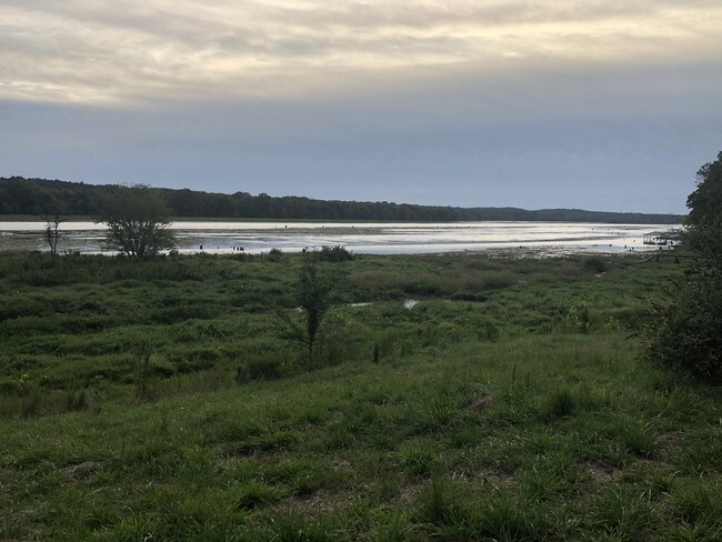
TRACT A 60.77 ACS; COMB 077 050B; W/077 050G
077-050B
COLUMBIA
Vacantlandnec
Georgia
B and X Area of moderate flood hazard, usually the area between the limits of the 100-year and 500-year floods.
60.77 AC
2025
Outlying Columbia County
2025
Augusta/Richmond County
030311
NEARBY LISTINGS FOR SALE OR LEASE
DEMOGRAPHICS near Mullikin Rd
1 mile
3 mile
5 mile
2025 Total Population
4,280
24,708
67,431
2030 Population
4,508
26,108
70,498
Pop Growth 2025-2030
+ 5.33%
+ 5.67%
+ 4.55%
Average Age
39
42
41
2025 Total Households
1,434
8,796
25,070
HH Growth 2025-2030
+ 5.37%
+ 5.70%
+ 4.43%
Median Household Inc
$153,314
$129,341
$105,898
Avg Household Size
3.00
2.70
2.60
2025 Avg HH Vehicles
2.00
2.00
2.00
Median Home Value
$395,980
$390,059
$334,216
Median Year Built
2002
1997
1993
Nearby Places
Map Layers
Map Styles
 Street
 Aerial
Transit
 Traffic
 Biking
Places
Listings with unknown addresses are not visible on the map
- Restaurants
- Banks
- Shops
- Fitness
- Groceries
PUBLIC TRANSPORTATION
AIRPORT
Augusta Regional at Bush Field
Drive
Walk
Distance
Augusta Regional at Bush Field
36 min
21.2 mi
Freight Ports
Georgia Ports - Savannah
Drive
Walk
Distance
Georgia Ports - Savannah
170 min
130.4 mi
SALE & LEASE HISTORY
LISTING DATE
SALE/LEASE

Jan 28, 2020
For Sale
Nearby Properties
Address
Land Use
TOTAL SIZE
Lot Size
Zoning
Address
Land Use
TOTAL SIZE
Lot Size
Zoning
52.46 AC
Address
Land Use
TOTAL SIZE
Lot Size
Zoning
2,070 SF
24.68 AC
Address
Land Use
TOTAL SIZE
Lot Size
Zoning
13.19 AC
Address
Land Use
TOTAL SIZE
Lot Size
Zoning
57,341 SF
54.33 AC
Address
Land Use
TOTAL SIZE
Lot Size
Zoning
100 SF
16.05 AC
Address
Land Use
TOTAL SIZE
Lot Size
Zoning
16,323 SF
24.61 AC
Address
Land Use
TOTAL SIZE
Lot Size
Zoning
53,653 SF
11.26 AC
Address
Land Use
TOTAL SIZE
Lot Size
Zoning
6,000 SF
Address
Land Use
TOTAL SIZE
Lot Size
Zoning
17,977 SF
21.43 AC
Address
Land Use
TOTAL SIZE
Lot Size
Zoning
4,800 SF
24.43 AC
PUD
Address
Land Use
TOTAL SIZE
Lot Size
Zoning
69,425 SF
14.17 AC
Address
Land Use
TOTAL SIZE
Lot Size
Zoning
9,952 SF
11 AC
C-2;GEN CO
Address
Land Use
TOTAL SIZE
Lot Size
Zoning
89,522 SF
5.83 AC
Address
Land Use
TOTAL SIZE
Lot Size
Zoning
84,414 SF
20.77 AC
Address
Land Use
TOTAL SIZE
Lot Size
Zoning
567,959 SF
40.61 AC
M-1;LIGHT
Address
Land Use
TOTAL SIZE
Lot Size
Zoning
45,073 SF
7.99 AC
Address
Land Use
TOTAL SIZE
Lot Size
Zoning
5,000 SF
14.96 AC
Address
Land Use
TOTAL SIZE
Lot Size
Zoning
1,792 SF
199.01 AC
R2
Address
Land Use
TOTAL SIZE
Lot Size
Zoning
550 SF
2.10 AC
Address
Land Use
TOTAL SIZE
Lot Size
Zoning
18,582 SF
0.83 AC
Address
Land Use
TOTAL SIZE
Lot Size
Zoning
93,480 SF
2.68 AC
Address
Land Use
TOTAL SIZE
Lot Size
Zoning
1,840 SF
3.84 AC
Address
Land Use
TOTAL SIZE
Lot Size
Zoning
8,228 SF
11.45 AC
Address
Land Use
TOTAL SIZE
Lot Size
Zoning
32,160 SF
1.46 AC
PUD;PLAN U
Address
Land Use
TOTAL SIZE
Lot Size
Zoning
1,617 SF
16.82 AC
Address
Land Use
TOTAL SIZE
Lot Size
Zoning
32,723 SF
4.17 AC
PUD
Address
Land Use
TOTAL SIZE
Lot Size
Zoning
52,352 SF
11.16 AC
Address
Land Use
TOTAL SIZE
Lot Size
Zoning
5,900 SF
9.39 AC
PUD;PLAN U
Address
Land Use
TOTAL SIZE
Lot Size
Zoning
18,326 SF
7 AC
S-1;SPECIA
Address
Land Use
TOTAL SIZE
Lot Size
Zoning
87,000 SF
16.75 AC
The World's #1 Commercial Real Estate Marketplace
Connect with us
© 2026 CoStar Group
The information above has been obtained from sources believed reliable. While we do not doubt its accuracy we have not verified it and make no guarantee, warranty or representation about it. It is your responsibility to independently confirm its accuracy and completeness. Any projections, opinions, assumptions, or estimates used are for example only and do not represent the current or future performance of the property. The value of this transaction to you depends on tax and other factors which should be evaluated by your tax, financial, and legal advisors. You and your advisors should conduct a careful, independent investigation of the property to determine to your satisfaction the suitability of the property for your needs.