Property Record
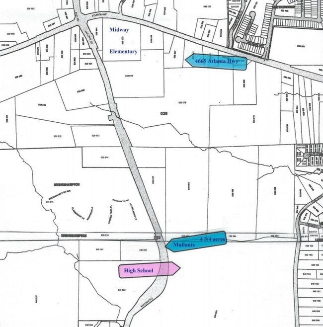
Mullinax Rd, Alpharetta, GA 30004


NEARBY LISTINGS FOR SALE OR LEASE
Property Detail
Mullinax Rd
Atlanta-Sandy Springs-Roswell, GA
Hwy S Comm Grassland 09 N
040-001
2-1 546
Commercialnec
Forsyth
X
Georgia
13117C0138F
546
2024
4.74 AC
2025
N Fulton/Forsyth County
011661
Atlanta
DEMOGRAPHICS near Mullinax Rd
1 Mile
3 Mile
5 Mile
2024 Total Population
3,790
48,119
127,421
2029 Population
4,412
55,121
142,805
Pop Growth 2024-2029
+ 16.41%
+ 14.55%
+ 12.07%
Average Age
36
37
38
2024 Total Households
1,232
16,126
43,413
HH Growth 2024-2029
+ 16.48%
+ 14.89%
+ 11.92%
Median Household Inc
$111,275
$139,274
$132,056
Avg Household Size
3.00
2.90
2.90
2024 Avg HH Vehicles
2.00
2.00
2.00
Median Home Value
$475,635
$480,814
$475,022
Median Year Built
2009
2007
2003
Nearby Places
Map Layers
Map Styles
 Street
 Aerial
- Restaurants
- Banks
- Shops
- Fitness
- Groceries
SALE & LEASE HISTORY
LISTING DATE
SALE/LEASE

Sep 03, 2020
For Sale
Oct 26, 2016
For Sale
Nearby Properties
Address
Land Use
TOTAL SIZE
Lot Size
Zoning
Address
Land Use
TOTAL SIZE
Lot Size
Zoning
383,859 SF
9.55 AC
CBD
Address
Land Use
TOTAL SIZE
Lot Size
Zoning
406,800 SF
11.61 AC
MP
Address
Land Use
TOTAL SIZE
Lot Size
Zoning
477,112 SF
20.58 AC
MP
Address
Land Use
TOTAL SIZE
Lot Size
Zoning
328,265 SF
4 AC
MP
Address
Land Use
TOTAL SIZE
Lot Size
Zoning
281,780 SF
19.08 AC
PUD
Address
Land Use
TOTAL SIZE
Lot Size
Zoning
10,908 SF
107.57 AC
RES3
Address
Land Use
TOTAL SIZE
Lot Size
Zoning
309,293 SF
16 AC
CBD
Address
Land Use
TOTAL SIZE
Lot Size
Zoning
2.12 AC
MP
Address
Land Use
TOTAL SIZE
Lot Size
Zoning
90,671 SF
11.03 AC
MP
Address
Land Use
TOTAL SIZE
Lot Size
Zoning
119,926 SF
23.23 AC
M1
Address
Land Use
TOTAL SIZE
Lot Size
Zoning
249,386 SF
33.24 AC
RES6
Address
Land Use
TOTAL SIZE
Lot Size
Zoning
4,616 SF
12.30 AC
R3
Address
Land Use
TOTAL SIZE
Lot Size
Zoning
83,161 SF
277.43 AC
A1
Address
Land Use
TOTAL SIZE
Lot Size
Zoning
222,893 SF
103.13 AC
M1
Address
Land Use
TOTAL SIZE
Lot Size
Zoning
141,728 SF
32.45 AC
M1
Address
Land Use
TOTAL SIZE
Lot Size
Zoning
232,832 SF
17.74 AC
M1
Address
Land Use
TOTAL SIZE
Lot Size
Zoning
122,964 SF
7.82 AC
RES6
Address
Land Use
TOTAL SIZE
Lot Size
Zoning
207,663 SF
60.62 AC
R2R
Address
Land Use
TOTAL SIZE
Lot Size
Zoning
16.56 AC
MP
Address
Land Use
TOTAL SIZE
Lot Size
Zoning
116,640 SF
6.92 AC
MP
Address
Land Use
TOTAL SIZE
Lot Size
Zoning
96,999 SF
10.93 AC
CBD
Address
Land Use
TOTAL SIZE
Lot Size
Zoning
293,211 SF
16.18 AC
M1
Address
Land Use
TOTAL SIZE
Lot Size
Zoning
130,155 SF
17.10 AC
M1
Address
Land Use
TOTAL SIZE
Lot Size
Zoning
155,701 SF
10.35 AC
R3
Address
Land Use
TOTAL SIZE
Lot Size
Zoning
136,122 SF
9.95 AC
M1
Address
Land Use
TOTAL SIZE
Lot Size
Zoning
198,235 SF
14.60 AC
M1
Address
Land Use
TOTAL SIZE
Lot Size
Zoning
95,950 SF
14 AC
M1
Address
Land Use
TOTAL SIZE
Lot Size
Zoning
76,622 SF
49.06 AC
A1
Address
Land Use
TOTAL SIZE
Lot Size
Zoning
73,120 SF
1.22 AC
AG1
Address
Land Use
TOTAL SIZE
Lot Size
Zoning
1.39 AC
MP
The World's #1 Commercial Real Estate Marketplace
Connect with us
© 2026 CoStar Group
The information above has been obtained from sources believed reliable. While we do not doubt its accuracy we have not verified it and make no guarantee, warranty or representation about it. It is your responsibility to independently confirm its accuracy and completeness. Any projections, opinions, assumptions, or estimates used are for example only and do not represent the current or future performance of the property. The value of this transaction to you depends on tax and other factors which should be evaluated by your tax, financial, and legal advisors. You and your advisors should conduct a careful, independent investigation of the property to determine to your satisfaction the suitability of the property for your needs.