Property Record
Murieta Dr, Rancho Murieta, CA 95683
NEARBY LISTINGS FOR SALE OR LEASE
-
-
View all Rancho Murieta listings for sale on LoopNet.com
Property Detail
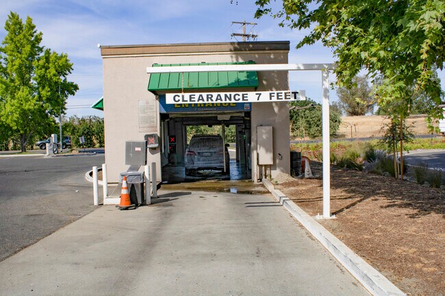
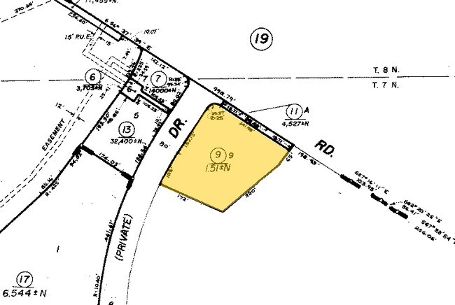
Murieta Dr
Sacramento--Roseville--Arden-Arcade, CA
Rancho Murieta Subd Of Pcl 14
073-0460-011
RANCHO MURIETA SUBD OF PCL 14, LOT A
Miscellaneous
Sacramento
X
California
06067C0376J
a
0
0.10 AC
2025
Outer Sacramento Cnty
008602
Sacramento
DEMOGRAPHICS near Murieta Dr
1 Mile
3 Mile
5 Mile
2024 Total Population
3,063
6,179
6,365
2029 Population
3,074
6,183
6,366
Pop Growth 2024-2029
+ 0.36%
+ 0.06%
+ 0.02%
Average Age
50
49
49
2024 Total Households
1,287
2,552
2,603
HH Growth 2024-2029
+ 0.31%
(0.04%)
(0.12%)
Median Household Inc
$128,125
$133,147
$132,721
Avg Household Size
2.40
2.40
2.40
2024 Avg HH Vehicles
2.00
2.00
2.00
Median Home Value
$686,478
$710,269
$712,464
Median Year Built
1985
1988
1988
Nearby Places
Map Layers
Map Styles
 Street
 Aerial
- Restaurants
- Banks
- Shops
- Fitness
- Groceries
PUBLIC TRANSPORTATION
AIRPORT
Sacramento International
DRIVE
WALK
Distance
Sacramento International
51 min
35.2 mi
Freight Ports
Port of Stockton
DRIVE
WALK
Distance
Port of Stockton
73 min
54.2 mi
SALE & LEASE HISTORY
LISTING DATE
SALE/LEASE

Jul 06, 2021
For Sale
Nearby Properties
Address
Land Use
TOTAL SIZE
Lot Size
Zoning
Address
Land Use
TOTAL SIZE
Lot Size
Zoning
86,342 SF
5.29 AC
LC (PD)
Address
Land Use
TOTAL SIZE
Lot Size
Zoning
87,251 SF
76.28 AC
A-2 (PD)
Address
Land Use
TOTAL SIZE
Lot Size
Zoning
41,511 SF
3.43 AC
LC (PD)
Address
Land Use
TOTAL SIZE
Lot Size
Zoning
12,284 SF
100.73 AC
A-2 (PD)
Address
Land Use
TOTAL SIZE
Lot Size
Zoning
61,155 SF
6.54 AC
LC (PD)
Address
Land Use
TOTAL SIZE
Lot Size
Zoning
2.06 AC
LC (PD)
Address
Land Use
TOTAL SIZE
Lot Size
Zoning
1.17 AC
LC (PD)
Address
Land Use
TOTAL SIZE
Lot Size
Zoning
18,643 SF
2.64 AC
M-1 (PD)
Address
Land Use
TOTAL SIZE
Lot Size
Zoning
9,610 SF
1.15 AC
LC (PD)
Address
Land Use
TOTAL SIZE
Lot Size
Zoning
9,295 SF
1.22 AC
LC (PD)
Address
Land Use
TOTAL SIZE
Lot Size
Zoning
5,451 SF
1.51 AC
LC (PD)
Address
Land Use
TOTAL SIZE
Lot Size
Zoning
0.65 AC
LC (PD)
Address
Land Use
TOTAL SIZE
Lot Size
Zoning
114.08 AC
AG-80
Address
Land Use
TOTAL SIZE
Lot Size
Zoning
34,219 SF
3.04 AC
MP (PD)
Address
Land Use
TOTAL SIZE
Lot Size
Zoning
0.79 AC
LC (PD)
Address
Land Use
TOTAL SIZE
Lot Size
Zoning
202.71 AC
A-2 (PD)
Address
Land Use
TOTAL SIZE
Lot Size
Zoning
34,231 SF
8.75 AC
A-2 (PD)
Address
Land Use
TOTAL SIZE
Lot Size
Zoning
17.80 AC
RD-30 (PD)
Address
Land Use
TOTAL SIZE
Lot Size
Zoning
2.35 AC
MP (PD)
Address
Land Use
TOTAL SIZE
Lot Size
Zoning
160 AC
AG-80
Address
Land Use
TOTAL SIZE
Lot Size
Zoning
33,363 SF
95.13 AC
A-2 (PD)
Address
Land Use
TOTAL SIZE
Lot Size
Zoning
223.40 AC
AG-80
Address
Land Use
TOTAL SIZE
Lot Size
Zoning
4,500 SF
120.20 AC
AG-80
Address
Land Use
TOTAL SIZE
Lot Size
Zoning
103.76 AC
A-2 (PD)
Address
Land Use
TOTAL SIZE
Lot Size
Zoning
5,961 SF
1,812.34 AC
AG-80
Address
Land Use
TOTAL SIZE
Lot Size
Zoning
4,326 SF
262.92 AC
AG-80
Address
Land Use
TOTAL SIZE
Lot Size
Zoning
6,756 SF
480 AC
AG-80
Address
Land Use
TOTAL SIZE
Lot Size
Zoning
80 AC
AG-80
Address
Land Use
TOTAL SIZE
Lot Size
Zoning
3,668 SF
10.72 AC
A-10
Address
Land Use
TOTAL SIZE
Lot Size
Zoning
760 SF
44.55 AC
A-2 (PD)
The World's #1 Commercial Real Estate Marketplace
Connect with us
© 2025 CoStar Group
The information above has been obtained from sources believed reliable. While we do not doubt its accuracy we have not verified it and make no guarantee, warranty or representation about it. It is your responsibility to independently confirm its accuracy and completeness. Any projections, opinions, assumptions, or estimates used are for example only and do not represent the current or future performance of the property. The value of this transaction to you depends on tax and other factors which should be evaluated by your tax, financial, and legal advisors. You and your advisors should conduct a careful, independent investigation of the property to determine to your satisfaction the suitability of the property for your needs.