Property Record
Muth Valley Rd, Lakeside, CA 92040


NEARBY LISTINGS FOR SALE OR LEASE
Property Detail
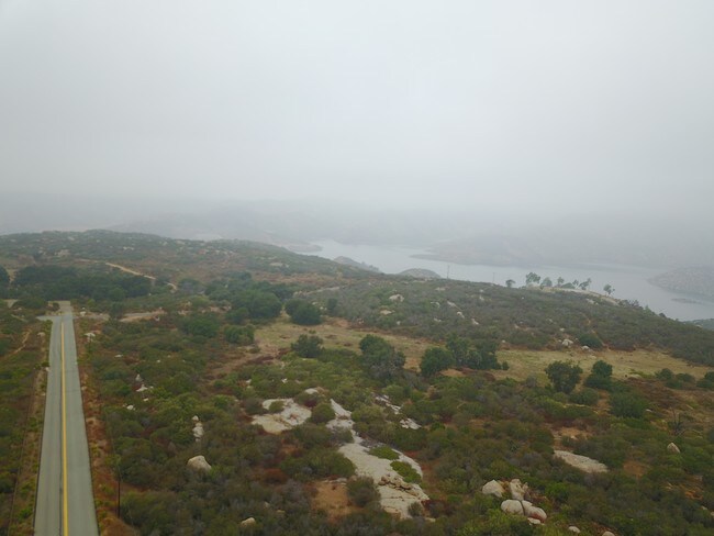
Muth Valley Rd
329-132-32
SEC 32-14-1E SEQ ALL NELY OF RS 546 IN W435 OF E1165FT OF SWQ OF
Vacantlandnec
San Diego
X
California
06073C1394G
12.58 AC
2024
Outlying SD County S
2025
San Diego
016804
San Diego-Carlsbad, CA
DEMOGRAPHICS near Muth Valley Rd
1 Mile
3 Mile
5 Mile
2024 Total Population
333
9,221
52,122
2029 Population
325
9,145
51,558
Pop Growth 2024-2029
(2.40%)
(0.82%)
(1.08%)
Average Age
41
38
41
2024 Total Households
108
3,111
18,313
HH Growth 2024-2029
(1.85%)
(0.96%)
(1.30%)
Median Household Inc
$115,384
$84,306
$90,732
Avg Household Size
2.90
2.90
2.80
2024 Avg HH Vehicles
3.00
2.00
2.00
Median Home Value
$811,224
$761,917
$686,261
Median Year Built
1988
1980
1978
Nearby Places
Map Layers
Map Styles
 Street
 Aerial
- Restaurants
- Banks
- Shops
- Fitness
- Groceries
PUBLIC TRANSPORTATION
AIRPORT
San Diego International
DRIVE
WALK
Distance
San Diego International
39 min
27.0 mi
Freight Ports
Port of San Diego
DRIVE
WALK
Distance
Port of San Diego
38 min
25.8 mi
SALE & LEASE HISTORY
LISTING DATE
SALE/LEASE

Sep 01, 2017
For Sale
Nearby Properties
Address
Land Use
TOTAL SIZE
Lot Size
Zoning
Address
Land Use
TOTAL SIZE
Lot Size
Zoning
5.77 AC
RU
Address
Land Use
TOTAL SIZE
Lot Size
Zoning
78,577 SF
14.03 AC
M54
Address
Land Use
TOTAL SIZE
Lot Size
Zoning
103.57 AC
M58
Address
Land Use
TOTAL SIZE
Lot Size
Zoning
2,781 SF
8.10 AC
M58
Address
Land Use
TOTAL SIZE
Lot Size
Zoning
41,310 SF
3.51 AC
M54
Address
Land Use
TOTAL SIZE
Lot Size
Zoning
44,144 SF
2.39 AC
RU
Address
Land Use
TOTAL SIZE
Lot Size
Zoning
4.80 AC
RU
Address
Land Use
TOTAL SIZE
Lot Size
Zoning
9,200 SF
4.30 AC
M58
Address
Land Use
TOTAL SIZE
Lot Size
Zoning
1,624 SF
4 AC
M58
Address
Land Use
TOTAL SIZE
Lot Size
Zoning
5.35 AC
M58
Address
Land Use
TOTAL SIZE
Lot Size
Zoning
5.07 AC
RS
Address
Land Use
TOTAL SIZE
Lot Size
Zoning
34,000 SF
67.94 AC
A70
Address
Land Use
TOTAL SIZE
Lot Size
Zoning
8 AC
M58
Address
Land Use
TOTAL SIZE
Lot Size
Zoning
10,000 SF
8.44 AC
M58
Address
Land Use
TOTAL SIZE
Lot Size
Zoning
17.70 AC
M58
Address
Land Use
TOTAL SIZE
Lot Size
Zoning
46,296 SF
2.21 AC
RU
Address
Land Use
TOTAL SIZE
Lot Size
Zoning
41,547 SF
2.13 AC
RR
Address
Land Use
TOTAL SIZE
Lot Size
Zoning
188.24 AC
R1
Address
Land Use
TOTAL SIZE
Lot Size
Zoning
28,132 SF
1.22 AC
RU
Address
Land Use
TOTAL SIZE
Lot Size
Zoning
17,755 SF
1.39 AC
M58
Address
Land Use
TOTAL SIZE
Lot Size
Zoning
5,883 SF
2.37 AC
M58
Address
Land Use
TOTAL SIZE
Lot Size
Zoning
19,527 SF
3.43 AC
RR
Address
Land Use
TOTAL SIZE
Lot Size
Zoning
57.37 AC
RR
Address
Land Use
TOTAL SIZE
Lot Size
Zoning
20.63 AC
RMH6
Address
Land Use
TOTAL SIZE
Lot Size
Zoning
111.59 AC
R1
Address
Land Use
TOTAL SIZE
Lot Size
Zoning
2,400 SF
3 AC
C32
Address
Land Use
TOTAL SIZE
Lot Size
Zoning
3,200 SF
2.43 AC
M58
Address
Land Use
TOTAL SIZE
Lot Size
Zoning
16,460 SF
3 AC
M58
Address
Land Use
TOTAL SIZE
Lot Size
Zoning
5,338 SF
50.09 AC
A70
Address
Land Use
TOTAL SIZE
Lot Size
Zoning
102.86 AC
M58
The World's #1 Commercial Real Estate Marketplace
Connect with us
© 2025 CoStar Group
The information above has been obtained from sources believed reliable. While we do not doubt its accuracy we have not verified it and make no guarantee, warranty or representation about it. It is your responsibility to independently confirm its accuracy and completeness. Any projections, opinions, assumptions, or estimates used are for example only and do not represent the current or future performance of the property. The value of this transaction to you depends on tax and other factors which should be evaluated by your tax, financial, and legal advisors. You and your advisors should conduct a careful, independent investigation of the property to determine to your satisfaction the suitability of the property for your needs.