Property Record
Myers Rd, North Canton, OH 44720
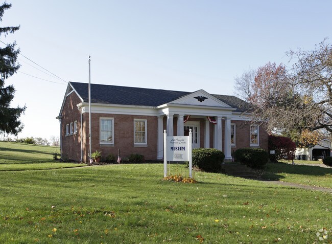

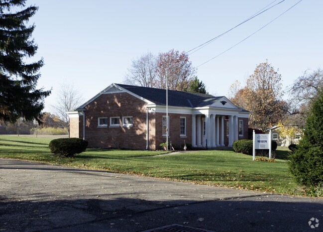
Property Detail
Myers Rd
02080121
24,25,26 WH EA A C MEYERS 1(CA#7030)
Municipalproperty
STARK
B and X Area of moderate flood hazard, usually the area between the limits of the 100-year and 500-year floods.
Ohio
0
0.69 AC
2025
Stark County
711900
Cleveland
1,458 SF
Canton-Massillon, OH
NEARBY LISTINGS FOR SALE OR LEASE
-
-
View all North Canton listings for sale on LoopNet.com
DEMOGRAPHICS near Myers Rd
1 mile
3 mile
5 mile
2025 Total Population
4,004
26,502
89,084
2030 Population
3,962
26,379
89,468
Pop Growth 2025-2030
(1.05%)
(0.46%)
+ 0.43%
Average Age
41
42
43
2025 Total Households
1,510
10,897
36,137
HH Growth 2025-2030
(1.06%)
(0.48%)
+ 0.49%
Median Household Inc
$98,576
$85,975
$86,019
Avg Household Size
2.60
2.40
2.40
2025 Avg HH Vehicles
2.00
2.00
2.00
Median Home Value
$288,388
$269,222
$265,403
Median Year Built
1984
1983
1979
Nearby Places
Map Layers
Map Styles
 Street
 Aerial
Layers
 Traffic
 Biking
Places
Listings with unknown addresses are not visible on the map
- Restaurants
- Banks
- Shops
- Fitness
- Groceries
Nearby Properties
Address
Land Use
TOTAL SIZE
Lot Size
Zoning
Address
Land Use
TOTAL SIZE
Lot Size
Zoning
223,734 SF
1,140.33 AC
Address
Land Use
TOTAL SIZE
Lot Size
Zoning
1,247.97 AC
Address
Land Use
TOTAL SIZE
Lot Size
Zoning
296,562 SF
36.07 AC
Address
Land Use
TOTAL SIZE
Lot Size
Zoning
356,083 SF
32.10 AC
Address
Land Use
TOTAL SIZE
Lot Size
Zoning
Address
Land Use
TOTAL SIZE
Lot Size
Zoning
Address
Land Use
TOTAL SIZE
Lot Size
Zoning
415,636 SF
91.33 AC
Address
Land Use
TOTAL SIZE
Lot Size
Zoning
106,867 SF
13.43 AC
Address
Land Use
TOTAL SIZE
Lot Size
Zoning
218,864 SF
11.84 AC
Address
Land Use
TOTAL SIZE
Lot Size
Zoning
160,650 SF
17.26 AC
Address
Land Use
TOTAL SIZE
Lot Size
Zoning
155,328 SF
22.08 AC
Address
Land Use
TOTAL SIZE
Lot Size
Zoning
255,406 SF
25.19 AC
Address
Land Use
TOTAL SIZE
Lot Size
Zoning
66,152 SF
31.58 AC
Address
Land Use
TOTAL SIZE
Lot Size
Zoning
129,322 SF
7 AC
Address
Land Use
TOTAL SIZE
Lot Size
Zoning
31.58 AC
Address
Land Use
TOTAL SIZE
Lot Size
Zoning
81,901 SF
7.14 AC
Address
Land Use
TOTAL SIZE
Lot Size
Zoning
155,112 SF
8.55 AC
Address
Land Use
TOTAL SIZE
Lot Size
Zoning
121,154 SF
9.45 AC
Address
Land Use
TOTAL SIZE
Lot Size
Zoning
61,261 SF
10.02 AC
Address
Land Use
TOTAL SIZE
Lot Size
Zoning
216,321 SF
13.34 AC
Address
Land Use
TOTAL SIZE
Lot Size
Zoning
96,386 SF
3.53 AC
Address
Land Use
TOTAL SIZE
Lot Size
Zoning
118,004 SF
8.18 AC
Address
Land Use
TOTAL SIZE
Lot Size
Zoning
157,515 SF
16.57 AC
Address
Land Use
TOTAL SIZE
Lot Size
Zoning
121,790 SF
5.94 AC
Address
Land Use
TOTAL SIZE
Lot Size
Zoning
155,622 SF
11.05 AC
Address
Land Use
TOTAL SIZE
Lot Size
Zoning
92,174 SF
8.68 AC
Address
Land Use
TOTAL SIZE
Lot Size
Zoning
244,719 SF
7.32 AC
Address
Land Use
TOTAL SIZE
Lot Size
Zoning
67,481 SF
9.82 AC
Address
Land Use
TOTAL SIZE
Lot Size
Zoning
48,705 SF
3.78 AC
Address
Land Use
TOTAL SIZE
Lot Size
Zoning
285,028 SF
4.63 AC
The World's #1 Commercial Real Estate Marketplace
Connect with us
© 2026 CoStar Group
The information above has been obtained from sources believed reliable. While we do not doubt its accuracy we have not verified it and make no guarantee, warranty or representation about it. It is your responsibility to independently confirm its accuracy and completeness. Any projections, opinions, assumptions, or estimates used are for example only and do not represent the current or future performance of the property. The value of this transaction to you depends on tax and other factors which should be evaluated by your tax, financial, and legal advisors. You and your advisors should conduct a careful, independent investigation of the property to determine to your satisfaction the suitability of the property for your needs.