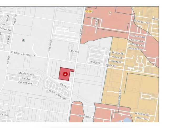
Property Record
N 10Th St, Mcallen, TX


NEARBY LISTINGS FOR SALE OR LEASE
Property Detail
N 10Th St
McAllen/Edinburg/Pharr
Tex-Mex Survey
McAllen-Edinburg-Mission, TX
TEX-MEX SURVEY AN IRR TR W698.88-E1028.89-S818.98 & E330.01-S130.58-N659.70 LOT 12 BLK 278 14.13AC GR 13.92AC NET
T2100-00-278-0012-09
Hidalgo
Vacantlandnec
Texas
2024
12
2025
13.92 AC
023522
Greater McAllen
DEMOGRAPHICS near N 10Th St
1 Mile
3 Mile
5 Mile
2024 Total Population
5,613
80,450
200,203
2029 Population
5,969
84,574
210,796
Pop Growth 2024-2029
+ 6.34%
+ 5.13%
+ 5.29%
Average Age
34
34
34
2024 Total Households
1,898
26,829
66,070
HH Growth 2024-2029
+ 6.32%
+ 4.93%
+ 5.21%
Median Household Inc
$64,540
$61,492
$56,548
Avg Household Size
2.90
2.90
2.90
2024 Avg HH Vehicles
2.00
2.00
2.00
Median Home Value
$217,123
$182,697
$166,706
Median Year Built
2010
1999
1999
Nearby Places
Map Layers
Map Styles
 Street
 Aerial
- Restaurants
- Banks
- Shops
- Fitness
- Groceries
PUBLIC TRANSPORTATION
AIRPORT
McAllen International
DRIVE
WALK
Distance
McAllen International
14 min
8.2 mi
Freight Ports
Port of Brownsville
DRIVE
WALK
Distance
Port of Brownsville
76 min
64.2 mi
SALE & LEASE HISTORY
LISTING DATE
SALE/LEASE

Aug 10, 2020
For Sale
Nearby Properties
Address
Land Use
TOTAL SIZE
Lot Size
Zoning
Address
Land Use
TOTAL SIZE
Lot Size
Zoning
543,452 SF
53.23 AC
CO
Address
Land Use
TOTAL SIZE
Lot Size
Zoning
407,190 SF
11.04 AC
CO
Address
Land Use
TOTAL SIZE
Lot Size
Zoning
357,818 SF
11.10 AC
Address
Land Use
TOTAL SIZE
Lot Size
Zoning
251,423 SF
27.39 AC
CO
Address
Land Use
TOTAL SIZE
Lot Size
Zoning
128,076 SF
5.01 AC
Address
Land Use
TOTAL SIZE
Lot Size
Zoning
109,791 SF
8.82 AC
Address
Land Use
TOTAL SIZE
Lot Size
Zoning
40,248 SF
10.36 AC
Address
Land Use
TOTAL SIZE
Lot Size
Zoning
1 SF
27.89 AC
Address
Land Use
TOTAL SIZE
Lot Size
Zoning
205,008 SF
22.13 AC
Address
Land Use
TOTAL SIZE
Lot Size
Zoning
92,603 SF
7.10 AC
CO
Address
Land Use
TOTAL SIZE
Lot Size
Zoning
135,878 SF
15.45 AC
Address
Land Use
TOTAL SIZE
Lot Size
Zoning
90,172 SF
8.71 AC
Address
Land Use
TOTAL SIZE
Lot Size
Zoning
2.38 AC
RS
Address
Land Use
TOTAL SIZE
Lot Size
Zoning
82,724 SF
3.27 AC
Address
Land Use
TOTAL SIZE
Lot Size
Zoning
1 SF
35.30 AC
Address
Land Use
TOTAL SIZE
Lot Size
Zoning
119,225 SF
23.30 AC
CO
Address
Land Use
TOTAL SIZE
Lot Size
Zoning
138,653 SF
22.89 AC
Address
Land Use
TOTAL SIZE
Lot Size
Zoning
5 SF
22.02 AC
Address
Land Use
TOTAL SIZE
Lot Size
Zoning
85,927 SF
3.59 AC
Address
Land Use
TOTAL SIZE
Lot Size
Zoning
195,599 SF
21.46 AC
CO
Address
Land Use
TOTAL SIZE
Lot Size
Zoning
122,692 SF
16.47 AC
Address
Land Use
TOTAL SIZE
Lot Size
Zoning
2 SF
37.14 AC
Address
Land Use
TOTAL SIZE
Lot Size
Zoning
62,624 SF
8.80 AC
Address
Land Use
TOTAL SIZE
Lot Size
Zoning
125,693 SF
11.17 AC
CO
Address
Land Use
TOTAL SIZE
Lot Size
Zoning
138,503 SF
24.24 AC
Address
Land Use
TOTAL SIZE
Lot Size
Zoning
102,023 SF
12.37 AC
Address
Land Use
TOTAL SIZE
Lot Size
Zoning
139,407 SF
11.13 AC
Address
Land Use
TOTAL SIZE
Lot Size
Zoning
109,852 SF
10.43 AC
Address
Land Use
TOTAL SIZE
Lot Size
Zoning
72,284 SF
39.11 AC
Address
Land Use
TOTAL SIZE
Lot Size
Zoning
91,918 SF
8.92 AC
CO
The World's #1 Commercial Real Estate Marketplace
Connect with us
© 2025 CoStar Group
The information above has been obtained from sources believed reliable. While we do not doubt its accuracy we have not verified it and make no guarantee, warranty or representation about it. It is your responsibility to independently confirm its accuracy and completeness. Any projections, opinions, assumptions, or estimates used are for example only and do not represent the current or future performance of the property. The value of this transaction to you depends on tax and other factors which should be evaluated by your tax, financial, and legal advisors. You and your advisors should conduct a careful, independent investigation of the property to determine to your satisfaction the suitability of the property for your needs.