Property Record
11290 N 135Th Ave E, Owasso, OK 74055


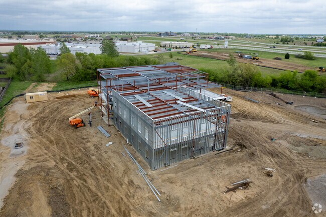
Property Detail
11290 N 135Th Ave E
Tulsa, OK
PRT LT 3 BEG SECR LT 2 TH SELY46 WLY210.16 S20.49 SELY124.55 ELY210.01 SELY41.25 S477.17 W349.14 NW109.93 NW156.51 NW68.37 NW268.12 N177.37 NW74.27 E392.90 ELY134.56 N25.72 CRV LF 55.90 CRV RT 38.17 NWLY191.21 CRV RT 87.15 CRV LF 113.76 NW26.56 NE46
61334-14-09-73300
TULSA
Commercialacreage
Oklahoma
CS
3
B and X Area of moderate flood hazard, usually the area between the limits of the 100-year and 500-year floods.
8.65 AC
2025
Northeast Tulsa
2025
Tulsa
005812
NEARBY LISTINGS FOR SALE OR LEASE
DEMOGRAPHICS near 11290 N 135Th Ave E
1 mile
3 mile
5 mile
2025 Total Population
4,041
38,303
67,538
2030 Population
4,142
39,624
70,117
Pop Growth 2025-2030
+ 2.50%
+ 3.45%
+ 3.82%
Average Age
37
38
38
2025 Total Households
1,462
14,011
25,030
HH Growth 2025-2030
+ 2.53%
+ 3.53%
+ 3.84%
Median Household Inc
$83,628
$85,977
$85,711
Avg Household Size
2.80
2.70
2.70
2025 Avg HH Vehicles
2.00
2.00
2.00
Median Home Value
$261,825
$261,321
$269,627
Median Year Built
2004
2001
1999
Nearby Places
Map Layers
Map Styles
 Street
 Aerial
Layers
 Traffic
 Biking
Places
Listings with unknown addresses are not visible on the map
- Restaurants
- Banks
- Shops
- Fitness
- Groceries
PUBLIC TRANSPORTATION
AIRPORT
Tulsa International
Drive
Walk
Distance
Tulsa International
17 min
11.1 mi
Freight Ports
Tulsa Port Of Catoosa
Drive
Walk
Distance
Tulsa Port Of Catoosa
20 min
14.0 mi
SALE & LEASE HISTORY
LISTING DATE
SALE/LEASE

Sep 30, 2019
For Lease
Nov 21, 2017
For Lease
Nearby Properties
Address
Land Use
TOTAL SIZE
Lot Size
Zoning
Address
Land Use
TOTAL SIZE
Lot Size
Zoning
299,471 SF
64.32 AC
AG
Address
Land Use
TOTAL SIZE
Lot Size
Zoning
111,792 SF
12.43 AC
OM
Address
Land Use
TOTAL SIZE
Lot Size
Zoning
47,798 SF
5.13 AC
CS
Address
Land Use
TOTAL SIZE
Lot Size
Zoning
115,952 SF
19.30 AC
RS3
Address
Land Use
TOTAL SIZE
Lot Size
Zoning
138,427 SF
8.90 AC
OM
Address
Land Use
TOTAL SIZE
Lot Size
Zoning
105,098 SF
18.22 AC
RS2
Address
Land Use
TOTAL SIZE
Lot Size
Zoning
43,882 SF
10 AC
AG
Address
Land Use
TOTAL SIZE
Lot Size
Zoning
93,712 SF
14.01 AC
RM1
Address
Land Use
TOTAL SIZE
Lot Size
Zoning
270,386 SF
14.65 AC
RM
Address
Land Use
TOTAL SIZE
Lot Size
Zoning
246,823 SF
12.77 AC
Address
Land Use
TOTAL SIZE
Lot Size
Zoning
24,164 SF
11.81 AC
NCU
Address
Land Use
TOTAL SIZE
Lot Size
Zoning
31,502 SF
11.08 AC
AG
Address
Land Use
TOTAL SIZE
Lot Size
Zoning
43,252 SF
7.86 AC
RS3
Address
Land Use
TOTAL SIZE
Lot Size
Zoning
2,112 SF
10.89 AC
Address
Land Use
TOTAL SIZE
Lot Size
Zoning
17,600 SF
15.04 AC
RE
Address
Land Use
TOTAL SIZE
Lot Size
Zoning
226,062 SF
11.78 AC
RM2
Address
Land Use
TOTAL SIZE
Lot Size
Zoning
307,768 SF
31.31 AC
RM1
Address
Land Use
TOTAL SIZE
Lot Size
Zoning
101,776 SF
9.96 AC
CS
Address
Land Use
TOTAL SIZE
Lot Size
Zoning
40,100 SF
4.36 AC
IM
Address
Land Use
TOTAL SIZE
Lot Size
Zoning
40,822 SF
11.39 AC
AG
Address
Land Use
TOTAL SIZE
Lot Size
Zoning
40,206 SF
3.72 AC
RS3
Address
Land Use
TOTAL SIZE
Lot Size
Zoning
178,815 SF
18.21 AC
CS
Address
Land Use
TOTAL SIZE
Lot Size
Zoning
28,400 SF
12.66 AC
AG
Address
Land Use
TOTAL SIZE
Lot Size
Zoning
8,543 SF
1.24 AC
CS
Address
Land Use
TOTAL SIZE
Lot Size
Zoning
133,301 SF
21.09 AC
RS3
Address
Land Use
TOTAL SIZE
Lot Size
Zoning
24,435 SF
4.41 AC
RE
Address
Land Use
TOTAL SIZE
Lot Size
Zoning
208,326 SF
16.36 AC
CS
Address
Land Use
TOTAL SIZE
Lot Size
Zoning
61.50 AC
Address
Land Use
TOTAL SIZE
Lot Size
Zoning
48,283 SF
6.91 AC
CS
Address
Land Use
TOTAL SIZE
Lot Size
Zoning
3,679 SF
33.74 AC
AG
The World's #1 Commercial Real Estate Marketplace
Connect with us
© 2026 CoStar Group
The information above has been obtained from sources believed reliable. While we do not doubt its accuracy we have not verified it and make no guarantee, warranty or representation about it. It is your responsibility to independently confirm its accuracy and completeness. Any projections, opinions, assumptions, or estimates used are for example only and do not represent the current or future performance of the property. The value of this transaction to you depends on tax and other factors which should be evaluated by your tax, financial, and legal advisors. You and your advisors should conduct a careful, independent investigation of the property to determine to your satisfaction the suitability of the property for your needs.