Property Record
N Broad St, Rome, GA 30161

Save to a Folder
{{folder.Name}}
{{folder.ListingIds.length}} Properties
{{folder.ListingIds.length}} Property
Create a New Folder
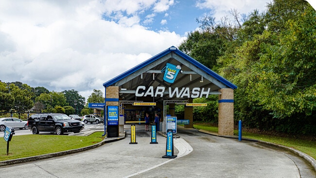
Property Detail
N Broad St
Rome, GA
LL235 246 23/3 TR3 PB38-195
J13O-076A
FLOYD
Religious
Georgia
B and X Area of moderate flood hazard, usually the area between the limits of the 100-year and 500-year floods.
3
0
0.31 AC
2025
Georgia Northwest
000900
Other Market Areas
NEARBY LISTINGS FOR SALE OR LEASE
-
-
View all Rome listings for sale on LoopNet.com
DEMOGRAPHICS near N Broad St
1 mile
3 mile
5 mile
2025 Total Population
4,969
31,483
60,009
2030 Population
5,268
32,764
62,142
Pop Growth 2025-2030
+ 6.02%
+ 4.07%
+ 3.55%
Average Age
41
38
38
2025 Total Households
2,235
11,986
22,122
HH Growth 2025-2030
+ 6.00%
+ 4.39%
+ 3.80%
Median Household Inc
$44,432
$48,488
$56,005
Avg Household Size
2.10
2.30
2.50
2025 Avg HH Vehicles
1.00
2.00
2.00
Median Home Value
$243,421
$222,315
$220,095
Median Year Built
1951
1967
1973
Nearby Places
Map Layers
Map Styles
 Street
 Aerial
Layers
 Traffic
 Biking
Places
Listings with unknown addresses are not visible on the map
- Restaurants
- Banks
- Shops
- Fitness
- Groceries
SALE & LEASE HISTORY
LISTING DATE
SALE/LEASE

Oct 15, 2025
For Sale
Nearby Properties
Address
Land Use
TOTAL SIZE
Lot Size
Zoning
Address
Land Use
TOTAL SIZE
Lot Size
Zoning
52,321 SF
18.34 AC
O-I
Address
Land Use
TOTAL SIZE
Lot Size
Zoning
136,498 SF
9.23 AC
O-I
Address
Land Use
TOTAL SIZE
Lot Size
Zoning
1 SF
767.46 AC
O-I
Address
Land Use
TOTAL SIZE
Lot Size
Zoning
4,394 SF
14.26 AC
Address
Land Use
TOTAL SIZE
Lot Size
Zoning
20,532 SF
16.56 AC
C-C
Address
Land Use
TOTAL SIZE
Lot Size
Zoning
75,156 SF
7.10 AC
O-I
Address
Land Use
TOTAL SIZE
Lot Size
Zoning
30,991 SF
8.94 AC
Address
Land Use
TOTAL SIZE
Lot Size
Zoning
141,680 SF
6.27 AC
U-M-U
Address
Land Use
TOTAL SIZE
Lot Size
Zoning
206,415 SF
5.78 AC
U-M-U
Address
Land Use
TOTAL SIZE
Lot Size
Zoning
57.50 AC
O-I
Address
Land Use
TOTAL SIZE
Lot Size
Zoning
83,971 SF
0.29 AC
Address
Land Use
TOTAL SIZE
Lot Size
Zoning
108,547 SF
1.54 AC
U-M-U
Address
Land Use
TOTAL SIZE
Lot Size
Zoning
54,817 SF
8.82 AC
C-C
Address
Land Use
TOTAL SIZE
Lot Size
Zoning
7,616 SF
4.80 AC
M-R
Address
Land Use
TOTAL SIZE
Lot Size
Zoning
3,416 SF
13.87 AC
C-C
Address
Land Use
TOTAL SIZE
Lot Size
Zoning
89,250 SF
7.05 AC
C-C
Address
Land Use
TOTAL SIZE
Lot Size
Zoning
1,980 SF
40.80 AC
H-I
Address
Land Use
TOTAL SIZE
Lot Size
Zoning
47,541 SF
5.24 AC
O-I
Address
Land Use
TOTAL SIZE
Lot Size
Zoning
30,267 SF
7.20 AC
C-C
Address
Land Use
TOTAL SIZE
Lot Size
Zoning
59,796 SF
Address
Land Use
TOTAL SIZE
Lot Size
Zoning
59,082 SF
8 AC
C-C
Address
Land Use
TOTAL SIZE
Lot Size
Zoning
137,726 SF
12.51 AC
C-C
Address
Land Use
TOTAL SIZE
Lot Size
Zoning
19.64 AC
Address
Land Use
TOTAL SIZE
Lot Size
Zoning
28,532 SF
9.46 AC
Address
Land Use
TOTAL SIZE
Lot Size
Zoning
6,998 SF
15 AC
M-R
Address
Land Use
TOTAL SIZE
Lot Size
Zoning
26.30 AC
H-I
Address
Land Use
TOTAL SIZE
Lot Size
Zoning
42,440 SF
4.30 AC
C-C
Address
Land Use
TOTAL SIZE
Lot Size
Zoning
47,136 SF
2 AC
C-C
Address
Land Use
TOTAL SIZE
Lot Size
Zoning
3,044 SF
9.84 AC
M-R
Address
Land Use
TOTAL SIZE
Lot Size
Zoning
11.84 AC
The World's #1 Commercial Real Estate Marketplace
Connect with us
© 2026 CoStar Group
The information above has been obtained from sources believed reliable. While we do not doubt its accuracy we have not verified it and make no guarantee, warranty or representation about it. It is your responsibility to independently confirm its accuracy and completeness. Any projections, opinions, assumptions, or estimates used are for example only and do not represent the current or future performance of the property. The value of this transaction to you depends on tax and other factors which should be evaluated by your tax, financial, and legal advisors. You and your advisors should conduct a careful, independent investigation of the property to determine to your satisfaction the suitability of the property for your needs.