Property Record
N Cass Pkwy, Raymore, MO 64083

Property Detail
N Cass Pkwy
Kansas City, MO-KS
PT NE AS REC
2176998
CASS
Agriculturalland
Missouri
AE The base floodplain where base flood elevations are provided. AE Zones are now used on new format FIRMs instead of A1-A30 Zones.
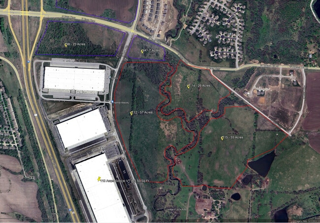
60.68 AC
2024
Cass County
2025
Kansas City
060309
NEARBY LISTINGS FOR SALE OR LEASE
DEMOGRAPHICS near N Cass Pkwy
1 mile
3 mile
5 mile
2025 Total Population
2,119
29,360
62,873
2030 Population
2,235
30,788
65,783
Pop Growth 2025-2030
+ 5.47%
+ 4.86%
+ 4.63%
Average Age
43
41
40
2025 Total Households
761
11,207
24,035
HH Growth 2025-2030
+ 5.39%
+ 5.03%
+ 4.82%
Median Household Inc
$109,821
$83,071
$81,916
Avg Household Size
2.70
2.60
2.60
2025 Avg HH Vehicles
2.00
2.00
2.00
Median Home Value
$334,697
$298,014
$270,778
Median Year Built
2003
1997
1994
Nearby Places
Map Layers
Map Styles
 Street
 Aerial
Transit
 Traffic
 Biking
Places
Listings with unknown addresses are not visible on the map
- Restaurants
- Banks
- Shops
- Fitness
- Groceries
SALE & LEASE HISTORY
LISTING DATE
SALE/LEASE

Feb 15, 2024
For Sale
Nearby Properties
Address
Land Use
TOTAL SIZE
Lot Size
Zoning
Address
Land Use
TOTAL SIZE
Lot Size
Zoning
59.51 AC
Address
Land Use
TOTAL SIZE
Lot Size
Zoning
28.36 AC
Address
Land Use
TOTAL SIZE
Lot Size
Zoning
27.53 AC
Address
Land Use
TOTAL SIZE
Lot Size
Zoning
4,954 SF
23.93 AC
Address
Land Use
TOTAL SIZE
Lot Size
Zoning
15.22 AC
Address
Land Use
TOTAL SIZE
Lot Size
Zoning
3.31 AC
Address
Land Use
TOTAL SIZE
Lot Size
Zoning
944,109 SF
17.75 AC
Address
Land Use
TOTAL SIZE
Lot Size
Zoning
2.23 AC
Address
Land Use
TOTAL SIZE
Lot Size
Zoning
50,121 SF
2.98 AC
Address
Land Use
TOTAL SIZE
Lot Size
Zoning
80,456 SF
8.23 AC
Address
Land Use
TOTAL SIZE
Lot Size
Zoning
2.18 AC
Address
Land Use
TOTAL SIZE
Lot Size
Zoning
53,306 SF
6.70 AC
Address
Land Use
TOTAL SIZE
Lot Size
Zoning
181,400 SF
12.23 AC
Address
Land Use
TOTAL SIZE
Lot Size
Zoning
1.94 AC
Address
Land Use
TOTAL SIZE
Lot Size
Zoning
1.76 AC
Address
Land Use
TOTAL SIZE
Lot Size
Zoning
5.46 AC
Address
Land Use
TOTAL SIZE
Lot Size
Zoning
594,769 SF
18.43 AC
Address
Land Use
TOTAL SIZE
Lot Size
Zoning
25,484 SF
2.13 AC
Address
Land Use
TOTAL SIZE
Lot Size
Zoning
611,460 SF
23.70 AC
Address
Land Use
TOTAL SIZE
Lot Size
Zoning
137,544 SF
11.36 AC
Address
Land Use
TOTAL SIZE
Lot Size
Zoning
137,824 SF
13.62 AC
Address
Land Use
TOTAL SIZE
Lot Size
Zoning
Address
Land Use
TOTAL SIZE
Lot Size
Zoning
19,714 SF
8.40 AC
Address
Land Use
TOTAL SIZE
Lot Size
Zoning
234,842 SF
7.97 AC
Address
Land Use
TOTAL SIZE
Lot Size
Zoning
81,294 SF
0.50 AC
Address
Land Use
TOTAL SIZE
Lot Size
Zoning
Address
Land Use
TOTAL SIZE
Lot Size
Zoning
146,601 SF
3.61 AC
Address
Land Use
TOTAL SIZE
Lot Size
Zoning
91,442 SF
9.38 AC
Address
Land Use
TOTAL SIZE
Lot Size
Zoning
168,060 SF
13.29 AC
Address
Land Use
TOTAL SIZE
Lot Size
Zoning
20,980 SF
3.06 AC
The World's #1 Commercial Real Estate Marketplace
Connect with us
© 2026 CoStar Group
The information above has been obtained from sources believed reliable. While we do not doubt its accuracy we have not verified it and make no guarantee, warranty or representation about it. It is your responsibility to independently confirm its accuracy and completeness. Any projections, opinions, assumptions, or estimates used are for example only and do not represent the current or future performance of the property. The value of this transaction to you depends on tax and other factors which should be evaluated by your tax, financial, and legal advisors. You and your advisors should conduct a careful, independent investigation of the property to determine to your satisfaction the suitability of the property for your needs.