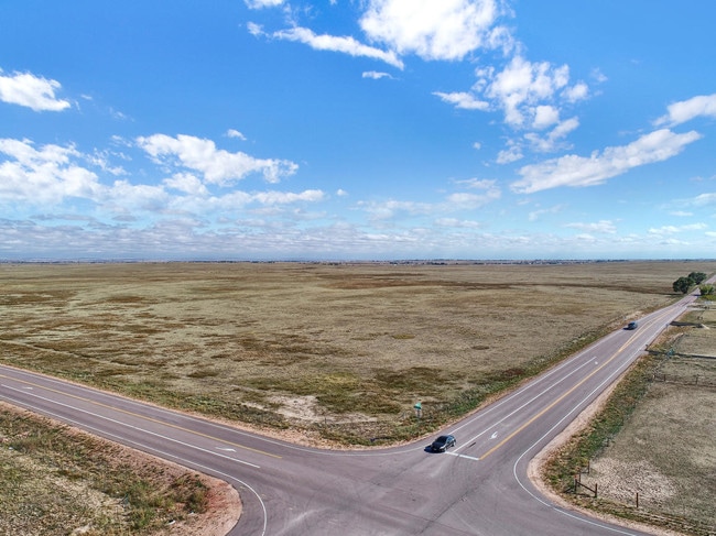
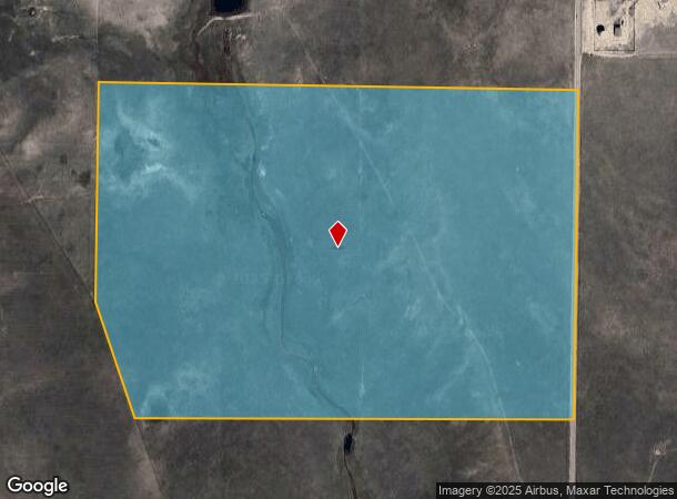
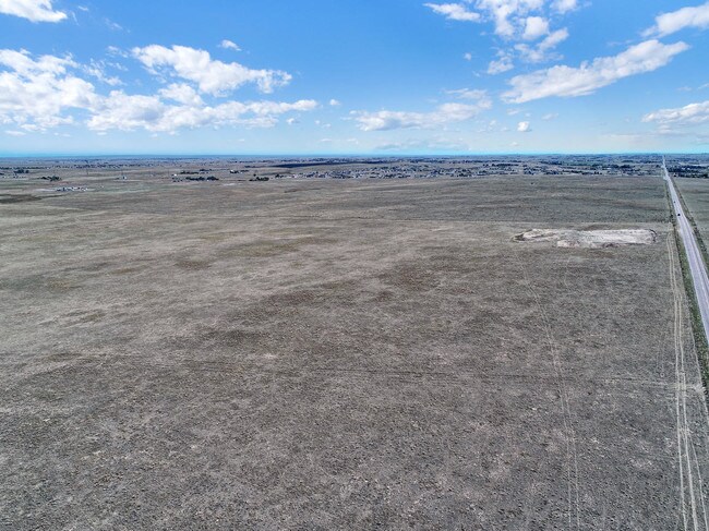
Property Record
N Curtis Rd, Peyton, CO 80831
NEARBY LISTINGS FOR SALE OR LEASE
Property Detail
N Curtis Rd
Colorado Springs, CO
Monument Add
43000-00-552
A PORT OF THE E2 OF SEC 09-13-64 DESC AS FOLS: BEG AT THE NE COR OF SD SEC 9; TH S 00<4337 W ALG THE E LN OF SD SEC 9 1491.36 FT FOR POB; TH CONTINUE CONT S 00<4337 W ALG SD E LN 1808.88 FT, N 89<4508 W 2406.04 FT, N 19<3009 W 675.81 FT TO A PT ON TH
Pasture
El Paso
A
Colorado
08041C0566G
37
2024
108 AC
2025
Southeast
003914
Colorado Springs
DEMOGRAPHICS near N Curtis Rd
1 Mile
3 Mile
5 Mile
2024 Total Population
215
7,665
28,006
2029 Population
224
7,921
29,242
Pop Growth 2024-2029
+ 4.19%
+ 3.34%
+ 4.41%
Average Age
43
37
36
2024 Total Households
81
2,537
8,915
HH Growth 2024-2029
+ 3.70%
+ 3.63%
+ 4.61%
Median Household Inc
$81,731
$99,883
$117,991
Avg Household Size
2.60
3.00
3.10
2024 Avg HH Vehicles
3.00
2.00
3.00
Median Home Value
$403,571
$407,976
$439,184
Median Year Built
1993
2003
2005
Nearby Places
Map Layers
Map Styles
 Street
 Aerial
- Restaurants
- Banks
- Shops
- Fitness
- Groceries
PUBLIC TRANSPORTATION
AIRPORT
City of Colorado Springs Municipal
DRIVE
WALK
Distance
City of Colorado Springs Municipal
24 min
16.6 mi
Freight Ports
Tulsa Port Of Catoosa
DRIVE
WALK
Distance
Tulsa Port Of Catoosa
715 min
678.6 mi
SALE & LEASE HISTORY
LISTING DATE
SALE/LEASE

May 15, 2019
For Sale
May 06, 2019
For Sale
Nearby Properties
Address
Land Use
TOTAL SIZE
Lot Size
Zoning
Address
Land Use
TOTAL SIZE
Lot Size
Zoning
39,446 SF
10.71 AC
RR-5
Address
Land Use
TOTAL SIZE
Lot Size
Zoning
123,673 SF
9.98 AC
CR
Address
Land Use
TOTAL SIZE
Lot Size
Zoning
7,573 SF
757.70 AC
PUD R-4 R-
Address
Land Use
TOTAL SIZE
Lot Size
Zoning
16,455 SF
6.89 AC
A-35 RR-2.
Address
Land Use
TOTAL SIZE
Lot Size
Zoning
15,406 SF
5.42 AC
RR-5
Address
Land Use
TOTAL SIZE
Lot Size
Zoning
10,017 SF
1.50 AC
CR
Address
Land Use
TOTAL SIZE
Lot Size
Zoning
13,048 SF
1.63 AC
CR
Address
Land Use
TOTAL SIZE
Lot Size
Zoning
3,148 SF
0.58 AC
CR
Address
Land Use
TOTAL SIZE
Lot Size
Zoning
38,804 SF
39.37 AC
RR-5
Address
Land Use
TOTAL SIZE
Lot Size
Zoning
41,592 SF
8.59 AC
RR-5
Address
Land Use
TOTAL SIZE
Lot Size
Zoning
6,289 SF
2.04 AC
CC
Address
Land Use
TOTAL SIZE
Lot Size
Zoning
8,788 SF
35.90 AC
RR-5
Address
Land Use
TOTAL SIZE
Lot Size
Zoning
26,235 SF
2.93 AC
CR
Address
Land Use
TOTAL SIZE
Lot Size
Zoning
9,901 SF
2.49 AC
CR
Address
Land Use
TOTAL SIZE
Lot Size
Zoning
22,680 SF
2.84 AC
CR
Address
Land Use
TOTAL SIZE
Lot Size
Zoning
326.51 AC
RR2
Address
Land Use
TOTAL SIZE
Lot Size
Zoning
55,980 SF
5.95 AC
CR
Address
Land Use
TOTAL SIZE
Lot Size
Zoning
54,150 SF
35.33 AC
CS
Address
Land Use
TOTAL SIZE
Lot Size
Zoning
9,566 SF
1.64 AC
CR
Address
Land Use
TOTAL SIZE
Lot Size
Zoning
16,139 SF
0.91 AC
PUD
Address
Land Use
TOTAL SIZE
Lot Size
Zoning
5,561 SF
280 AC
RR5
Address
Land Use
TOTAL SIZE
Lot Size
Zoning
4,123 SF
1.55 AC
CR
Address
Land Use
TOTAL SIZE
Lot Size
Zoning
1.46 AC
CS
Address
Land Use
TOTAL SIZE
Lot Size
Zoning
4,972 SF
1.62 AC
CR
Address
Land Use
TOTAL SIZE
Lot Size
Zoning
5,341 SF
69.25 AC
A35
Address
Land Use
TOTAL SIZE
Lot Size
Zoning
10,926 SF
1.57 AC
CR
Address
Land Use
TOTAL SIZE
Lot Size
Zoning
4,400 SF
3.03 AC
CS
Address
Land Use
TOTAL SIZE
Lot Size
Zoning
11,400 SF
1.70 AC
CR
Address
Land Use
TOTAL SIZE
Lot Size
Zoning
2,861 SF
5.01 AC
RR-5
Address
Land Use
TOTAL SIZE
Lot Size
Zoning
4,136 SF
5.22 AC
PUD
The World's #1 Commercial Real Estate Marketplace
Connect with us
© 2026 CoStar Group
The information above has been obtained from sources believed reliable. While we do not doubt its accuracy we have not verified it and make no guarantee, warranty or representation about it. It is your responsibility to independently confirm its accuracy and completeness. Any projections, opinions, assumptions, or estimates used are for example only and do not represent the current or future performance of the property. The value of this transaction to you depends on tax and other factors which should be evaluated by your tax, financial, and legal advisors. You and your advisors should conduct a careful, independent investigation of the property to determine to your satisfaction the suitability of the property for your needs.