Property Record
N Earl Rudder Fwy, , TX

Property Detail
N Earl Rudder Fwy
College Station-Bryan, TX
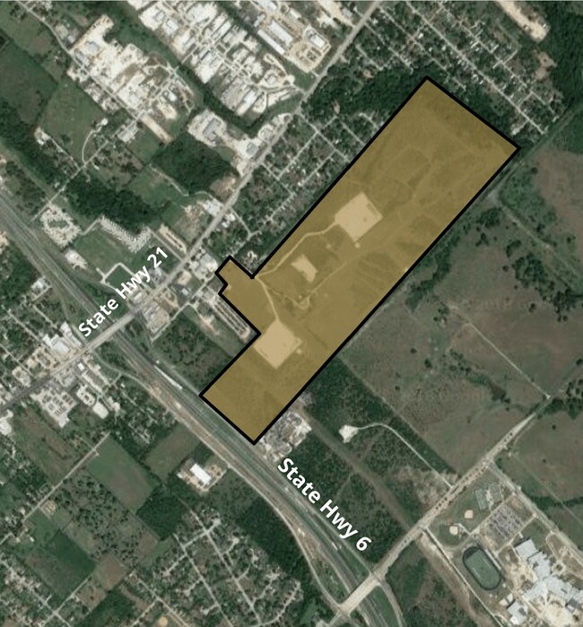
SFA #10, BLOCK 12, LOT 84, ACRES 43.737
78411
BRAZOS
Farms
Texas
B and X Area of moderate flood hazard, usually the area between the limits of the 100-year and 500-year floods.
84
2024
43.74 AC
2025
Bryan & College Station
000000
Other Market Areas
2,310 SF
NEARBY LISTINGS FOR SALE OR LEASE
DEMOGRAPHICS near N Earl Rudder Fwy
1 mile
3 mile
5 mile
2025 Total Population
3,361
44,525
100,042
2030 Population
3,622
47,246
106,185
Pop Growth 2025-2030
+ 7.77%
+ 6.11%
+ 6.14%
Average Age
38
38
36
2025 Total Households
1,174
16,225
37,914
HH Growth 2025-2030
+ 8.26%
+ 6.69%
+ 6.66%
Median Household Inc
$48,921
$55,844
$51,328
Avg Household Size
2.80
2.60
2.40
2025 Avg HH Vehicles
2.00
2.00
2.00
Median Home Value
$163,792
$213,465
$231,212
Median Year Built
1996
1987
1990
Nearby Places
Map Layers
Map Styles
 Street
 Aerial
Layers
 Traffic
 Biking
Places
Listings with unknown addresses are not visible on the map
- Restaurants
- Banks
- Shops
- Fitness
- Groceries
PUBLIC TRANSPORTATION
AIRPORT
Easterwood Field
Drive
Walk
Distance
Easterwood Field
25 min
13.1 mi
Freight Ports
Port of Houston
Drive
Walk
Distance
Port of Houston
128 min
103.9 mi
SALE & LEASE HISTORY
LISTING DATE
SALE/LEASE

Oct 01, 2018
For Sale
Aug 08, 2017
For Sale
Nearby Properties
Address
Land Use
TOTAL SIZE
Lot Size
Zoning
Address
Land Use
TOTAL SIZE
Lot Size
Zoning
527,548 SF
13.77 AC
Address
Land Use
TOTAL SIZE
Lot Size
Zoning
381,196 SF
87 AC
Address
Land Use
TOTAL SIZE
Lot Size
Zoning
96.70 AC
Address
Land Use
TOTAL SIZE
Lot Size
Zoning
232,070 SF
13.33 AC
Address
Land Use
TOTAL SIZE
Lot Size
Zoning
217,450 SF
18.28 AC
Address
Land Use
TOTAL SIZE
Lot Size
Zoning
17.89 AC
Address
Land Use
TOTAL SIZE
Lot Size
Zoning
212,117 SF
16.33 AC
Address
Land Use
TOTAL SIZE
Lot Size
Zoning
257,741 SF
29.42 AC
Address
Land Use
TOTAL SIZE
Lot Size
Zoning
222,358 SF
11.47 AC
Address
Land Use
TOTAL SIZE
Lot Size
Zoning
300,322 SF
2.34 AC
Address
Land Use
TOTAL SIZE
Lot Size
Zoning
62,500 SF
1.44 AC
Address
Land Use
TOTAL SIZE
Lot Size
Zoning
1,020 SF
4.01 AC
Address
Land Use
TOTAL SIZE
Lot Size
Zoning
118,012 SF
8.90 AC
Address
Land Use
TOTAL SIZE
Lot Size
Zoning
32,520 SF
38.68 AC
Address
Land Use
TOTAL SIZE
Lot Size
Zoning
4,608 SF
49.75 AC
Address
Land Use
TOTAL SIZE
Lot Size
Zoning
175,812 SF
5.57 AC
Address
Land Use
TOTAL SIZE
Lot Size
Zoning
164,740 SF
10.91 AC
Address
Land Use
TOTAL SIZE
Lot Size
Zoning
145,250 SF
269.06 AC
Address
Land Use
TOTAL SIZE
Lot Size
Zoning
15.99 AC
Address
Land Use
TOTAL SIZE
Lot Size
Zoning
66,295 SF
3 AC
Address
Land Use
TOTAL SIZE
Lot Size
Zoning
136,274 SF
7.28 AC
Address
Land Use
TOTAL SIZE
Lot Size
Zoning
127,774 SF
11.55 AC
Address
Land Use
TOTAL SIZE
Lot Size
Zoning
22.25 AC
Address
Land Use
TOTAL SIZE
Lot Size
Zoning
15.57 AC
Address
Land Use
TOTAL SIZE
Lot Size
Zoning
92,856 SF
3.92 AC
Address
Land Use
TOTAL SIZE
Lot Size
Zoning
83,766 SF
9.62 AC
Address
Land Use
TOTAL SIZE
Lot Size
Zoning
15,342 SF
7.87 AC
Address
Land Use
TOTAL SIZE
Lot Size
Zoning
51,334 SF
0.49 AC
Address
Land Use
TOTAL SIZE
Lot Size
Zoning
9,215 SF
0.12 AC
Address
Land Use
TOTAL SIZE
Lot Size
Zoning
80,718 SF
14.19 AC
The World's #1 Commercial Real Estate Marketplace
Connect with us
© 2026 CoStar Group
The information above has been obtained from sources believed reliable. While we do not doubt its accuracy we have not verified it and make no guarantee, warranty or representation about it. It is your responsibility to independently confirm its accuracy and completeness. Any projections, opinions, assumptions, or estimates used are for example only and do not represent the current or future performance of the property. The value of this transaction to you depends on tax and other factors which should be evaluated by your tax, financial, and legal advisors. You and your advisors should conduct a careful, independent investigation of the property to determine to your satisfaction the suitability of the property for your needs.