Property Record
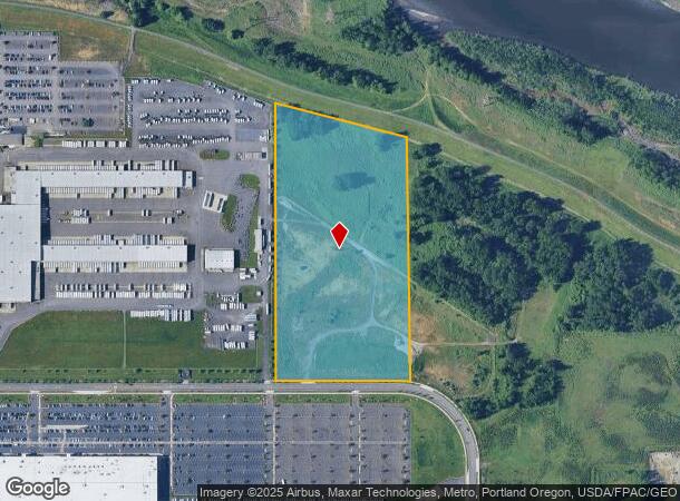
N End Nw Swigert Way, Troutdale, OR 97060

NEARBY LISTINGS FOR SALE OR LEASE
Property Detail
N End Nw Swigert Way
Portland-Vancouver-Hillsboro, OR-WA
Troutdale Reynolds Industrial Pk
R642925
TROUTDALE REYNOLDS INDUSTRIAL PK, LOT 3 TL 110, SPLIT MAP R642929 (R843600250)
Industrialacreage
Multnomah
X
Oregon
41051C0217J
3
2025
19.29 AC
2025
East Columbia Corridor
010306
Portland
DEMOGRAPHICS near N End Nw Swigert Way
1 Mile
3 Mile
5 Mile
2024 Total Population
0
46,531
150,706
2029 Population
0
47,058
152,270
Pop Growth 2024-2029
0.00%
+ 1.13%
+ 1.04%
Average Age
0
40
39
2024 Total Households
0
16,970
54,234
HH Growth 2024-2029
0.00%
+ 1.04%
+ 0.78%
Median Household Inc
$0
$75,827
$74,262
Avg Household Size
.00
2.70
2.70
2024 Avg HH Vehicles
.00
2.00
2.00
Median Home Value
$0
$411,195
$423,428
Median Year Built
0
1989
1988
Nearby Places
Map Layers
Map Styles
 Street
 Aerial
- Restaurants
- Banks
- Shops
- Fitness
- Groceries
PUBLIC TRANSPORTATION
AIRPORT
Portland International
DRIVE
WALK
Distance
Portland International
24 min
11.1 mi
Freight Ports
Port of Portland
DRIVE
WALK
Distance
Port of Portland
33 min
20.5 mi
SALE & LEASE HISTORY
LISTING DATE
SALE/LEASE

Sep 24, 2016
For Sale
Nearby Properties
Address
Land Use
TOTAL SIZE
Lot Size
Zoning
Address
Land Use
TOTAL SIZE
Lot Size
Zoning
1,500,000 SF
189.27 AC
HI
Address
Land Use
TOTAL SIZE
Lot Size
Zoning
Address
Land Use
TOTAL SIZE
Lot Size
Zoning
478,472 SF
77.86 AC
GI
Address
Land Use
TOTAL SIZE
Lot Size
Zoning
302,114 SF
31.69 AC
R-5
Address
Land Use
TOTAL SIZE
Lot Size
Zoning
8.69 AC
NULL
Address
Land Use
TOTAL SIZE
Lot Size
Zoning
857,470 SF
73.72 AC
GI
Address
Land Use
TOTAL SIZE
Lot Size
Zoning
836,366 SF
38.86 AC
LI
Address
Land Use
TOTAL SIZE
Lot Size
Zoning
14,059 SF
12.83 AC
GI
Address
Land Use
TOTAL SIZE
Lot Size
Zoning
197,834 SF
8.67 AC
R5
Address
Land Use
TOTAL SIZE
Lot Size
Zoning
219,470 SF
9.77 AC
R_MF
Address
Land Use
TOTAL SIZE
Lot Size
Zoning
213,544 SF
6.64 AC
A2
Address
Land Use
TOTAL SIZE
Lot Size
Zoning
224,500 SF
12.30 AC
R-7.5
Address
Land Use
TOTAL SIZE
Lot Size
Zoning
273,264 SF
11.39 AC
CMF
Address
Land Use
TOTAL SIZE
Lot Size
Zoning
114,696 SF
2.29 AC
MF-18
Address
Land Use
TOTAL SIZE
Lot Size
Zoning
156,393 SF
5.82 AC
GC
Address
Land Use
TOTAL SIZE
Lot Size
Zoning
142,571 SF
1.73 AC
TC-C
Address
Land Use
TOTAL SIZE
Lot Size
Zoning
733,232 SF
37.41 AC
NULL
Address
Land Use
TOTAL SIZE
Lot Size
Zoning
Address
Land Use
TOTAL SIZE
Lot Size
Zoning
349,080 SF
18.69 AC
GI
Address
Land Use
TOTAL SIZE
Lot Size
Zoning
19.55 AC
GI
Address
Land Use
TOTAL SIZE
Lot Size
Zoning
194,991 SF
5.56 AC
TCC
Address
Land Use
TOTAL SIZE
Lot Size
Zoning
70,955 SF
4.78 AC
R/CSP
Address
Land Use
TOTAL SIZE
Lot Size
Zoning
165,000 SF
14.35 AC
CC
Address
Land Use
TOTAL SIZE
Lot Size
Zoning
140,587 SF
9.73 AC
R_MF
Address
Land Use
TOTAL SIZE
Lot Size
Zoning
175,153 SF
4.90 AC
LM
Address
Land Use
TOTAL SIZE
Lot Size
Zoning
193,944 SF
11.27 AC
GI
Address
Land Use
TOTAL SIZE
Lot Size
Zoning
Address
Land Use
TOTAL SIZE
Lot Size
Zoning
4,490 SF
75.54 AC
GI
Address
Land Use
TOTAL SIZE
Lot Size
Zoning
73,073 SF
1.37 AC
R-5
Address
Land Use
TOTAL SIZE
Lot Size
Zoning
58,000 SF
21.71 AC
R/CSP
The World's #1 Commercial Real Estate Marketplace
Connect with us
© 2025 CoStar Group
The information above has been obtained from sources believed reliable. While we do not doubt its accuracy we have not verified it and make no guarantee, warranty or representation about it. It is your responsibility to independently confirm its accuracy and completeness. Any projections, opinions, assumptions, or estimates used are for example only and do not represent the current or future performance of the property. The value of this transaction to you depends on tax and other factors which should be evaluated by your tax, financial, and legal advisors. You and your advisors should conduct a careful, independent investigation of the property to determine to your satisfaction the suitability of the property for your needs.