Property Record
Expressway 77, Combes, TX 78535
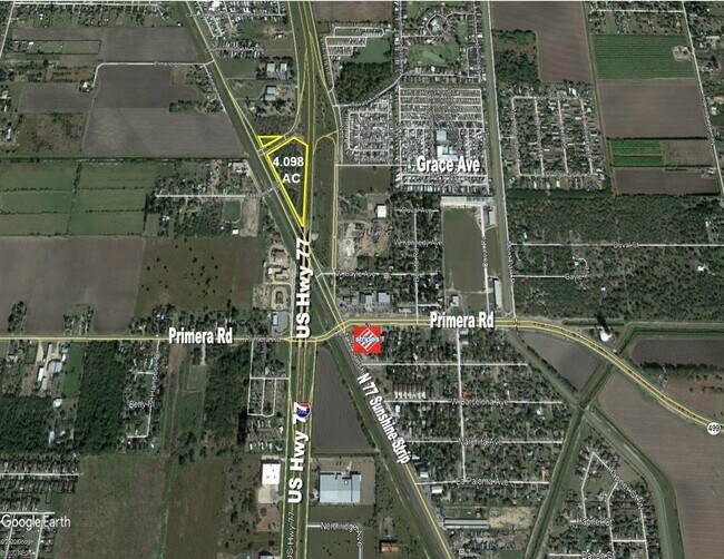

NEARBY LISTINGS FOR SALE OR LEASE
Property Detail
Expressway 77
Brownsville/Harlingen
David & Stephenson Subdivision
Brownsville-Harlingen, TX
Cameron
973780-0090-000000
Texas
Ruralagriculturalresidence
11.54 AC
X
Outlying Cameron County
48061C0255F
DEMOGRAPHICS near Expressway 77
1 Mile
3 Mile
5 Mile
2024 Total Population
2,300
21,376
64,731
2029 Population
2,296
21,654
66,085
Pop Growth 2024-2029
(0.17%)
+ 1.30%
+ 2.09%
Average Age
39
36
37
2024 Total Households
743
6,862
22,085
HH Growth 2024-2029
(0.54%)
+ 1.21%
+ 2.10%
Median Household Inc
$50,714
$50,986
$48,514
Avg Household Size
3.00
3.00
2.80
2024 Avg HH Vehicles
2.00
2.00
2.00
Median Home Value
$81,756
$94,269
$99,948
Median Year Built
1987
1992
1986
Nearby Places
Map Layers
Map Styles
 Street
 Aerial
- Restaurants
- Banks
- Shops
- Fitness
- Groceries
PUBLIC TRANSPORTATION
AIRPORT
Valley International
DRIVE
WALK
Distance
Valley International
10 min
5.9 mi
Brownsville/South Padre Island International
DRIVE
WALK
Distance
Brownsville/South Padre Island International
42 min
32.7 mi
Freight Ports
Port of Brownsville
DRIVE
WALK
Distance
Port of Brownsville
35 min
30.3 mi
SALE & LEASE HISTORY
LISTING DATE
SALE/LEASE

Jan 19, 2021
For Sale
Nearby Properties
Address
Land Use
TOTAL SIZE
Lot Size
Zoning
Address
Land Use
TOTAL SIZE
Lot Size
Zoning
43,540 SF
26.19 AC
C
Address
Land Use
TOTAL SIZE
Lot Size
Zoning
13,924 SF
31.33 AC
C
Address
Land Use
TOTAL SIZE
Lot Size
Zoning
76,756 SF
15.35 AC
Address
Land Use
TOTAL SIZE
Lot Size
Zoning
81,569 SF
36.61 AC
Address
Land Use
TOTAL SIZE
Lot Size
Zoning
20.64 AC
C
Address
Land Use
TOTAL SIZE
Lot Size
Zoning
144,000 SF
7.05 AC
Address
Land Use
TOTAL SIZE
Lot Size
Zoning
194,090 SF
13.17 AC
C
Address
Land Use
TOTAL SIZE
Lot Size
Zoning
1,216 SF
39.91 AC
A-R
Address
Land Use
TOTAL SIZE
Lot Size
Zoning
13,496 SF
0.99 AC
Address
Land Use
TOTAL SIZE
Lot Size
Zoning
256,460 SF
19.15 AC
C
Address
Land Use
TOTAL SIZE
Lot Size
Zoning
41,600 SF
10 AC
C
Address
Land Use
TOTAL SIZE
Lot Size
Zoning
7,947 SF
16.10 AC
CRV
Address
Land Use
TOTAL SIZE
Lot Size
Zoning
5.22 AC
M-U
Address
Land Use
TOTAL SIZE
Lot Size
Zoning
48,841 SF
6.99 AC
C
Address
Land Use
TOTAL SIZE
Lot Size
Zoning
87,573 SF
8.45 AC
C
Address
Land Use
TOTAL SIZE
Lot Size
Zoning
125,000 SF
6.63 AC
C
Address
Land Use
TOTAL SIZE
Lot Size
Zoning
32,225 SF
3.33 AC
Address
Land Use
TOTAL SIZE
Lot Size
Zoning
63,714 SF
17.51 AC
Address
Land Use
TOTAL SIZE
Lot Size
Zoning
83,056 SF
6.39 AC
C
Address
Land Use
TOTAL SIZE
Lot Size
Zoning
22,476 SF
0.85 AC
Address
Land Use
TOTAL SIZE
Lot Size
Zoning
115,352 SF
12.60 AC
C
Address
Land Use
TOTAL SIZE
Lot Size
Zoning
25,911 SF
8.94 AC
AC
Address
Land Use
TOTAL SIZE
Lot Size
Zoning
47,310 SF
5.68 AC
C
Address
Land Use
TOTAL SIZE
Lot Size
Zoning
38,020 SF
1 AC
Address
Land Use
TOTAL SIZE
Lot Size
Zoning
238,700 SF
Address
Land Use
TOTAL SIZE
Lot Size
Zoning
4,928 SF
7.92 AC
Address
Land Use
TOTAL SIZE
Lot Size
Zoning
35,179 SF
3.57 AC
C
Address
Land Use
TOTAL SIZE
Lot Size
Zoning
17,305 SF
1.05 AC
C
Address
Land Use
TOTAL SIZE
Lot Size
Zoning
26,221 SF
7.17 AC
C
Address
Land Use
TOTAL SIZE
Lot Size
Zoning
34,290 SF
1.97 AC
The World's #1 Commercial Real Estate Marketplace
Connect with us
© 2026 CoStar Group
The information above has been obtained from sources believed reliable. While we do not doubt its accuracy we have not verified it and make no guarantee, warranty or representation about it. It is your responsibility to independently confirm its accuracy and completeness. Any projections, opinions, assumptions, or estimates used are for example only and do not represent the current or future performance of the property. The value of this transaction to you depends on tax and other factors which should be evaluated by your tax, financial, and legal advisors. You and your advisors should conduct a careful, independent investigation of the property to determine to your satisfaction the suitability of the property for your needs.