Property Record
N Gantzel Rd, , AZ

Property Detail
N Gantzel Rd
210-07-001M
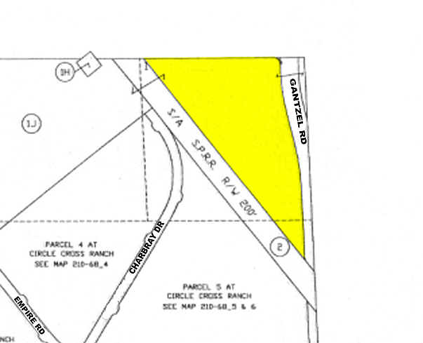
COM @ NE COR OF SEC 6-3S-8E TH W-198.70 TH CURVE SLY W/RAD OF 178 7.00 A DIST OF 71.77 TO POB TH CURVE NWLY W/RAD OF 33.00 A DIST O F 50.59 TH W-1064.29 TH S38D E-2078.17 TH N02D W-625.41 TH CURVE NWLY W/RAD OF 1637.00 A DIST OF 341.70 TH N14D W-248.
Farms
PINAL
CB2
Arizona
B and X Area of moderate flood hazard, usually the area between the limits of the 100-year and 500-year floods.
21.19 AC
2024
Pinal County
2025
Phoenix
000000
Phoenix-Mesa-Chandler, AZ
NEARBY LISTINGS FOR SALE OR LEASE
DEMOGRAPHICS near N Gantzel Rd
1 mile
3 mile
5 mile
2025 Total Population
12,882
86,967
168,428
2030 Population
15,209
103,009
196,358
Pop Growth 2025-2030
+ 18.06%
+ 18.45%
+ 16.58%
Average Age
41
37
36
2025 Total Households
4,444
27,302
52,234
HH Growth 2025-2030
+ 18.56%
+ 18.61%
+ 16.75%
Median Household Inc
$96,470
$98,669
$102,232
Avg Household Size
2.90
3.10
3.20
2025 Avg HH Vehicles
2.00
2.00
2.00
Median Home Value
$484,624
$455,382
$463,276
Median Year Built
2010
2009
2009
Nearby Places
Map Layers
Map Styles
 Street
 Aerial
Transit
 Traffic
 Biking
Places
Listings with unknown addresses are not visible on the map
- Restaurants
- Banks
- Shops
- Fitness
- Groceries
PUBLIC TRANSPORTATION
AIRPORT
Phoenix-Mesa Gateway
Drive
Walk
Distance
Phoenix-Mesa Gateway
22 min
11.4 mi
Freight Ports
Port of San Diego
Drive
Walk
Distance
Port of San Diego
423 min
378.6 mi
SALE & LEASE HISTORY
LISTING DATE
SALE/LEASE

Nov 03, 2023
For Sale
Nearby Properties
Address
Land Use
TOTAL SIZE
Lot Size
Zoning
Address
Land Use
TOTAL SIZE
Lot Size
Zoning
590,319 SF
41.54 AC
Address
Land Use
TOTAL SIZE
Lot Size
Zoning
193,293 SF
22.36 AC
UNDESIGNAT
Address
Land Use
TOTAL SIZE
Lot Size
Zoning
95,730 SF
19.71 AC
Address
Land Use
TOTAL SIZE
Lot Size
Zoning
208,206 SF
22.84 AC
CB2
Address
Land Use
TOTAL SIZE
Lot Size
Zoning
107,352 SF
12.70 AC
CB2
Address
Land Use
TOTAL SIZE
Lot Size
Zoning
12 AC
CR3
Address
Land Use
TOTAL SIZE
Lot Size
Zoning
107,832 SF
9.23 AC
Address
Land Use
TOTAL SIZE
Lot Size
Zoning
10.30 AC
CR3
Address
Land Use
TOTAL SIZE
Lot Size
Zoning
52,327 SF
21.32 AC
Address
Land Use
TOTAL SIZE
Lot Size
Zoning
Address
Land Use
TOTAL SIZE
Lot Size
Zoning
37,368 SF
5 AC
Address
Land Use
TOTAL SIZE
Lot Size
Zoning
64,499 SF
10 AC
Address
Land Use
TOTAL SIZE
Lot Size
Zoning
63,296 SF
7.44 AC
Address
Land Use
TOTAL SIZE
Lot Size
Zoning
156,414 SF
4.81 AC
CB2
Address
Land Use
TOTAL SIZE
Lot Size
Zoning
18,568 SF
6.92 AC
Address
Land Use
TOTAL SIZE
Lot Size
Zoning
73,723 SF
3.57 AC
Address
Land Use
TOTAL SIZE
Lot Size
Zoning
Address
Land Use
TOTAL SIZE
Lot Size
Zoning
37,375 SF
3.72 AC
Address
Land Use
TOTAL SIZE
Lot Size
Zoning
20,472 SF
6.50 AC
Address
Land Use
TOTAL SIZE
Lot Size
Zoning
4,524 SF
20.66 AC
Address
Land Use
TOTAL SIZE
Lot Size
Zoning
19,537 SF
3.95 AC
Address
Land Use
TOTAL SIZE
Lot Size
Zoning
8,022 SF
1.14 AC
Address
Land Use
TOTAL SIZE
Lot Size
Zoning
24,313 SF
5.88 AC
CR3
Address
Land Use
TOTAL SIZE
Lot Size
Zoning
40,000 SF
4.54 AC
CI2
Address
Land Use
TOTAL SIZE
Lot Size
Zoning
16,446 SF
4.39 AC
Address
Land Use
TOTAL SIZE
Lot Size
Zoning
19.76 AC
Address
Land Use
TOTAL SIZE
Lot Size
Zoning
4,945 SF
2.17 AC
CB1
Address
Land Use
TOTAL SIZE
Lot Size
Zoning
17,632 SF
2.09 AC
CB2
Address
Land Use
TOTAL SIZE
Lot Size
Zoning
16 AC
GR
The World's #1 Commercial Real Estate Marketplace
Connect with us
© 2026 CoStar Group
The information above has been obtained from sources believed reliable. While we do not doubt its accuracy we have not verified it and make no guarantee, warranty or representation about it. It is your responsibility to independently confirm its accuracy and completeness. Any projections, opinions, assumptions, or estimates used are for example only and do not represent the current or future performance of the property. The value of this transaction to you depends on tax and other factors which should be evaluated by your tax, financial, and legal advisors. You and your advisors should conduct a careful, independent investigation of the property to determine to your satisfaction the suitability of the property for your needs.