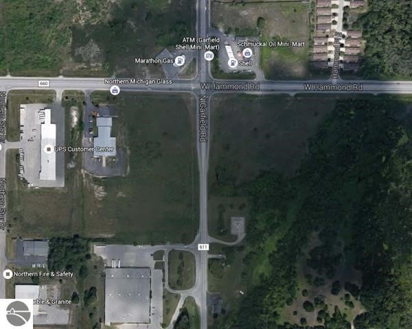
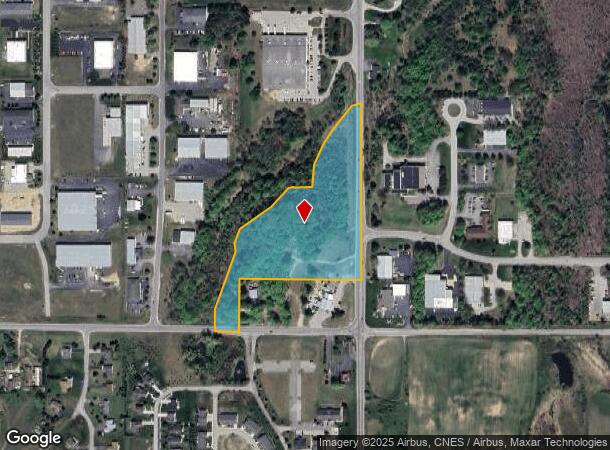
Property Record
N Garfield Rd, Traverse City, MI 49696
NEARBY LISTINGS FOR SALE OR LEASE
Property Detail
N Garfield Rd
05-026-001-05
COM 1375.84' S OF NE COR SEC 26 T27N R11W TH S 0 DEG 18' E 981.92' TH W 685.16' TH S 295.16' TH W 12
Residentialacreage
Grand Traverse
X
Michigan
26055C0228C
11.61 AC
2024
Michigan Northwest Area
2025
Other Market Areas
550601
Traverse City, MI
DEMOGRAPHICS near N Garfield Rd
1 Mile
3 Mile
5 Mile
2024 Total Population
1,675
14,600
47,340
2029 Population
1,720
15,032
48,800
Pop Growth 2024-2029
+ 2.69%
+ 2.96%
+ 3.08%
Average Age
41
42
43
2024 Total Households
730
6,793
20,932
HH Growth 2024-2029
+ 2.60%
+ 2.96%
+ 3.10%
Median Household Inc
$53,924
$54,107
$60,906
Avg Household Size
2.20
2.10
2.20
2024 Avg HH Vehicles
2.00
2.00
2.00
Median Home Value
$193,373
$209,775
$278,667
Median Year Built
1993
1991
1982
Nearby Places
Map Layers
Map Styles
 Street
 Aerial
- Restaurants
- Banks
- Shops
- Fitness
- Groceries
PUBLIC TRANSPORTATION
AIRPORT
Cherry Capital
DRIVE
WALK
Distance
Cherry Capital
12 min
4.7 mi
Freight Ports
Port Milwaukee
DRIVE
WALK
Distance
Port Milwaukee
452 min
398.5 mi
SALE & LEASE HISTORY
LISTING DATE
SALE/LEASE

Jan 04, 2017
For Sale
Nearby Properties
Address
Land Use
TOTAL SIZE
Lot Size
Zoning
Address
Land Use
TOTAL SIZE
Lot Size
Zoning
81,900 SF
870.88 AC
Address
Land Use
TOTAL SIZE
Lot Size
Zoning
24,879 SF
19.31 AC
Address
Land Use
TOTAL SIZE
Lot Size
Zoning
5,308 SF
27.64 AC
Address
Land Use
TOTAL SIZE
Lot Size
Zoning
41,084 SF
22.79 AC
Address
Land Use
TOTAL SIZE
Lot Size
Zoning
189,750 SF
94.80 AC
Address
Land Use
TOTAL SIZE
Lot Size
Zoning
25,208 SF
15.01 AC
Address
Land Use
TOTAL SIZE
Lot Size
Zoning
28,864 SF
20.26 AC
Address
Land Use
TOTAL SIZE
Lot Size
Zoning
6,354 SF
97.88 AC
Address
Land Use
TOTAL SIZE
Lot Size
Zoning
28,864 SF
14.43 AC
Address
Land Use
TOTAL SIZE
Lot Size
Zoning
420,291 SF
41.91 AC
Address
Land Use
TOTAL SIZE
Lot Size
Zoning
8,820 SF
15.24 AC
Address
Land Use
TOTAL SIZE
Lot Size
Zoning
136,197 SF
62.59 AC
Address
Land Use
TOTAL SIZE
Lot Size
Zoning
45,574 SF
21.75 AC
Address
Land Use
TOTAL SIZE
Lot Size
Zoning
78,933 SF
19.79 AC
Address
Land Use
TOTAL SIZE
Lot Size
Zoning
17,892 SF
18.28 AC
Address
Land Use
TOTAL SIZE
Lot Size
Zoning
100,409 SF
32.45 AC
Address
Land Use
TOTAL SIZE
Lot Size
Zoning
74,411 SF
28.31 AC
Address
Land Use
TOTAL SIZE
Lot Size
Zoning
43,100 SF
10.29 AC
Address
Land Use
TOTAL SIZE
Lot Size
Zoning
92,450 SF
5.71 AC
Address
Land Use
TOTAL SIZE
Lot Size
Zoning
14,592 SF
12.79 AC
Address
Land Use
TOTAL SIZE
Lot Size
Zoning
65,000 SF
7.04 AC
Address
Land Use
TOTAL SIZE
Lot Size
Zoning
155,882 SF
19.57 AC
Address
Land Use
TOTAL SIZE
Lot Size
Zoning
54,094 SF
7.02 AC
Address
Land Use
TOTAL SIZE
Lot Size
Zoning
25,271 SF
3.24 AC
Address
Land Use
TOTAL SIZE
Lot Size
Zoning
49,152 SF
54.05 AC
Address
Land Use
TOTAL SIZE
Lot Size
Zoning
36,464 SF
7.22 AC
Address
Land Use
TOTAL SIZE
Lot Size
Zoning
27,889 SF
14.55 AC
Address
Land Use
TOTAL SIZE
Lot Size
Zoning
Address
Land Use
TOTAL SIZE
Lot Size
Zoning
9,608 SF
10.99 AC
Address
Land Use
TOTAL SIZE
Lot Size
Zoning
24,328 SF
21.63 AC
The World's #1 Commercial Real Estate Marketplace
Connect with us
© 2025 CoStar Group
The information above has been obtained from sources believed reliable. While we do not doubt its accuracy we have not verified it and make no guarantee, warranty or representation about it. It is your responsibility to independently confirm its accuracy and completeness. Any projections, opinions, assumptions, or estimates used are for example only and do not represent the current or future performance of the property. The value of this transaction to you depends on tax and other factors which should be evaluated by your tax, financial, and legal advisors. You and your advisors should conduct a careful, independent investigation of the property to determine to your satisfaction the suitability of the property for your needs.