Property Record
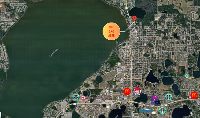
901 N Grove St, Eustis, FL 32726


Property Detail
901 N Grove St
Orlando-Kissimmee-Sanford, FL
EUSTIS SHOREACRES NO 5 PB 11 PG 99 LOTS 1 2 BLK 3 ORB 5540 PG 1336
02-19-26-0700-003-00100
Lake
Commercialacreage
Florida
B and X Area of moderate flood hazard, usually the area between the limits of the 100-year and 500-year floods.
1
2024
0.40 AC
2026
Lake County
030206
Orlando
NEARBY LISTINGS FOR SALE OR LEASE
DEMOGRAPHICS near 901 N Grove St
1 mile
3 mile
5 mile
2025 Total Population
5,540
31,851
76,444
2030 Population
6,272
36,169
86,909
Pop Growth 2025-2030
+ 13.21%
+ 13.56%
+ 13.69%
Average Age
41
43
45
2025 Total Households
2,254
13,219
32,662
HH Growth 2025-2030
+ 13.31%
+ 13.81%
+ 13.91%
Median Household Inc
$52,992
$63,266
$66,180
Avg Household Size
2.30
2.40
2.30
2025 Avg HH Vehicles
2.00
2.00
2.00
Median Home Value
$215,757
$274,254
$286,837
Median Year Built
1977
1984
1987
Nearby Places
Map Layers
Map Styles
 Street
 Aerial
Layers
 Traffic
 Biking
Places
Listings with unknown addresses are not visible on the map
- Restaurants
- Banks
- Shops
- Fitness
- Groceries
PUBLIC TRANSPORTATION
AIRPORT
Orlando Sanford International
Drive
Walk
Distance
Orlando Sanford International
58 min
36.2 mi
Freight Ports
Port Canaveral
Drive
Walk
Distance
Port Canaveral
117 min
93.7 mi
SALE & LEASE HISTORY
LISTING DATE
SALE/LEASE

Nov 21, 2024
For Sale
Jul 23, 2021
For Sale
Jan 18, 2022
For Sale
Dec 05, 2025
For Sale
Nearby Properties
Address
Land Use
TOTAL SIZE
Lot Size
Zoning
Address
Land Use
TOTAL SIZE
Lot Size
Zoning
278,266 SF
23.85 AC
PD
Address
Land Use
TOTAL SIZE
Lot Size
Zoning
226,508 SF
19.15 AC
Address
Land Use
TOTAL SIZE
Lot Size
Zoning
158,442 SF
17.50 AC
MCI
Address
Land Use
TOTAL SIZE
Lot Size
Zoning
135,298 SF
9.22 AC
SR
Address
Land Use
TOTAL SIZE
Lot Size
Zoning
190,551 SF
20.31 AC
GC
Address
Land Use
TOTAL SIZE
Lot Size
Zoning
36,261 SF
6.27 AC
PD
Address
Land Use
TOTAL SIZE
Lot Size
Zoning
174,744 SF
38.45 AC
GI
Address
Land Use
TOTAL SIZE
Lot Size
Zoning
94,435 SF
8.16 AC
GC
Address
Land Use
TOTAL SIZE
Lot Size
Zoning
106,175 SF
8.10 AC
UR
Address
Land Use
TOTAL SIZE
Lot Size
Zoning
77,567 SF
5.14 AC
UR
Address
Land Use
TOTAL SIZE
Lot Size
Zoning
100,117 SF
7.45 AC
GC
Address
Land Use
TOTAL SIZE
Lot Size
Zoning
116,261 SF
5.66 AC
Address
Land Use
TOTAL SIZE
Lot Size
Zoning
60,476 SF
6.76 AC
MCR
Address
Land Use
TOTAL SIZE
Lot Size
Zoning
70,525 SF
37.62 AC
R2
Address
Land Use
TOTAL SIZE
Lot Size
Zoning
44,275 SF
22.50 AC
C1
Address
Land Use
TOTAL SIZE
Lot Size
Zoning
12,573 SF
43.71 AC
A
Address
Land Use
TOTAL SIZE
Lot Size
Zoning
2,000 SF
44.77 AC
CFD
Address
Land Use
TOTAL SIZE
Lot Size
Zoning
59,200 SF
7.66 AC
C3
Address
Land Use
TOTAL SIZE
Lot Size
Zoning
46,374 SF
6.96 AC
GC
Address
Land Use
TOTAL SIZE
Lot Size
Zoning
70,765 SF
6.12 AC
SR
Address
Land Use
TOTAL SIZE
Lot Size
Zoning
48,624 SF
12.01 AC
MCR
Address
Land Use
TOTAL SIZE
Lot Size
Zoning
10,979 SF
3.20 AC
MCR
Address
Land Use
TOTAL SIZE
Lot Size
Zoning
2,000 SF
21.47 AC
SR
Address
Land Use
TOTAL SIZE
Lot Size
Zoning
43,644 SF
8.59 AC
C3
Address
Land Use
TOTAL SIZE
Lot Size
Zoning
46,080 SF
5.22 AC
GC
Address
Land Use
TOTAL SIZE
Lot Size
Zoning
43,472 SF
3.52 AC
UR
Address
Land Use
TOTAL SIZE
Lot Size
Zoning
65,868 SF
9.33 AC
MCR
Address
Land Use
TOTAL SIZE
Lot Size
Zoning
2,000 SF
35.84 AC
PI
Address
Land Use
TOTAL SIZE
Lot Size
Zoning
64,630 SF
3.42 AC
SR
Address
Land Use
TOTAL SIZE
Lot Size
Zoning
63,560 SF
5.62 AC
C3
The World's #1 Commercial Real Estate Marketplace
Connect with us
© 2026 CoStar Group
The information above has been obtained from sources believed reliable. While we do not doubt its accuracy we have not verified it and make no guarantee, warranty or representation about it. It is your responsibility to independently confirm its accuracy and completeness. Any projections, opinions, assumptions, or estimates used are for example only and do not represent the current or future performance of the property. The value of this transaction to you depends on tax and other factors which should be evaluated by your tax, financial, and legal advisors. You and your advisors should conduct a careful, independent investigation of the property to determine to your satisfaction the suitability of the property for your needs.