Property Record
N Highway 101, Salinas, CA 93906


Property Detail
N Highway 101
253-201-049-000
VOL 13 PARCEL MAP PG 86 PARCEL 12 4.32 AC EXC RW
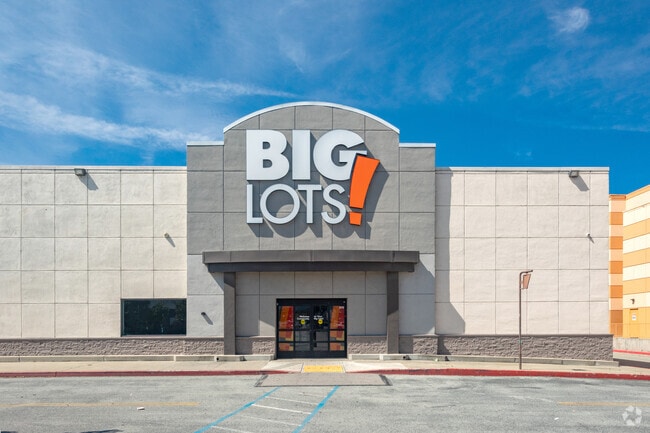
Regionalshoppingcenterormallwithanchorstore
MONTEREY
B and X Area of moderate flood hazard, usually the area between the limits of the 100-year and 500-year floods.
California
2024
4.32 AC
2025
Salinas
000105
Salinas
43,195 SF
Salinas, CA
NEARBY LISTINGS FOR SALE OR LEASE
DEMOGRAPHICS near N Highway 101
1 mile
3 mile
5 mile
2025 Total Population
19,857
93,094
166,926
2030 Population
19,548
92,398
165,236
Pop Growth 2025-2030
(1.56%)
(0.75%)
(1.01%)
Average Age
34
35
35
2025 Total Households
5,600
24,909
43,837
HH Growth 2025-2030
(1.77%)
(1.01%)
(1.26%)
Median Household Inc
$81,909
$88,333
$85,843
Avg Household Size
3.50
3.50
3.60
2025 Avg HH Vehicles
2.00
2.00
2.00
Median Home Value
$544,715
$662,459
$678,569
Median Year Built
1982
1979
1975
Nearby Places
Map Layers
Map Styles
 Street
 Aerial
Layers
 Traffic
 Biking
Places
Listings with unknown addresses are not visible on the map
- Restaurants
- Banks
- Shops
- Fitness
- Groceries
PUBLIC TRANSPORTATION
COMMUTER RAIL
Drive
Walk
Distance
9 min
3.4 mi
AIRPORT
Monterey Regional
Drive
Walk
Distance
Monterey Regional
30 min
18.8 mi
SALE & LEASE HISTORY
LISTING DATE
SALE/LEASE

Sep 17, 2019
For Sale
Oct 28, 2024
For Lease
Jan 12, 2026
For Lease
Apr 03, 2025
For Sale
Nearby Properties
Address
Land Use
TOTAL SIZE
Lot Size
Zoning
Address
Land Use
TOTAL SIZE
Lot Size
Zoning
1.28 AC
Address
Land Use
TOTAL SIZE
Lot Size
Zoning
230,236 SF
15.57 AC
Address
Land Use
TOTAL SIZE
Lot Size
Zoning
1.21 AC
Address
Land Use
TOTAL SIZE
Lot Size
Zoning
32.88 AC
Address
Land Use
TOTAL SIZE
Lot Size
Zoning
13.86 AC
Address
Land Use
TOTAL SIZE
Lot Size
Zoning
100.17 AC
Address
Land Use
TOTAL SIZE
Lot Size
Zoning
156,370 SF
58.55 AC
Address
Land Use
TOTAL SIZE
Lot Size
Zoning
115,480 SF
12.31 AC
Address
Land Use
TOTAL SIZE
Lot Size
Zoning
181,089 SF
11 AC
Address
Land Use
TOTAL SIZE
Lot Size
Zoning
75,772 SF
2.04 AC
Address
Land Use
TOTAL SIZE
Lot Size
Zoning
0.09 AC
Address
Land Use
TOTAL SIZE
Lot Size
Zoning
14,960 SF
16.02 AC
Address
Land Use
TOTAL SIZE
Lot Size
Zoning
193,480 SF
16.27 AC
Address
Land Use
TOTAL SIZE
Lot Size
Zoning
76,737 SF
3.36 AC
Address
Land Use
TOTAL SIZE
Lot Size
Zoning
9.80 AC
Address
Land Use
TOTAL SIZE
Lot Size
Zoning
112,816 SF
9.91 AC
Address
Land Use
TOTAL SIZE
Lot Size
Zoning
8.10 AC
Address
Land Use
TOTAL SIZE
Lot Size
Zoning
Address
Land Use
TOTAL SIZE
Lot Size
Zoning
118,797 SF
8.83 AC
Address
Land Use
TOTAL SIZE
Lot Size
Zoning
1,000 SF
1.05 AC
Address
Land Use
TOTAL SIZE
Lot Size
Zoning
3.96 AC
Address
Land Use
TOTAL SIZE
Lot Size
Zoning
70,391 SF
2.46 AC
Address
Land Use
TOTAL SIZE
Lot Size
Zoning
122,700 SF
9.53 AC
Address
Land Use
TOTAL SIZE
Lot Size
Zoning
130,970 SF
10.56 AC
Address
Land Use
TOTAL SIZE
Lot Size
Zoning
100,584 SF
0.19 AC
Address
Land Use
TOTAL SIZE
Lot Size
Zoning
49,493 SF
3.25 AC
Address
Land Use
TOTAL SIZE
Lot Size
Zoning
138,336 SF
13.37 AC
Address
Land Use
TOTAL SIZE
Lot Size
Zoning
1.30 AC
Address
Land Use
TOTAL SIZE
Lot Size
Zoning
4,366 SF
100.26 AC
The World's #1 Commercial Real Estate Marketplace
Connect with us
© 2026 CoStar Group
The information above has been obtained from sources believed reliable. While we do not doubt its accuracy we have not verified it and make no guarantee, warranty or representation about it. It is your responsibility to independently confirm its accuracy and completeness. Any projections, opinions, assumptions, or estimates used are for example only and do not represent the current or future performance of the property. The value of this transaction to you depends on tax and other factors which should be evaluated by your tax, financial, and legal advisors. You and your advisors should conduct a careful, independent investigation of the property to determine to your satisfaction the suitability of the property for your needs.