Property Record
N Highway 29, Newnan, GA 30265

NEARBY LISTINGS FOR SALE OR LEASE
Property Detail
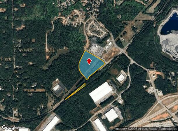
N Highway 29
Atlanta-Sandy Springs-Roswell, GA
20.2238AC +/- LL 11 LD 6 HWY 29 N
107-6011-006
Coweta
Commercialnec
Georgia
X
11
13077C0155D
20.22 AC
2025
Fayette/Coweta County
2025
Atlanta
170310
DEMOGRAPHICS near N Highway 29
1 Mile
3 Mile
5 Mile
2024 Total Population
1,079
12,105
45,689
2029 Population
1,193
13,351
50,469
Pop Growth 2024-2029
+ 10.57%
+ 10.29%
+ 10.46%
Average Age
41
41
41
2024 Total Households
355
4,249
16,657
HH Growth 2024-2029
+ 10.70%
+ 10.31%
+ 10.53%
Median Household Inc
$163,541
$104,936
$104,409
Avg Household Size
3.00
2.80
2.70
2024 Avg HH Vehicles
2.00
3.00
2.00
Median Home Value
$497,332
$332,155
$324,056
Median Year Built
2003
1996
1996
Nearby Places
Map Layers
Map Styles
 Street
 Aerial
- Restaurants
- Banks
- Shops
- Fitness
- Groceries
PUBLIC TRANSPORTATION
AIRPORT
Hartsfield - Jackson Atlanta International
DRIVE
WALK
Distance
Hartsfield - Jackson Atlanta International
33 min
25.2 mi
Freight Ports
Georgia Ports - Savannah
DRIVE
WALK
Distance
Georgia Ports - Savannah
295 min
251.8 mi
SALE & LEASE HISTORY
LISTING DATE
SALE/LEASE

Dec 13, 2017
For Sale
Nearby Properties
Address
Land Use
TOTAL SIZE
Lot Size
Zoning
Address
Land Use
TOTAL SIZE
Lot Size
Zoning
1,001,000 SF
118.56 AC
R1
Address
Land Use
TOTAL SIZE
Lot Size
Zoning
1,079,000 SF
73.44 AC
M
Address
Land Use
TOTAL SIZE
Lot Size
Zoning
1,206,927 SF
109.06 AC
R1
Address
Land Use
TOTAL SIZE
Lot Size
Zoning
1,206,927 SF
109.06 AC
R1
Address
Land Use
TOTAL SIZE
Lot Size
Zoning
293,156 SF
59.97 AC
R1
Address
Land Use
TOTAL SIZE
Lot Size
Zoning
76,445 SF
25.12 AC
R1
Address
Land Use
TOTAL SIZE
Lot Size
Zoning
457,922 SF
45.16 AC
R1
Address
Land Use
TOTAL SIZE
Lot Size
Zoning
215,344 SF
28.12 AC
R1
Address
Land Use
TOTAL SIZE
Lot Size
Zoning
299,520 SF
32.45 AC
R1
Address
Land Use
TOTAL SIZE
Lot Size
Zoning
134,417 SF
13.01 AC
R1
Address
Land Use
TOTAL SIZE
Lot Size
Zoning
216,250 SF
20.12 AC
R1
Address
Land Use
TOTAL SIZE
Lot Size
Zoning
186,249 SF
17.99 AC
R1
Address
Land Use
TOTAL SIZE
Lot Size
Zoning
255.27 AC
NC
Address
Land Use
TOTAL SIZE
Lot Size
Zoning
48,000 SF
4.65 AC
M
Address
Land Use
TOTAL SIZE
Lot Size
Zoning
186,695 SF
29.47 AC
R1
Address
Land Use
TOTAL SIZE
Lot Size
Zoning
90,474 SF
12.56 AC
C
Address
Land Use
TOTAL SIZE
Lot Size
Zoning
117,635 SF
20 AC
001
Address
Land Use
TOTAL SIZE
Lot Size
Zoning
125,758 SF
10.77 AC
002
Address
Land Use
TOTAL SIZE
Lot Size
Zoning
215,323 SF
29.24 AC
003
Address
Land Use
TOTAL SIZE
Lot Size
Zoning
150,000 SF
10.47 AC
002
Address
Land Use
TOTAL SIZE
Lot Size
Zoning
200,000 SF
13 AC
M
Address
Land Use
TOTAL SIZE
Lot Size
Zoning
106,920 SF
14.15 AC
R1
Address
Land Use
TOTAL SIZE
Lot Size
Zoning
106,920 SF
14.15 AC
R1
Address
Land Use
TOTAL SIZE
Lot Size
Zoning
33,276 SF
21.02 AC
R1
Address
Land Use
TOTAL SIZE
Lot Size
Zoning
37.78 AC
002
Address
Land Use
TOTAL SIZE
Lot Size
Zoning
76,920 SF
6.40 AC
R1
Address
Land Use
TOTAL SIZE
Lot Size
Zoning
31,256 SF
20.15 AC
R1
Address
Land Use
TOTAL SIZE
Lot Size
Zoning
59,730 SF
18.33 AC
R1
Address
Land Use
TOTAL SIZE
Lot Size
Zoning
59,730 SF
18.33 AC
R1
Address
Land Use
TOTAL SIZE
Lot Size
Zoning
47,400 SF
92.84 AC
M
The World's #1 Commercial Real Estate Marketplace
Connect with us
© 2026 CoStar Group
The information above has been obtained from sources believed reliable. While we do not doubt its accuracy we have not verified it and make no guarantee, warranty or representation about it. It is your responsibility to independently confirm its accuracy and completeness. Any projections, opinions, assumptions, or estimates used are for example only and do not represent the current or future performance of the property. The value of this transaction to you depends on tax and other factors which should be evaluated by your tax, financial, and legal advisors. You and your advisors should conduct a careful, independent investigation of the property to determine to your satisfaction the suitability of the property for your needs.