Property Record
N Highway 365, Maumelle, AR 72113

NEARBY LISTINGS FOR SALE OR LEASE
-
-
View all Maumelle listings for sale on LoopNet.com
Property Detail
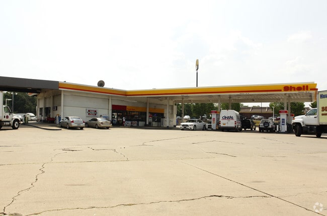
N Highway 365
Little Rock-North Little Rock-Conway, AR
Winnetka Acres
42M-022-25-043-02
IMPS ONLY PT TR 15 MPDA BEG SE COR N930 MOL N73*4741E331 30 S1022 54 MOL TO SW COR W331.6 TO POB
Commercialacreage
Pulaski
X
Arkansas
05119C0145G
15
2025
9.86 AC
2025
Outlying Pulaski County
004310
Little Rock/N Little Rock
DEMOGRAPHICS near N Highway 365
1 Mile
3 Mile
5 Mile
2024 Total Population
2,083
17,177
30,081
2029 Population
2,071
16,982
29,912
Pop Growth 2024-2029
(0.58%)
(1.14%)
(0.56%)
Average Age
40
40
39
2024 Total Households
878
7,148
13,021
HH Growth 2024-2029
(0.68%)
(1.15%)
(0.56%)
Median Household Inc
$49,730
$74,762
$67,138
Avg Household Size
2.30
2.40
2.30
2024 Avg HH Vehicles
2.00
2.00
2.00
Median Home Value
$140,879
$200,342
$226,426
Median Year Built
1997
1998
2000
Nearby Places
Map Layers
Map Styles
 Street
 Aerial
- Restaurants
- Banks
- Shops
- Fitness
- Groceries
PUBLIC TRANSPORTATION
AIRPORT
Bill and Hillary Clinton Ntl/Adams Field
DRIVE
WALK
Distance
Bill and Hillary Clinton Ntl/Adams Field
23 min
17.8 mi
Nearby Properties
Address
Land Use
TOTAL SIZE
Lot Size
Zoning
Address
Land Use
TOTAL SIZE
Lot Size
Zoning
1,160,360 SF
119.55 AC
Address
Land Use
TOTAL SIZE
Lot Size
Zoning
320,000 SF
91.54 AC
Address
Land Use
TOTAL SIZE
Lot Size
Zoning
55,997 SF
11.51 AC
Address
Land Use
TOTAL SIZE
Lot Size
Zoning
77,478 SF
38.22 AC
Address
Land Use
TOTAL SIZE
Lot Size
Zoning
12,077 SF
27.97 AC
Address
Land Use
TOTAL SIZE
Lot Size
Zoning
484,932 SF
32.85 AC
Address
Land Use
TOTAL SIZE
Lot Size
Zoning
157,500 SF
54.99 AC
Address
Land Use
TOTAL SIZE
Lot Size
Zoning
2,340 SF
37.56 AC
Address
Land Use
TOTAL SIZE
Lot Size
Zoning
192,104 SF
34.51 AC
Address
Land Use
TOTAL SIZE
Lot Size
Zoning
139,444 SF
7.63 AC
Address
Land Use
TOTAL SIZE
Lot Size
Zoning
8,624 SF
10.37 AC
Address
Land Use
TOTAL SIZE
Lot Size
Zoning
66,619 SF
5.89 AC
Address
Land Use
TOTAL SIZE
Lot Size
Zoning
56,423 SF
Address
Land Use
TOTAL SIZE
Lot Size
Zoning
8,417 SF
101 AC
Address
Land Use
TOTAL SIZE
Lot Size
Zoning
38,369 SF
10.04 AC
Address
Land Use
TOTAL SIZE
Lot Size
Zoning
6,357 SF
10.80 AC
Address
Land Use
TOTAL SIZE
Lot Size
Zoning
37,955 SF
2.45 AC
Address
Land Use
TOTAL SIZE
Lot Size
Zoning
840 SF
20.01 AC
Address
Land Use
TOTAL SIZE
Lot Size
Zoning
83,647 SF
11.60 AC
Address
Land Use
TOTAL SIZE
Lot Size
Zoning
71,132 SF
5.89 AC
Address
Land Use
TOTAL SIZE
Lot Size
Zoning
162,010 SF
10.45 AC
Address
Land Use
TOTAL SIZE
Lot Size
Zoning
90,746 SF
5.84 AC
Address
Land Use
TOTAL SIZE
Lot Size
Zoning
31,220 SF
2.29 AC
Address
Land Use
TOTAL SIZE
Lot Size
Zoning
68,304 SF
4.18 AC
Address
Land Use
TOTAL SIZE
Lot Size
Zoning
29,599 SF
6.06 AC
Address
Land Use
TOTAL SIZE
Lot Size
Zoning
45,780 SF
7.27 AC
Address
Land Use
TOTAL SIZE
Lot Size
Zoning
13,815 SF
7.40 AC
Address
Land Use
TOTAL SIZE
Lot Size
Zoning
48,716 SF
5.09 AC
Address
Land Use
TOTAL SIZE
Lot Size
Zoning
24,265 SF
6.86 AC
Address
Land Use
TOTAL SIZE
Lot Size
Zoning
7,955 SF
7.08 AC
The World's #1 Commercial Real Estate Marketplace
Connect with us
© 2025 CoStar Group
The information above has been obtained from sources believed reliable. While we do not doubt its accuracy we have not verified it and make no guarantee, warranty or representation about it. It is your responsibility to independently confirm its accuracy and completeness. Any projections, opinions, assumptions, or estimates used are for example only and do not represent the current or future performance of the property. The value of this transaction to you depends on tax and other factors which should be evaluated by your tax, financial, and legal advisors. You and your advisors should conduct a careful, independent investigation of the property to determine to your satisfaction the suitability of the property for your needs.