Property Record
N Hunt Hwy, Florence, AZ 85132

NEARBY LISTINGS FOR SALE OR LEASE
Property Detail
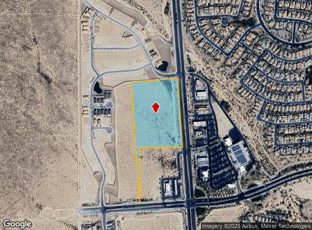
N Hunt Hwy
211-02-001R
COM @ SW COR OF SEC 24-04S-08E TH E-739.58 TH N-406.07 TO POB TH N04D W-1353.97 TH N85D E-586.20 TH S04D E-878.14 TH W-550.81 TH S -516.39 TO POB 11.75 AC
Commercialacreage
Pinal
X
Arizona
04021C0875E
11.75 AC
2024
Pinal County
2025
Phoenix
000804
Phoenix-Mesa-Scottsdale, AZ
DEMOGRAPHICS near N Hunt Hwy
1 Mile
3 Mile
5 Mile
2024 Total Population
4,808
15,623
17,671
2029 Population
6,221
20,120
22,726
Pop Growth 2024-2029
+ 29.39%
+ 28.78%
+ 28.61%
Average Age
49
44
43
2024 Total Households
1,887
5,630
6,259
HH Growth 2024-2029
+ 29.36%
+ 28.81%
+ 28.58%
Median Household Inc
$85,337
$82,821
$82,445
Avg Household Size
2.50
2.70
2.70
2024 Avg HH Vehicles
2.00
2.00
2.00
Median Home Value
$357,280
$347,615
$344,980
Median Year Built
2010
2010
2010
Nearby Places
Map Layers
Map Styles
 Street
 Aerial
- Restaurants
- Banks
- Shops
- Fitness
- Groceries
PUBLIC TRANSPORTATION
AIRPORT
Phoenix-Mesa Gateway
DRIVE
WALK
Distance
Phoenix-Mesa Gateway
36 min
21.9 mi
Freight Ports
Port of San Diego
DRIVE
WALK
Distance
Port of San Diego
415 min
378.2 mi
SALE & LEASE HISTORY
LISTING DATE
SALE/LEASE

May 05, 2021
For Sale
Nearby Properties
Address
Land Use
TOTAL SIZE
Lot Size
Zoning
Address
Land Use
TOTAL SIZE
Lot Size
Zoning
73,818 SF
5.70 AC
Address
Land Use
TOTAL SIZE
Lot Size
Zoning
13.70 AC
UNDESIGNAT
Address
Land Use
TOTAL SIZE
Lot Size
Zoning
97,827 SF
6.45 AC
Address
Land Use
TOTAL SIZE
Lot Size
Zoning
57,699 SF
6.39 AC
Address
Land Use
TOTAL SIZE
Lot Size
Zoning
62,436 SF
6.52 AC
Address
Land Use
TOTAL SIZE
Lot Size
Zoning
12,022 SF
15.43 AC
Address
Land Use
TOTAL SIZE
Lot Size
Zoning
Address
Land Use
TOTAL SIZE
Lot Size
Zoning
21,096 SF
6.33 AC
Address
Land Use
TOTAL SIZE
Lot Size
Zoning
11,057 SF
5.05 AC
Address
Land Use
TOTAL SIZE
Lot Size
Zoning
5,198 SF
9.98 AC
Address
Land Use
TOTAL SIZE
Lot Size
Zoning
72,453 SF
158.41 AC
CR3
Address
Land Use
TOTAL SIZE
Lot Size
Zoning
7,104 SF
1.01 AC
Address
Land Use
TOTAL SIZE
Lot Size
Zoning
8,300 SF
3.56 AC
UNDESIGNAT
Address
Land Use
TOTAL SIZE
Lot Size
Zoning
18.83 AC
UNDESIGNAT
Address
Land Use
TOTAL SIZE
Lot Size
Zoning
5,074 SF
0.99 AC
Address
Land Use
TOTAL SIZE
Lot Size
Zoning
4,756 SF
1.09 AC
Address
Land Use
TOTAL SIZE
Lot Size
Zoning
3,914 SF
0.99 AC
Address
Land Use
TOTAL SIZE
Lot Size
Zoning
6,600 SF
0.77 AC
Address
Land Use
TOTAL SIZE
Lot Size
Zoning
226.11 AC
GR
Address
Land Use
TOTAL SIZE
Lot Size
Zoning
17.98 AC
Address
Land Use
TOTAL SIZE
Lot Size
Zoning
90 AC
GR
Address
Land Use
TOTAL SIZE
Lot Size
Zoning
4,800 SF
0.74 AC
Address
Land Use
TOTAL SIZE
Lot Size
Zoning
6.02 AC
UNDESIGNAT
Address
Land Use
TOTAL SIZE
Lot Size
Zoning
4,250 SF
0.68 AC
The World's #1 Commercial Real Estate Marketplace
Connect with us
© 2026 CoStar Group
The information above has been obtained from sources believed reliable. While we do not doubt its accuracy we have not verified it and make no guarantee, warranty or representation about it. It is your responsibility to independently confirm its accuracy and completeness. Any projections, opinions, assumptions, or estimates used are for example only and do not represent the current or future performance of the property. The value of this transaction to you depends on tax and other factors which should be evaluated by your tax, financial, and legal advisors. You and your advisors should conduct a careful, independent investigation of the property to determine to your satisfaction the suitability of the property for your needs.