Property Record
0 N N Spring Dr, Houston, TX 77373

NEARBY LISTINGS FOR SALE OR LEASE
Property Detail
0 N N Spring Dr
1073100000058
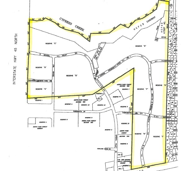
North Spring Sec 1 U/R & R/P
Nightclub
RES A1 (WATER PLANT NO 1) NORTH SPRING SEC 1 U/R & R/P
X
Harris
48339C0700F
Texas
0
0.67 AC
2025
FM 1960/I-45 North
241101
Houston
900 SF
Houston-Pasadena-The Woodlands, TX
DEMOGRAPHICS near 0 N N Spring Dr
1 Mile
3 Mile
5 Mile
2024 Total Population
13,538
104,760
255,082
2029 Population
14,018
106,968
261,188
Pop Growth 2024-2029
+ 3.55%
+ 2.11%
+ 2.39%
Average Age
33
35
35
2024 Total Households
5,293
36,968
87,656
HH Growth 2024-2029
+ 3.38%
+ 2.19%
+ 2.40%
Median Household Inc
$40,144
$59,035
$64,260
Avg Household Size
2.50
2.80
2.80
2024 Avg HH Vehicles
1.00
2.00
2.00
Median Home Value
$174,894
$193,837
$206,082
Median Year Built
1986
1991
1995
Nearby Places
Map Layers
Map Styles
 Street
 Aerial
- Restaurants
- Banks
- Shops
- Fitness
- Groceries
PUBLIC TRANSPORTATION
AIRPORT
George Bush Intcntl/Houston
DRIVE
WALK
Distance
George Bush Intcntl/Houston
20 min
11.8 mi
William P Hobby
DRIVE
WALK
Distance
William P Hobby
55 min
37.1 mi
Freight Ports
Port of Houston
DRIVE
WALK
Distance
Port of Houston
44 min
29.6 mi
SALE & LEASE HISTORY
LISTING DATE
SALE/LEASE

Sep 24, 2016
For Sale
Nearby Properties
Address
Land Use
TOTAL SIZE
Lot Size
Zoning
Address
Land Use
TOTAL SIZE
Lot Size
Zoning
288,721 SF
Address
Land Use
TOTAL SIZE
Lot Size
Zoning
280,283 SF
16.56 AC
Address
Land Use
TOTAL SIZE
Lot Size
Zoning
271,432 SF
35.81 AC
Address
Land Use
TOTAL SIZE
Lot Size
Zoning
136,748 SF
30.29 AC
Address
Land Use
TOTAL SIZE
Lot Size
Zoning
259,000 SF
15.73 AC
Address
Land Use
TOTAL SIZE
Lot Size
Zoning
259,000 SF
14.73 AC
Address
Land Use
TOTAL SIZE
Lot Size
Zoning
158,081 SF
23.46 AC
Address
Land Use
TOTAL SIZE
Lot Size
Zoning
244,846 SF
10.03 AC
Address
Land Use
TOTAL SIZE
Lot Size
Zoning
134,368 SF
7.10 AC
Address
Land Use
TOTAL SIZE
Lot Size
Zoning
196,000 SF
19.44 AC
Address
Land Use
TOTAL SIZE
Lot Size
Zoning
204,870 SF
13.40 AC
Address
Land Use
TOTAL SIZE
Lot Size
Zoning
223,231 SF
21.23 AC
Address
Land Use
TOTAL SIZE
Lot Size
Zoning
267,250 SF
11.83 AC
Address
Land Use
TOTAL SIZE
Lot Size
Zoning
127,260 SF
14 AC
Address
Land Use
TOTAL SIZE
Lot Size
Zoning
92,975 SF
10.66 AC
Address
Land Use
TOTAL SIZE
Lot Size
Zoning
174,800 SF
14.43 AC
Address
Land Use
TOTAL SIZE
Lot Size
Zoning
59,589 SF
9.74 AC
Address
Land Use
TOTAL SIZE
Lot Size
Zoning
222,382 SF
10.44 AC
Address
Land Use
TOTAL SIZE
Lot Size
Zoning
22,412 SF
15.48 AC
Address
Land Use
TOTAL SIZE
Lot Size
Zoning
152,898 SF
17 AC
Address
Land Use
TOTAL SIZE
Lot Size
Zoning
135,628 SF
15.04 AC
Address
Land Use
TOTAL SIZE
Lot Size
Zoning
216,390 SF
8.42 AC
Address
Land Use
TOTAL SIZE
Lot Size
Zoning
138,536 SF
15.99 AC
Address
Land Use
TOTAL SIZE
Lot Size
Zoning
281,563 SF
19.98 AC
Address
Land Use
TOTAL SIZE
Lot Size
Zoning
53,730 SF
10.75 AC
Address
Land Use
TOTAL SIZE
Lot Size
Zoning
144,380 SF
5.67 AC
Address
Land Use
TOTAL SIZE
Lot Size
Zoning
104,360 SF
11.36 AC
Address
Land Use
TOTAL SIZE
Lot Size
Zoning
101,064 SF
11.83 AC
Address
Land Use
TOTAL SIZE
Lot Size
Zoning
56,524 SF
9.46 AC
Address
Land Use
TOTAL SIZE
Lot Size
Zoning
142,282 SF
23.63 AC
The World's #1 Commercial Real Estate Marketplace
Connect with us
© 2026 CoStar Group
The information above has been obtained from sources believed reliable. While we do not doubt its accuracy we have not verified it and make no guarantee, warranty or representation about it. It is your responsibility to independently confirm its accuracy and completeness. Any projections, opinions, assumptions, or estimates used are for example only and do not represent the current or future performance of the property. The value of this transaction to you depends on tax and other factors which should be evaluated by your tax, financial, and legal advisors. You and your advisors should conduct a careful, independent investigation of the property to determine to your satisfaction the suitability of the property for your needs.