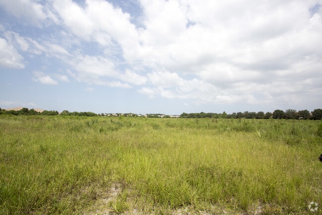
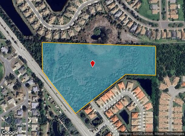
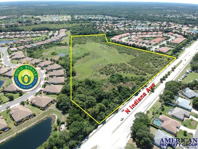
Property Record
1251 N Indiana Ave, Englewood, FL 34223
NEARBY LISTINGS FOR SALE OR LEASE
Property Detail
1251 N Indiana Ave
North Port-Sarasota-Bradenton, FL
Not Part Of A Subdivision
0494-11-0001
PART OF SE 1/4 OF NW 1/4 OF SEC 24-40-19 BEING DESC AS BEG AT NE COR OF SAID SE 1/4 OF NW 1/4 OF SEC 24 TH S 0-41-54 W ALG ELY BOUNDARY OF SAID SE 1/4 OF NW 1/4 A DISTANCE OF 330.16 FT TH
Miscellaneous
Sarasota
AE
Florida
12115C0451G
15.70 AC
2023
Sarasota Outlying
2024
Tampa/St Petersburg
002733
DEMOGRAPHICS near 1251 N Indiana Ave
1 Mile
3 Mile
5 Mile
2024 Total Population
5,004
18,051
50,166
2029 Population
5,841
21,060
59,144
Pop Growth 2024-2029
+ 16.73%
+ 16.67%
+ 17.90%
Average Age
62
60
60
2024 Total Households
2,624
9,386
25,590
HH Growth 2024-2029
+ 16.77%
+ 16.64%
+ 18.06%
Median Household Inc
$60,030
$61,562
$69,603
Avg Household Size
1.80
1.90
1.90
2024 Avg HH Vehicles
2.00
2.00
2.00
Median Home Value
$342,901
$342,786
$330,335
Median Year Built
1986
1984
1988
Nearby Places
- Restaurants
- Banks
- Shops
- Fitness
- Groceries
PUBLIC TRANSPORTATION
AIRPORT
Punta Gorda
DRIVE
WALK
Distance
Punta Gorda
53 min
31.9 mi
Freight Ports
Port Manatee
DRIVE
WALK
Distance
Port Manatee
67 min
51.3 mi
SALE & LEASE HISTORY
LISTING DATE
SALE/LEASE

Oct 17, 2019
For Sale
May 20, 2020
For Sale
Aug 25, 2017
For Sale
Nearby Properties
Address
Land Use
TOTAL SIZE
Lot Size
Zoning
Address
Land Use
TOTAL SIZE
Lot Size
Zoning
314.81 AC
V
Address
Land Use
TOTAL SIZE
Lot Size
Zoning
84,817 SF
8.98 AC
GU
Address
Land Use
TOTAL SIZE
Lot Size
Zoning
63,480 SF
6.22 AC
RMF3
Address
Land Use
TOTAL SIZE
Lot Size
Zoning
30,565 SF
136.67 AC
GU
Address
Land Use
TOTAL SIZE
Lot Size
Zoning
54.51 AC
SAPD
Address
Land Use
TOTAL SIZE
Lot Size
Zoning
103,161 SF
2.54 AC
ILW
Address
Land Use
TOTAL SIZE
Lot Size
Zoning
95,900 SF
5.56 AC
RMF3
Address
Land Use
TOTAL SIZE
Lot Size
Zoning
71,462 SF
24.99 AC
RE1
Address
Land Use
TOTAL SIZE
Lot Size
Zoning
136.72 AC
OUC
Address
Land Use
TOTAL SIZE
Lot Size
Zoning
80,850 SF
2.84 AC
CG
Address
Land Use
TOTAL SIZE
Lot Size
Zoning
2,495 SF
6.97 AC
RMH
Address
Land Use
TOTAL SIZE
Lot Size
Zoning
50,672 SF
77.41 AC
RMF1
Address
Land Use
TOTAL SIZE
Lot Size
Zoning
4,219 SF
69.48 AC
GU
Address
Land Use
TOTAL SIZE
Lot Size
Zoning
91,755 SF
5.70 AC
RMF2
Address
Land Use
TOTAL SIZE
Lot Size
Zoning
4,990 SF
11.86 AC
OUE1
Address
Land Use
TOTAL SIZE
Lot Size
Zoning
72,168 SF
7.11 AC
CG
Address
Land Use
TOTAL SIZE
Lot Size
Zoning
38,753 SF
8.78 AC
OPI
Address
Land Use
TOTAL SIZE
Lot Size
Zoning
44,594 SF
5.70 AC
CG
Address
Land Use
TOTAL SIZE
Lot Size
Zoning
51,182 SF
2.62 AC
OPI
Address
Land Use
TOTAL SIZE
Lot Size
Zoning
14,938 SF
1.63 AC
CG
Address
Land Use
TOTAL SIZE
Lot Size
Zoning
72,549 SF
4.54 AC
CI
Address
Land Use
TOTAL SIZE
Lot Size
Zoning
93.43 AC
RSF2
Address
Land Use
TOTAL SIZE
Lot Size
Zoning
8,448 SF
1.46 AC
RE2
Address
Land Use
TOTAL SIZE
Lot Size
Zoning
0.38 AC
V
Address
Land Use
TOTAL SIZE
Lot Size
Zoning
11,475 SF
3.86 AC
RE2
Address
Land Use
TOTAL SIZE
Lot Size
Zoning
42,955 SF
15.64 AC
OUE1
Address
Land Use
TOTAL SIZE
Lot Size
Zoning
3,907 SF
2.43 AC
RE2
Address
Land Use
TOTAL SIZE
Lot Size
Zoning
2,807 SF
98 AC
GU
Address
Land Use
TOTAL SIZE
Lot Size
Zoning
5,995 SF
3.01 AC
RE2
Address
Land Use
TOTAL SIZE
Lot Size
Zoning
6,166 SF
9 AC
RMH
The World's #1 Commercial Real Estate Marketplace
Connect with us
© 2025 CoStar Group
The information above has been obtained from sources believed reliable. While we do not doubt its accuracy we have not verified it and make no guarantee, warranty or representation about it. It is your responsibility to independently confirm its accuracy and completeness. Any projections, opinions, assumptions, or estimates used are for example only and do not represent the current or future performance of the property. The value of this transaction to you depends on tax and other factors which should be evaluated by your tax, financial, and legal advisors. You and your advisors should conduct a careful, independent investigation of the property to determine to your satisfaction the suitability of the property for your needs.