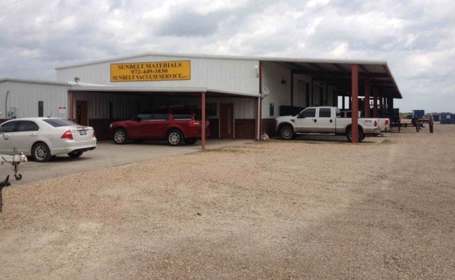
Property Record
N Interstate 45, Palmer, TX 75152
Current Lease Availabilities
Property Detail
N Interstate 45
Dallas-Fort Worth-Arlington, TX
3 R PENA Q-E 3.31 ACRES
138320
ELLIS
Agriculturalland
Texas
B and X Area of moderate flood hazard, usually the area between the limits of the 100-year and 500-year floods.
5.55 AC
2024
Outlying Ellis Cnty
2025
Dallas/Ft Worth
060106
NEARBY LISTINGS FOR SALE OR LEASE
-
-
View all Palmer listings for lease on LoopNet.com
DEMOGRAPHICS near N Interstate 45
1 mile
3 mile
5 mile
2024 Total Population
1,377
4,696
8,489
2029 Population
1,609
5,483
9,886
Pop Growth 2024-2029
+ 16.85%
+ 16.76%
+ 16.46%
Average Age
36
36
37
2024 Total Households
436
1,484
2,727
HH Growth 2024-2029
+ 16.97%
+ 16.91%
+ 16.57%
Median Household Inc
$72,735
$78,796
$80,118
Avg Household Size
3.10
3.10
3.10
2024 Avg HH Vehicles
2.00
3.00
3.00
Median Home Value
$163,571
$208,960
$253,214
Median Year Built
1996
1996
1996
Nearby Places
Map Layers
Map Styles
 Street
 Aerial
Transit
 Traffic
 Biking
Places
Listings with unknown addresses are not visible on the map
- Restaurants
- Banks
- Shops
- Fitness
- Groceries
PUBLIC TRANSPORTATION
AIRPORT
Dallas Love Field
Drive
Walk
Distance
Dallas Love Field
41 min
29.9 mi
Freight Ports
Port of Shreveport
Drive
Walk
Distance
Port of Shreveport
222 min
205.8 mi
Nearby Properties
Address
Land Use
TOTAL SIZE
Lot Size
Zoning
Address
Land Use
TOTAL SIZE
Lot Size
Zoning
37,348 SF
10.08 AC
Address
Land Use
TOTAL SIZE
Lot Size
Zoning
36,000 SF
6.19 AC
Address
Land Use
TOTAL SIZE
Lot Size
Zoning
48,400 SF
4.32 AC
Address
Land Use
TOTAL SIZE
Lot Size
Zoning
49,320 SF
25.10 AC
Address
Land Use
TOTAL SIZE
Lot Size
Zoning
26,779 SF
11.29 AC
Address
Land Use
TOTAL SIZE
Lot Size
Zoning
12,600 SF
6.97 AC
Address
Land Use
TOTAL SIZE
Lot Size
Zoning
8,259 SF
48.37 AC
Address
Land Use
TOTAL SIZE
Lot Size
Zoning
44,644 SF
1.87 AC
Address
Land Use
TOTAL SIZE
Lot Size
Zoning
5,635 SF
1.51 AC
Address
Land Use
TOTAL SIZE
Lot Size
Zoning
10,580 SF
4.13 AC
Address
Land Use
TOTAL SIZE
Lot Size
Zoning
49.48 AC
Address
Land Use
TOTAL SIZE
Lot Size
Zoning
9,000 SF
3 AC
Address
Land Use
TOTAL SIZE
Lot Size
Zoning
107.63 AC
Address
Land Use
TOTAL SIZE
Lot Size
Zoning
22,400 SF
15.36 AC
Address
Land Use
TOTAL SIZE
Lot Size
Zoning
9,760 SF
5.42 AC
Address
Land Use
TOTAL SIZE
Lot Size
Zoning
9,600 SF
5.88 AC
Address
Land Use
TOTAL SIZE
Lot Size
Zoning
4,256 SF
242.63 AC
Address
Land Use
TOTAL SIZE
Lot Size
Zoning
20,488 SF
24.02 AC
Address
Land Use
TOTAL SIZE
Lot Size
Zoning
18,364 SF
37.66 AC
Address
Land Use
TOTAL SIZE
Lot Size
Zoning
4,307 SF
3.14 AC
Address
Land Use
TOTAL SIZE
Lot Size
Zoning
6,244 SF
19.79 AC
Address
Land Use
TOTAL SIZE
Lot Size
Zoning
4,793 SF
5.94 AC
Address
Land Use
TOTAL SIZE
Lot Size
Zoning
11,879 SF
2.22 AC
Address
Land Use
TOTAL SIZE
Lot Size
Zoning
4,930 SF
22.83 AC
Address
Land Use
TOTAL SIZE
Lot Size
Zoning
6,400 SF
5.16 AC
Address
Land Use
TOTAL SIZE
Lot Size
Zoning
31.44 AC
Address
Land Use
TOTAL SIZE
Lot Size
Zoning
6,380 SF
5.60 AC
Address
Land Use
TOTAL SIZE
Lot Size
Zoning
13,700 SF
45.56 AC
Address
Land Use
TOTAL SIZE
Lot Size
Zoning
10,900 SF
10.01 AC
Address
Land Use
TOTAL SIZE
Lot Size
Zoning
6,174 SF
10.10 AC
The World's #1 Commercial Real Estate Marketplace
Connect with us
© 2026 CoStar Group
The information above has been obtained from sources believed reliable. While we do not doubt its accuracy we have not verified it and make no guarantee, warranty or representation about it. It is your responsibility to independently confirm its accuracy and completeness. Any projections, opinions, assumptions, or estimates used are for example only and do not represent the current or future performance of the property. The value of this transaction to you depends on tax and other factors which should be evaluated by your tax, financial, and legal advisors. You and your advisors should conduct a careful, independent investigation of the property to determine to your satisfaction the suitability of the property for your needs.