Property Record
N Jillian Way, Maricopa, AZ 85139
Save to a Folder
{{folder.Name}}
{{folder.ListingIds.length}} Properties
{{folder.ListingIds.length}} Property
Create a New Folder
Property Detail
N Jillian Way
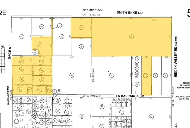
510-75-008F
W-30 OF NE NW OF SEC 21-4S-2E EXC N-50 THEREOF .87 AC
Vacantlandnec
PINAL
CR1A
Arizona
B and X Area of moderate flood hazard, usually the area between the limits of the 100-year and 500-year floods.
9 AC
2024
Pinal County
2025
Phoenix
001701
Phoenix-Mesa-Chandler, AZ
NEARBY LISTINGS FOR SALE OR LEASE
DEMOGRAPHICS near N Jillian Way
1 mile
3 mile
5 mile
2025 Total Population
203
706
1,079
2030 Population
245
851
1,285
Pop Growth 2025-2030
+ 20.69%
+ 20.54%
+ 19.09%
Average Age
44
44
44
2025 Total Households
71
246
372
HH Growth 2025-2030
+ 19.72%
+ 20.33%
+ 18.82%
Median Household Inc
$104,412
$104,271
$103,765
Avg Household Size
2.70
2.80
2.80
2025 Avg HH Vehicles
3.00
3.00
3.00
Median Home Value
$393,749
$391,666
$390,505
Median Year Built
2001
2001
2001
Nearby Places
Map Layers
Map Styles
 Street
 Aerial
Layers
 Traffic
 Biking
Places
Listings with unknown addresses are not visible on the map
- Restaurants
- Banks
- Shops
- Fitness
- Groceries
PUBLIC TRANSPORTATION
COMMUTER RAIL
Maricopa (Sunset Limited - Amtrak, Texas Eagle - Amtrak)
Drive
Walk
Distance
Maricopa (Sunset Limited - Amtrak, Texas Eagle - Amtrak)
18 min
9.5 mi
AIRPORT
Phoenix Sky Harbor International
Drive
Walk
Distance
Phoenix Sky Harbor International
57 min
37.1 mi
Freight Ports
Port of San Diego
Drive
Walk
Distance
Port of San Diego
374 min
324.2 mi
Nearby Properties
Address
Land Use
TOTAL SIZE
Lot Size
Zoning
Address
Land Use
TOTAL SIZE
Lot Size
Zoning
108,328 SF
320 AC
Address
Land Use
TOTAL SIZE
Lot Size
Zoning
7,414 SF
100 AC
GR
Address
Land Use
TOTAL SIZE
Lot Size
Zoning
7,184 SF
23.34 AC
Address
Land Use
TOTAL SIZE
Lot Size
Zoning
77.08 AC
GR
Address
Land Use
TOTAL SIZE
Lot Size
Zoning
69.20 AC
Address
Land Use
TOTAL SIZE
Lot Size
Zoning
3,552 SF
10 AC
CI2
Address
Land Use
TOTAL SIZE
Lot Size
Zoning
46.96 AC
CI2
Address
Land Use
TOTAL SIZE
Lot Size
Zoning
76.97 AC
Address
Land Use
TOTAL SIZE
Lot Size
Zoning
Address
Land Use
TOTAL SIZE
Lot Size
Zoning
4,800 SF
5 AC
CI2
Address
Land Use
TOTAL SIZE
Lot Size
Zoning
2,352 SF
5 AC
CI2
Address
Land Use
TOTAL SIZE
Lot Size
Zoning
2,358 SF
5 AC
CI2
Address
Land Use
TOTAL SIZE
Lot Size
Zoning
29.86 AC
GR
Address
Land Use
TOTAL SIZE
Lot Size
Zoning
Address
Land Use
TOTAL SIZE
Lot Size
Zoning
4,720 SF
5 AC
CI2
Address
Land Use
TOTAL SIZE
Lot Size
Zoning
1,968 SF
218.43 AC
CI2
Address
Land Use
TOTAL SIZE
Lot Size
Zoning
7 AC
CI2
Address
Land Use
TOTAL SIZE
Lot Size
Zoning
19.55 AC
GR
Address
Land Use
TOTAL SIZE
Lot Size
Zoning
5 AC
CI2
Address
Land Use
TOTAL SIZE
Lot Size
Zoning
15 AC
GR
Address
Land Use
TOTAL SIZE
Lot Size
Zoning
3,244 SF
8.96 AC
GR
Address
Land Use
TOTAL SIZE
Lot Size
Zoning
1,254 SF
3 AC
Address
Land Use
TOTAL SIZE
Lot Size
Zoning
Address
Land Use
TOTAL SIZE
Lot Size
Zoning
2,282 SF
147.11 AC
The World's #1 Commercial Real Estate Marketplace
Connect with us
© 2026 CoStar Group
The information above has been obtained from sources believed reliable. While we do not doubt its accuracy we have not verified it and make no guarantee, warranty or representation about it. It is your responsibility to independently confirm its accuracy and completeness. Any projections, opinions, assumptions, or estimates used are for example only and do not represent the current or future performance of the property. The value of this transaction to you depends on tax and other factors which should be evaluated by your tax, financial, and legal advisors. You and your advisors should conduct a careful, independent investigation of the property to determine to your satisfaction the suitability of the property for your needs.