Property Record
N Kegley Rd, Temple, TX 76502
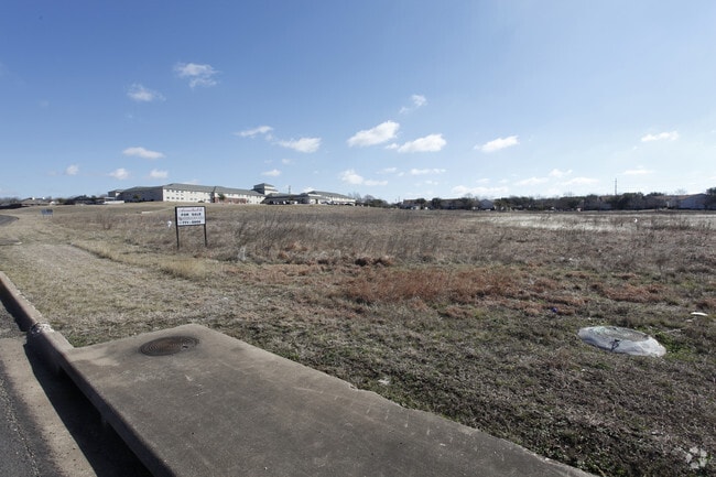


Property Detail
N Kegley Rd
Killeen-Temple, TX
FRIENDSHIP PLAZA AMENDING NO 3 (L4,5 B1), BLOCK 001, LOT 0001, ACRES 8.427
492326
BELL
Commercialnec
Texas
2025
1
2025
8.43 AC
021203
Temple
46,858 SF
Killeen/Temple/Fort Hood
NEARBY LISTINGS FOR SALE OR LEASE
DEMOGRAPHICS near N Kegley Rd
1 mile
3 mile
5 mile
2025 Total Population
4,944
42,985
98,707
2030 Population
5,260
46,019
105,293
Pop Growth 2025-2030
+ 6.39%
+ 7.06%
+ 6.67%
Average Age
37
37
38
2025 Total Households
2,195
16,825
39,322
HH Growth 2025-2030
+ 6.33%
+ 7.00%
+ 6.73%
Median Household Inc
$65,028
$71,822
$68,997
Avg Household Size
2.20
2.50
2.40
2025 Avg HH Vehicles
2.00
2.00
2.00
Median Home Value
$292,013
$260,473
$258,225
Median Year Built
1994
1996
1991
Nearby Places
Map Layers
Map Styles
 Street
 Aerial
Layers
 Traffic
 Biking
Places
Listings with unknown addresses are not visible on the map
- Restaurants
- Banks
- Shops
- Fitness
- Groceries
PUBLIC TRANSPORTATION
COMMUTER RAIL
Drive
Walk
Distance
7 min
3.6 mi
AIRPORT
Killeen Municipal
Drive
Walk
Distance
Killeen Municipal
30 min
21.3 mi
Robert Gray AAF
Drive
Walk
Distance
Robert Gray AAF
49 min
35.2 mi
Waco Regional
Drive
Walk
Distance
Waco Regional
60 min
45.2 mi
SALE & LEASE HISTORY
LISTING DATE
SALE/LEASE

Oct 04, 2021
For Sale
Nearby Properties
Address
Land Use
TOTAL SIZE
Lot Size
Zoning
Address
Land Use
TOTAL SIZE
Lot Size
Zoning
274,710 SF
38.05 AC
C
Address
Land Use
TOTAL SIZE
Lot Size
Zoning
1 SF
14.43 AC
Address
Land Use
TOTAL SIZE
Lot Size
Zoning
109,343 SF
413.13 AC
LI
Address
Land Use
TOTAL SIZE
Lot Size
Zoning
86,326 SF
8.70 AC
MF1
Address
Land Use
TOTAL SIZE
Lot Size
Zoning
77,450 SF
16.51 AC
Address
Land Use
TOTAL SIZE
Lot Size
Zoning
Address
Land Use
TOTAL SIZE
Lot Size
Zoning
180,360 SF
9.66 AC
Address
Land Use
TOTAL SIZE
Lot Size
Zoning
208,941 SF
9.23 AC
Address
Land Use
TOTAL SIZE
Lot Size
Zoning
1 SF
15 AC
SCHL
Address
Land Use
TOTAL SIZE
Lot Size
Zoning
92,815 SF
15.78 AC
Address
Land Use
TOTAL SIZE
Lot Size
Zoning
214,028 SF
14.37 AC
Address
Land Use
TOTAL SIZE
Lot Size
Zoning
228,154 SF
17.95 AC
Address
Land Use
TOTAL SIZE
Lot Size
Zoning
230,116 SF
12.79 AC
Address
Land Use
TOTAL SIZE
Lot Size
Zoning
Address
Land Use
TOTAL SIZE
Lot Size
Zoning
188,072 SF
9.51 AC
C
Address
Land Use
TOTAL SIZE
Lot Size
Zoning
Address
Land Use
TOTAL SIZE
Lot Size
Zoning
170,234 SF
8.97 AC
C
Address
Land Use
TOTAL SIZE
Lot Size
Zoning
265,000 SF
15.41 AC
Address
Land Use
TOTAL SIZE
Lot Size
Zoning
168,754 SF
10.36 AC
LI
Address
Land Use
TOTAL SIZE
Lot Size
Zoning
41,630 SF
11.85 AC
Address
Land Use
TOTAL SIZE
Lot Size
Zoning
195,291 SF
36.30 AC
Address
Land Use
TOTAL SIZE
Lot Size
Zoning
153,043 SF
12.61 AC
Address
Land Use
TOTAL SIZE
Lot Size
Zoning
161,036 SF
52.18 AC
PD
Address
Land Use
TOTAL SIZE
Lot Size
Zoning
71,931 SF
8.64 AC
Address
Land Use
TOTAL SIZE
Lot Size
Zoning
261,265 SF
17.50 AC
C
Address
Land Use
TOTAL SIZE
Lot Size
Zoning
1,088 SF
Address
Land Use
TOTAL SIZE
Lot Size
Zoning
206,897 SF
12.51 AC
COMB
Address
Land Use
TOTAL SIZE
Lot Size
Zoning
165,357 SF
33.03 AC
Address
Land Use
TOTAL SIZE
Lot Size
Zoning
57,121 SF
54.72 AC
Address
Land Use
TOTAL SIZE
Lot Size
Zoning
155,262 SF
10 AC
MF2
The World's #1 Commercial Real Estate Marketplace
Connect with us
© 2026 CoStar Group
The information above has been obtained from sources believed reliable. While we do not doubt its accuracy we have not verified it and make no guarantee, warranty or representation about it. It is your responsibility to independently confirm its accuracy and completeness. Any projections, opinions, assumptions, or estimates used are for example only and do not represent the current or future performance of the property. The value of this transaction to you depends on tax and other factors which should be evaluated by your tax, financial, and legal advisors. You and your advisors should conduct a careful, independent investigation of the property to determine to your satisfaction the suitability of the property for your needs.