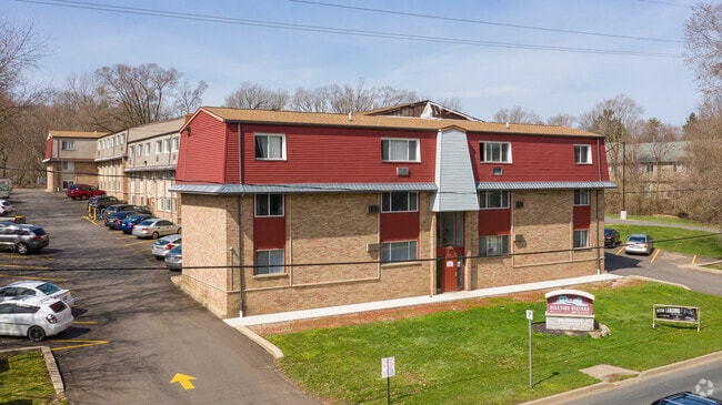
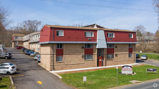
Property Record
N Kendall Ave, Kalamazoo, MI 49006
NEARBY LISTINGS FOR SALE OR LEASE
Property Detail
N Kendall Ave
Kalamazoo-Portage, MI
Kendalls Add
06-17-305-130
3314240 3906 17 305 140 SUPERVISORS PLAT OF KENDALLS ADDITION LOT 14 & THE S 36.1 FT OF LOT 13 EXC THAT PART LYING WITHIN
Commercialacreage
Kalamazoo
X
Michigan
26077C0175E
10-14
2024
0.71 AC
2025
Westwood
001502
West Michigan
DEMOGRAPHICS near N Kendall Ave
1 Mile
3 Mile
5 Mile
2024 Total Population
13,859
77,212
139,731
2029 Population
13,839
77,497
139,747
Pop Growth 2024-2029
(0.14%)
+ 0.37%
+ 0.01%
Average Age
33
35
36
2024 Total Households
5,739
32,657
58,188
HH Growth 2024-2029
(0.17%)
+ 0.40%
0.00%
Median Household Inc
$47,872
$43,025
$50,333
Avg Household Size
2.00
2.10
2.20
2024 Avg HH Vehicles
2.00
2.00
2.00
Median Home Value
$162,474
$186,968
$173,078
Median Year Built
1974
1972
1969
Nearby Places
Map Layers
Map Styles
 Street
 Aerial
- Restaurants
- Banks
- Shops
- Fitness
- Groceries
PUBLIC TRANSPORTATION
COMMUTER RAIL
Kalamazoo (Blue Water - Amtrak, Wolverine - Amtrak)
DRIVE
WALK
Distance
Kalamazoo (Blue Water - Amtrak, Wolverine - Amtrak)
6 min
2.7 mi
AIRPORT
Kalamazoo/Battle Creek International
DRIVE
WALK
Distance
Kalamazoo/Battle Creek International
20 min
9.5 mi
Freight Ports
Port of Toledo
DRIVE
WALK
Distance
Port of Toledo
179 min
147.0 mi
Nearby Properties
Address
Land Use
TOTAL SIZE
Lot Size
Zoning
Address
Land Use
TOTAL SIZE
Lot Size
Zoning
632,218 SF
10.84 AC
M-1
Address
Land Use
TOTAL SIZE
Lot Size
Zoning
374,906 SF
16.31 AC
RM-36
Address
Land Use
TOTAL SIZE
Lot Size
Zoning
289,865 SF
23.60 AC
PUD
Address
Land Use
TOTAL SIZE
Lot Size
Zoning
125,343 SF
37.39 AC
C-1 COM
Address
Land Use
TOTAL SIZE
Lot Size
Zoning
265,402 SF
21.70 AC
R-4 MUL
Address
Land Use
TOTAL SIZE
Lot Size
Zoning
35,870 SF
12.78 AC
CC
Address
Land Use
TOTAL SIZE
Lot Size
Zoning
449,275 SF
33.70 AC
R-4 MUL
Address
Land Use
TOTAL SIZE
Lot Size
Zoning
331,571 SF
19.68 AC
RM-15
Address
Land Use
TOTAL SIZE
Lot Size
Zoning
304,247 SF
44.91 AC
R-4 MUL
Address
Land Use
TOTAL SIZE
Lot Size
Zoning
329,276 SF
43.86 AC
RM-1
Address
Land Use
TOTAL SIZE
Lot Size
Zoning
429,500 SF
2 AC
CCBD
Address
Land Use
TOTAL SIZE
Lot Size
Zoning
228,088 SF
19.14 AC
R-4 MUL
Address
Land Use
TOTAL SIZE
Lot Size
Zoning
315,422 SF
25.40 AC
RM-15
Address
Land Use
TOTAL SIZE
Lot Size
Zoning
877,422 SF
38.18 AC
M-2
Address
Land Use
TOTAL SIZE
Lot Size
Zoning
14,095 SF
27.05 AC
PUD
Address
Land Use
TOTAL SIZE
Lot Size
Zoning
186,073 SF
28.64 AC
C COMM
Address
Land Use
TOTAL SIZE
Lot Size
Zoning
447,142 SF
34.79 AC
R-4 MUL
Address
Land Use
TOTAL SIZE
Lot Size
Zoning
126.09 AC
R-5 MHP
Address
Land Use
TOTAL SIZE
Lot Size
Zoning
291,495 SF
18.39 AC
PUD
Address
Land Use
TOTAL SIZE
Lot Size
Zoning
105,046 SF
19.30 AC
RM-15
Address
Land Use
TOTAL SIZE
Lot Size
Zoning
273,122 SF
16.12 AC
PUD
Address
Land Use
TOTAL SIZE
Lot Size
Zoning
201,940 SF
9.30 AC
RM-36
Address
Land Use
TOTAL SIZE
Lot Size
Zoning
230,820 SF
16.50 AC
R-4 MUL
Address
Land Use
TOTAL SIZE
Lot Size
Zoning
110,686 SF
9.45 AC
CCBD
Address
Land Use
TOTAL SIZE
Lot Size
Zoning
273,205 SF
24.70 AC
R-4 MUL
Address
Land Use
TOTAL SIZE
Lot Size
Zoning
275,595 SF
0.65 AC
CCBD
Address
Land Use
TOTAL SIZE
Lot Size
Zoning
217,443 SF
36.48 AC
C COMM
Address
Land Use
TOTAL SIZE
Lot Size
Zoning
Address
Land Use
TOTAL SIZE
Lot Size
Zoning
50,826 SF
0.79 AC
CCBD
Address
Land Use
TOTAL SIZE
Lot Size
Zoning
186,652 SF
28.29 AC
PUD
The World's #1 Commercial Real Estate Marketplace
Connect with us
© 2025 CoStar Group
The information above has been obtained from sources believed reliable. While we do not doubt its accuracy we have not verified it and make no guarantee, warranty or representation about it. It is your responsibility to independently confirm its accuracy and completeness. Any projections, opinions, assumptions, or estimates used are for example only and do not represent the current or future performance of the property. The value of this transaction to you depends on tax and other factors which should be evaluated by your tax, financial, and legal advisors. You and your advisors should conduct a careful, independent investigation of the property to determine to your satisfaction the suitability of the property for your needs.