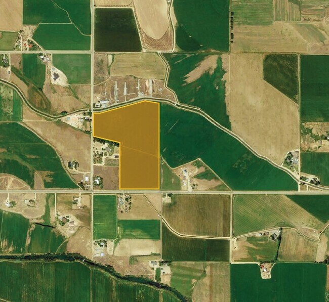
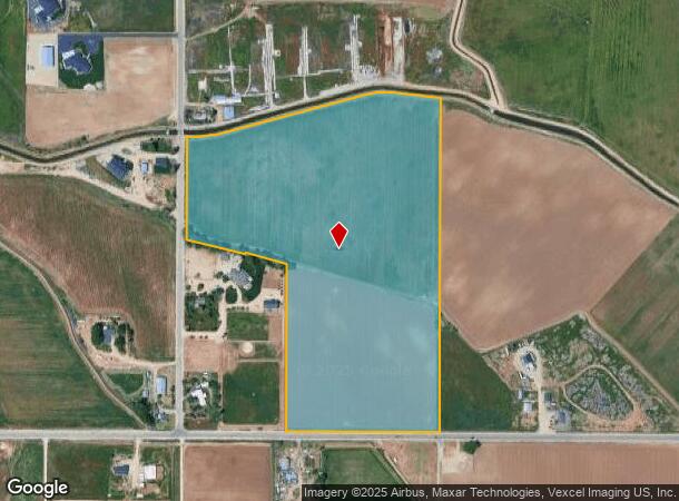
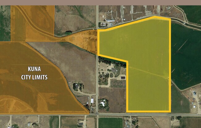
Property Record
N Locust Grove Rd, Kuna, ID 83634
NEARBY LISTINGS FOR SALE OR LEASE
Property Detail
N Locust Grove Rd
S1420325708
PAR #5708 OF W2SW4 SEC 20 2N 1E #325706-B
Agriculturalland
Ada
X
Idaho
16001C0425H
37.83 AC
2024
South Ada County
2025
Boise City/Nampa
010406
Boise City, ID
DEMOGRAPHICS near N Locust Grove Rd
1 Mile
3 Mile
5 Mile
2024 Total Population
254
23,630
56,134
2029 Population
293
26,902
64,030
Pop Growth 2024-2029
+ 15.35%
+ 13.85%
+ 14.07%
Average Age
37
36
36
2024 Total Households
94
6,978
17,145
HH Growth 2024-2029
+ 15.96%
+ 14.56%
+ 14.59%
Median Household Inc
$47,321
$75,423
$83,925
Avg Household Size
2.70
3.00
3.00
2024 Avg HH Vehicles
4.00
3.00
2.00
Median Home Value
$858,333
$435,391
$442,930
Median Year Built
1997
2004
2007
Nearby Places
Map Layers
Map Styles
 Street
 Aerial
- Restaurants
- Banks
- Shops
- Fitness
- Groceries
PUBLIC TRANSPORTATION
AIRPORT
Boise Air Trml/Gowen Field
DRIVE
WALK
Distance
Boise Air Trml/Gowen Field
37 min
15.8 mi
Freight Ports
Port of Portland
DRIVE
WALK
Distance
Port of Portland
477 min
430.8 mi
SALE & LEASE HISTORY
LISTING DATE
SALE/LEASE

Feb 03, 2020
For Sale
Nearby Properties
Address
Land Use
TOTAL SIZE
Lot Size
Zoning
Address
Land Use
TOTAL SIZE
Lot Size
Zoning
52,296 SF
4.44 AC
R-12
Address
Land Use
TOTAL SIZE
Lot Size
Zoning
109,033 SF
8.77 AC
C-2
Address
Land Use
TOTAL SIZE
Lot Size
Zoning
56,325 SF
8.66 AC
M-1
Address
Land Use
TOTAL SIZE
Lot Size
Zoning
55,652 SF
6.71 AC
C-1
Address
Land Use
TOTAL SIZE
Lot Size
Zoning
50,027 SF
5.48 AC
C-1
Address
Land Use
TOTAL SIZE
Lot Size
Zoning
12,231 SF
6.72 AC
R-12
Address
Land Use
TOTAL SIZE
Lot Size
Zoning
5,747 SF
2.49 AC
C-1
Address
Land Use
TOTAL SIZE
Lot Size
Zoning
35,167 SF
2.83 AC
C-1
Address
Land Use
TOTAL SIZE
Lot Size
Zoning
34,436 SF
5.90 AC
C-2
Address
Land Use
TOTAL SIZE
Lot Size
Zoning
40.19 AC
R-6
Address
Land Use
TOTAL SIZE
Lot Size
Zoning
12,796 SF
1.45 AC
C-1
Address
Land Use
TOTAL SIZE
Lot Size
Zoning
27,416 SF
2.06 AC
R-6
Address
Land Use
TOTAL SIZE
Lot Size
Zoning
14,739 SF
1.72 AC
C-1
Address
Land Use
TOTAL SIZE
Lot Size
Zoning
18,720 SF
3.16 AC
C-1
Address
Land Use
TOTAL SIZE
Lot Size
Zoning
29.51 AC
R-6
Address
Land Use
TOTAL SIZE
Lot Size
Zoning
21.76 AC
R-6
Address
Land Use
TOTAL SIZE
Lot Size
Zoning
38.60 AC
R-6
Address
Land Use
TOTAL SIZE
Lot Size
Zoning
2,768 SF
0.87 AC
C-1
Address
Land Use
TOTAL SIZE
Lot Size
Zoning
12,792 SF
1.50 AC
C-1
Address
Land Use
TOTAL SIZE
Lot Size
Zoning
15,217 SF
286.60 AC
R-6
Address
Land Use
TOTAL SIZE
Lot Size
Zoning
93,770 SF
1.81 AC
C-1
Address
Land Use
TOTAL SIZE
Lot Size
Zoning
33,728 SF
3.46 AC
R-12
Address
Land Use
TOTAL SIZE
Lot Size
Zoning
9.55 AC
R-6
Address
Land Use
TOTAL SIZE
Lot Size
Zoning
16,576 SF
1.35 AC
R-16
Address
Land Use
TOTAL SIZE
Lot Size
Zoning
9.24 AC
M-1
Address
Land Use
TOTAL SIZE
Lot Size
Zoning
3,790 SF
1.32 AC
C-1
Address
Land Use
TOTAL SIZE
Lot Size
Zoning
17,280 SF
1.23 AC
M-1
Address
Land Use
TOTAL SIZE
Lot Size
Zoning
4,106 SF
0.77 AC
C-1
Address
Land Use
TOTAL SIZE
Lot Size
Zoning
10,177 SF
1.36 AC
C-3
Address
Land Use
TOTAL SIZE
Lot Size
Zoning
6,281 SF
0.82 AC
C-1
The World's #1 Commercial Real Estate Marketplace
Connect with us
© 2025 CoStar Group
The information above has been obtained from sources believed reliable. While we do not doubt its accuracy we have not verified it and make no guarantee, warranty or representation about it. It is your responsibility to independently confirm its accuracy and completeness. Any projections, opinions, assumptions, or estimates used are for example only and do not represent the current or future performance of the property. The value of this transaction to you depends on tax and other factors which should be evaluated by your tax, financial, and legal advisors. You and your advisors should conduct a careful, independent investigation of the property to determine to your satisfaction the suitability of the property for your needs.