Property Record
N Main St, Ashland, OR 97520

Property Detail
N Main St
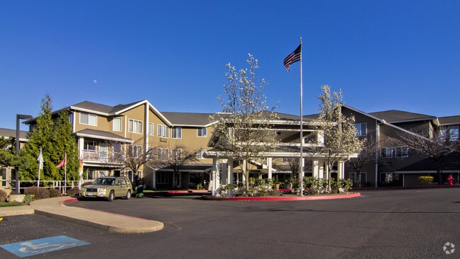
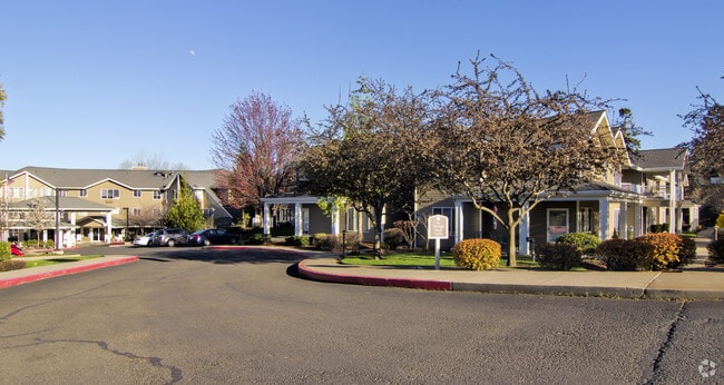
Commercialbuilding
JACKSON
HC
Oregon
B and X Area of moderate flood hazard, usually the area between the limits of the 100-year and 500-year floods.
0.95 AC
2025
Medford/Grants Pass
2026
Other Market Areas
001801
Medford, OR
90,048 SF
10053976
NEARBY LISTINGS FOR SALE OR LEASE
DEMOGRAPHICS near N Main St
1 mile
3 mile
5 mile
2025 Total Population
7,522
23,711
34,516
2030 Population
7,568
24,061
34,805
Pop Growth 2025-2030
+ 0.61%
+ 1.48%
+ 0.84%
Average Age
48
44
44
2025 Total Households
3,568
10,773
15,673
HH Growth 2025-2030
+ 0.50%
+ 1.49%
+ 0.85%
Median Household Inc
$76,659
$66,815
$64,822
Avg Household Size
2.10
2.00
2.10
2025 Avg HH Vehicles
2.00
2.00
2.00
Median Home Value
$688,905
$655,977
$600,676
Median Year Built
1984
1985
1986
Nearby Places
Map Layers
Map Styles
 Street
 Aerial
Layers
 Traffic
 Biking
Places
Listings with unknown addresses are not visible on the map
- Restaurants
- Banks
- Shops
- Fitness
- Groceries
PUBLIC TRANSPORTATION
AIRPORT
Rogue Valley International - Medford
Drive
Walk
Distance
Rogue Valley International - Medford
24 min
15.4 mi
Freight Ports
Port of Coos Bay, OR
Drive
Walk
Distance
Port of Coos Bay, OR
233 min
176.8 mi
Nearby Properties
Address
Land Use
TOTAL SIZE
Lot Size
Zoning
Address
Land Use
TOTAL SIZE
Lot Size
Zoning
17.46 AC
SO
Address
Land Use
TOTAL SIZE
Lot Size
Zoning
78,000 SF
15.17 AC
SO
Address
Land Use
TOTAL SIZE
Lot Size
Zoning
25,300 SF
14.69 AC
SO
Address
Land Use
TOTAL SIZE
Lot Size
Zoning
21.36 AC
SO
Address
Land Use
TOTAL SIZE
Lot Size
Zoning
25.14 AC
R-1-5
Address
Land Use
TOTAL SIZE
Lot Size
Zoning
9.73 AC
R-1-5
Address
Land Use
TOTAL SIZE
Lot Size
Zoning
142,419 SF
6.33 AC
HC
Address
Land Use
TOTAL SIZE
Lot Size
Zoning
11.04 AC
SO
Address
Land Use
TOTAL SIZE
Lot Size
Zoning
80 AC
WR-20
Address
Land Use
TOTAL SIZE
Lot Size
Zoning
12.05 AC
R-2
Address
Land Use
TOTAL SIZE
Lot Size
Zoning
3.83 AC
R-1-5
Address
Land Use
TOTAL SIZE
Lot Size
Zoning
29.34 AC
SO
Address
Land Use
TOTAL SIZE
Lot Size
Zoning
123,060 SF
7.22 AC
SO
Address
Land Use
TOTAL SIZE
Lot Size
Zoning
3.46 AC
R-2
Address
Land Use
TOTAL SIZE
Lot Size
Zoning
31.79 AC
WR-20
Address
Land Use
TOTAL SIZE
Lot Size
Zoning
27.25 AC
WR
Address
Land Use
TOTAL SIZE
Lot Size
Zoning
43,034 SF
0.96 AC
C-1-D
Address
Land Use
TOTAL SIZE
Lot Size
Zoning
26,208 SF
2.85 AC
HC
Address
Land Use
TOTAL SIZE
Lot Size
Zoning
24.96 AC
WR
Address
Land Use
TOTAL SIZE
Lot Size
Zoning
320,862 SF
5.91 AC
C-1
Address
Land Use
TOTAL SIZE
Lot Size
Zoning
26,175 SF
2.57 AC
GC
Address
Land Use
TOTAL SIZE
Lot Size
Zoning
6,633 SF
1.70 AC
C-1
Address
Land Use
TOTAL SIZE
Lot Size
Zoning
20.03 AC
WR-20
Address
Land Use
TOTAL SIZE
Lot Size
Zoning
0.37 AC
C-1-D
Address
Land Use
TOTAL SIZE
Lot Size
Zoning
18.84 AC
WR-20
Address
Land Use
TOTAL SIZE
Lot Size
Zoning
56,386 SF
2.98 AC
C-1
Address
Land Use
TOTAL SIZE
Lot Size
Zoning
65,160 SF
4.82 AC
E-1
Address
Land Use
TOTAL SIZE
Lot Size
Zoning
90,048 SF
1.81 AC
HC
Address
Land Use
TOTAL SIZE
Lot Size
Zoning
26,966 SF
3.42 AC
E-1
Address
Land Use
TOTAL SIZE
Lot Size
Zoning
42,033 SF
8.48 AC
E-1
The World's #1 Commercial Real Estate Marketplace
Connect with us
© 2026 CoStar Group
The information above has been obtained from sources believed reliable. While we do not doubt its accuracy we have not verified it and make no guarantee, warranty or representation about it. It is your responsibility to independently confirm its accuracy and completeness. Any projections, opinions, assumptions, or estimates used are for example only and do not represent the current or future performance of the property. The value of this transaction to you depends on tax and other factors which should be evaluated by your tax, financial, and legal advisors. You and your advisors should conduct a careful, independent investigation of the property to determine to your satisfaction the suitability of the property for your needs.