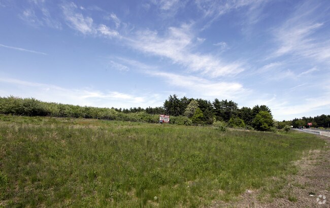
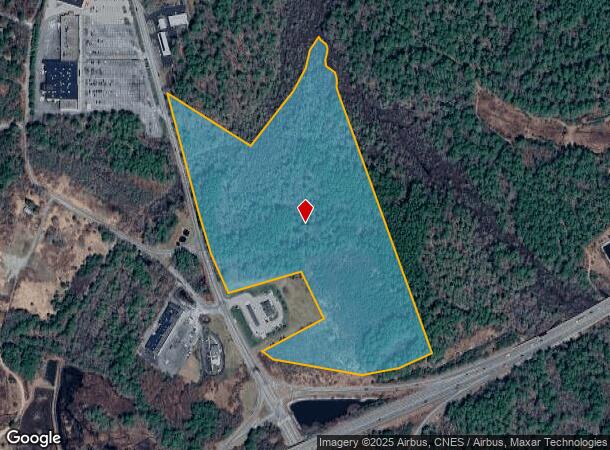
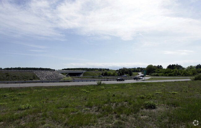
Property Record
N Main St, Carver, MA 02330
NEARBY LISTINGS FOR SALE OR LEASE
Property Detail
N Main St
CARV-000025-000000-000001
Plymouth
Commercialacreage
Massachusetts
A
29.50 AC
25023C0341J
Route 3 South
2025
Boston
2025
Boston-Cambridge-Newton, MA-NH
544200
DEMOGRAPHICS near N Main St
1 Mile
3 Mile
5 Mile
2024 Total Population
987
9,644
28,401
2029 Population
986
9,656
28,520
Pop Growth 2024-2029
(0.10%)
+ 0.12%
+ 0.42%
Average Age
42
42
44
2024 Total Households
346
3,358
10,503
HH Growth 2024-2029
(0.29%)
0.00%
+ 0.30%
Median Household Inc
$81,250
$93,603
$95,747
Avg Household Size
2.80
2.80
2.60
2024 Avg HH Vehicles
2.00
2.00
2.00
Median Home Value
$394,736
$412,777
$414,709
Median Year Built
1976
1977
1979
Nearby Places
Map Layers
Map Styles
 Street
 Aerial
- Restaurants
- Banks
- Shops
- Fitness
- Groceries
PUBLIC TRANSPORTATION
COMMUTER RAIL
Halifax (Kingston/Plymouth Line - Massachusetts Bay Transportation Authority Commuter Rail (Purple Line))
DRIVE
WALK
Distance
Halifax (Kingston/Plymouth Line - Massachusetts Bay Transportation Authority Commuter Rail (Purple Line))
15 min
7.7 mi
Kingston/Route 3 (Kingston/Plymouth Line - Massachusetts Bay Transportation Authority Commuter Rail (Purple Line))
DRIVE
WALK
Distance
Kingston/Route 3 (Kingston/Plymouth Line - Massachusetts Bay Transportation Authority Commuter Rail (Purple Line))
16 min
8.7 mi
Freight Ports
Port of New Bedford Harbor
DRIVE
WALK
Distance
Port of New Bedford Harbor
43 min
29.5 mi
SALE & LEASE HISTORY
LISTING DATE
SALE/LEASE

Oct 05, 2016
For Sale
Nearby Properties
Address
Land Use
TOTAL SIZE
Lot Size
Zoning
Address
Land Use
TOTAL SIZE
Lot Size
Zoning
82.62 AC
I
Address
Land Use
TOTAL SIZE
Lot Size
Zoning
15.13 AC
HC
Address
Land Use
TOTAL SIZE
Lot Size
Zoning
68,240 SF
10 AC
R1
Address
Land Use
TOTAL SIZE
Lot Size
Zoning
33.98 AC
RA
Address
Land Use
TOTAL SIZE
Lot Size
Zoning
45.45 AC
I
Address
Land Use
TOTAL SIZE
Lot Size
Zoning
227 AC
HC
Address
Land Use
TOTAL SIZE
Lot Size
Zoning
76,134 SF
HC
Address
Land Use
TOTAL SIZE
Lot Size
Zoning
5.90 AC
C
Address
Land Use
TOTAL SIZE
Lot Size
Zoning
12.57 AC
RA
Address
Land Use
TOTAL SIZE
Lot Size
Zoning
2,911 SF
123.74 AC
RA
Address
Land Use
TOTAL SIZE
Lot Size
Zoning
6.82 AC
IC
Address
Land Use
TOTAL SIZE
Lot Size
Zoning
1,586 SF
4.06 AC
GB
Address
Land Use
TOTAL SIZE
Lot Size
Zoning
1.20 AC
R1
Address
Land Use
TOTAL SIZE
Lot Size
Zoning
22,030 SF
3.73 AC
HC
Address
Land Use
TOTAL SIZE
Lot Size
Zoning
2,653 SF
B
Address
Land Use
TOTAL SIZE
Lot Size
Zoning
14,182 SF
6.49 AC
Address
Land Use
TOTAL SIZE
Lot Size
Zoning
26,729 SF
2.84 AC
VB
Address
Land Use
TOTAL SIZE
Lot Size
Zoning
3.76 AC
IC
Address
Land Use
TOTAL SIZE
Lot Size
Zoning
2.76 AC
GB
Address
Land Use
TOTAL SIZE
Lot Size
Zoning
1.90 AC
SSI
Address
Land Use
TOTAL SIZE
Lot Size
Zoning
97.20 AC
RA
Address
Land Use
TOTAL SIZE
Lot Size
Zoning
39.70 AC
I
Address
Land Use
TOTAL SIZE
Lot Size
Zoning
3 AC
IC
Address
Land Use
TOTAL SIZE
Lot Size
Zoning
3.01 AC
IC
Address
Land Use
TOTAL SIZE
Lot Size
Zoning
3,195 SF
7.84 AC
RA
Address
Land Use
TOTAL SIZE
Lot Size
Zoning
1,088 SF
202.01 AC
R1
Address
Land Use
TOTAL SIZE
Lot Size
Zoning
6,640 SF
2.91 AC
VB
Address
Land Use
TOTAL SIZE
Lot Size
Zoning
87.39 AC
Address
Land Use
TOTAL SIZE
Lot Size
Zoning
4,272 SF
3.42 AC
HC
The World's #1 Commercial Real Estate Marketplace
Connect with us
© 2025 CoStar Group
The information above has been obtained from sources believed reliable. While we do not doubt its accuracy we have not verified it and make no guarantee, warranty or representation about it. It is your responsibility to independently confirm its accuracy and completeness. Any projections, opinions, assumptions, or estimates used are for example only and do not represent the current or future performance of the property. The value of this transaction to you depends on tax and other factors which should be evaluated by your tax, financial, and legal advisors. You and your advisors should conduct a careful, independent investigation of the property to determine to your satisfaction the suitability of the property for your needs.