Property Record
N Mccarran Blvd, Reno, NV 89503
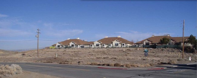


Property Detail
N Mccarran Blvd
002-020-14
FR SW4 SW4 SEC 34 TWP 20 RGE 19
Commercialacreage
WASHOE
PO
Nevada
B and X Area of moderate flood hazard, usually the area between the limits of the 100-year and 500-year floods.
1.25 AC
2025
Downtown
2026
Reno/Sparks
002500
Reno, NV
NEARBY LISTINGS FOR SALE OR LEASE
DEMOGRAPHICS near N Mccarran Blvd
1 mile
3 mile
5 mile
2025 Total Population
8,580
95,080
212,581
2030 Population
8,789
97,488
218,409
Pop Growth 2025-2030
+ 2.44%
+ 2.53%
+ 2.74%
Average Age
39
39
39
2025 Total Households
3,392
40,468
87,066
HH Growth 2025-2030
+ 2.56%
+ 2.60%
+ 2.82%
Median Household Inc
$92,493
$64,124
$68,616
Avg Household Size
2.40
2.20
2.30
2025 Avg HH Vehicles
2.00
2.00
2.00
Median Home Value
$473,308
$501,936
$498,987
Median Year Built
1980
1985
1984
Nearby Places
Map Layers
Map Styles
 Street
 Aerial
Transit
 Traffic
 Biking
Places
Listings with unknown addresses are not visible on the map
- Restaurants
- Banks
- Shops
- Fitness
- Groceries
PUBLIC TRANSPORTATION
COMMUTER RAIL
Reno (California Zephyr - Amtrak)
Drive
Walk
Distance
Reno (California Zephyr - Amtrak)
7 min
3.1 mi
AIRPORT
Reno/Tahoe International
Drive
Walk
Distance
Reno/Tahoe International
29 min
10.2 mi
Freight Ports
Port of Stockton
Drive
Walk
Distance
Port of Stockton
208 min
179.0 mi
SALE & LEASE HISTORY
LISTING DATE
SALE/LEASE

Oct 15, 2019
For Sale
Nov 18, 2016
For Sale
Nearby Properties
Address
Land Use
TOTAL SIZE
Lot Size
Zoning
Address
Land Use
TOTAL SIZE
Lot Size
Zoning
120.45 AC
PF
Address
Land Use
TOTAL SIZE
Lot Size
Zoning
2,041,608 SF
28.47 AC
MU
Address
Land Use
TOTAL SIZE
Lot Size
Zoning
1,865,345 SF
2.75 AC
MD-ED
Address
Land Use
TOTAL SIZE
Lot Size
Zoning
1.47 AC
MD-UD
Address
Land Use
TOTAL SIZE
Lot Size
Zoning
55,187 SF
116.12 AC
GC
Address
Land Use
TOTAL SIZE
Lot Size
Zoning
391,195 SF
53.65 AC
PF
Address
Land Use
TOTAL SIZE
Lot Size
Zoning
507,606 SF
3.42 AC
MU
Address
Land Use
TOTAL SIZE
Lot Size
Zoning
501,541 SF
2.89 AC
MD-ED
Address
Land Use
TOTAL SIZE
Lot Size
Zoning
292,461 SF
1.22 AC
MU
Address
Land Use
TOTAL SIZE
Lot Size
Zoning
378,145 SF
27.36 AC
PD
Address
Land Use
TOTAL SIZE
Lot Size
Zoning
460,367 SF
1.52 AC
MD-ED
Address
Land Use
TOTAL SIZE
Lot Size
Zoning
477,926 SF
54.37 AC
MF14
Address
Land Use
TOTAL SIZE
Lot Size
Zoning
396,810 SF
16.21 AC
PD
Address
Land Use
TOTAL SIZE
Lot Size
Zoning
189,861 SF
1.69 AC
MD-NWQ
Address
Land Use
TOTAL SIZE
Lot Size
Zoning
232,156 SF
1.76 AC
MU
Address
Land Use
TOTAL SIZE
Lot Size
Zoning
460,688 SF
62.55 AC
PF
Address
Land Use
TOTAL SIZE
Lot Size
Zoning
306,626 SF
17.61 AC
MF14 44% /
Address
Land Use
TOTAL SIZE
Lot Size
Zoning
234,478 SF
2.93 AC
MD-ED
Address
Land Use
TOTAL SIZE
Lot Size
Zoning
342,947 SF
8.95 AC
MF30
Address
Land Use
TOTAL SIZE
Lot Size
Zoning
587,380 SF
2.59 AC
MD-ED
Address
Land Use
TOTAL SIZE
Lot Size
Zoning
257,400 SF
2.71 AC
MD-ED
Address
Land Use
TOTAL SIZE
Lot Size
Zoning
434,002 SF
7.64 AC
MD-NWQ
Address
Land Use
TOTAL SIZE
Lot Size
Zoning
194,000 SF
2.24 AC
MD-RD
Address
Land Use
TOTAL SIZE
Lot Size
Zoning
283,243 SF
2.02 AC
MD-UD
Address
Land Use
TOTAL SIZE
Lot Size
Zoning
600 SF
279.66 AC
ME 61% / P
Address
Land Use
TOTAL SIZE
Lot Size
Zoning
304,344 SF
10.24 AC
GC
Address
Land Use
TOTAL SIZE
Lot Size
Zoning
109,936 SF
1.80 AC
MD-RD
Address
Land Use
TOTAL SIZE
Lot Size
Zoning
125,324 SF
2.06 AC
MD-NWQ
Address
Land Use
TOTAL SIZE
Lot Size
Zoning
285,214 SF
11.46 AC
MS
Address
Land Use
TOTAL SIZE
Lot Size
Zoning
100,469 SF
2.76 AC
MD-ED
The World's #1 Commercial Real Estate Marketplace
Connect with us
© 2026 CoStar Group
The information above has been obtained from sources believed reliable. While we do not doubt its accuracy we have not verified it and make no guarantee, warranty or representation about it. It is your responsibility to independently confirm its accuracy and completeness. Any projections, opinions, assumptions, or estimates used are for example only and do not represent the current or future performance of the property. The value of this transaction to you depends on tax and other factors which should be evaluated by your tax, financial, and legal advisors. You and your advisors should conduct a careful, independent investigation of the property to determine to your satisfaction the suitability of the property for your needs.