Property Record
N Narcoossee Rd, Saint Cloud, FL 34771


NEARBY LISTINGS FOR SALE OR LEASE
Property Detail
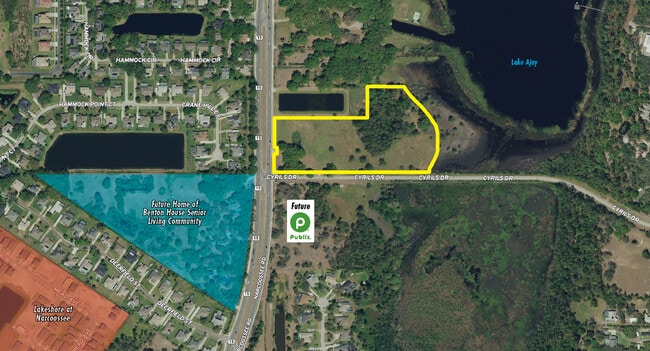
N Narcoossee Rd
Orlando-Kissimmee-Sanford, FL
Narcoossee New Map Of
04-25-31-4260-0001-0140
NEW MAP OF NARCOOSSEE PB 1 PG 73 LOT 14 LESS N 65.75 FT AND LESS COM AT SW COR OF IDLE HOUR EST PB 10 PG 181, S 250 FT TO POB; E 624.92 FT, S 209.75 FT, W 624.92 FT, N 209.75 FT TO POB & LESS BEG AT INTER OF E R/W LINE OF NARCOOSSEE RD & N R/W LINE O
Vacantlandnec
Osceola
A
Florida
12095C0675G
14
2024
9.35 AC
2025
Osceola Outlying
043700
Orlando
2,461 SF
DEMOGRAPHICS near N Narcoossee Rd
1 Mile
3 Mile
5 Mile
2024 Total Population
4,386
27,858
59,664
2029 Population
5,275
32,053
67,864
Pop Growth 2024-2029
+ 20.27%
+ 15.06%
+ 13.74%
Average Age
38
37
37
2024 Total Households
1,433
9,167
20,086
HH Growth 2024-2029
+ 20.17%
+ 14.89%
+ 13.46%
Median Household Inc
$110,534
$104,849
$97,495
Avg Household Size
3.00
3.00
2.90
2024 Avg HH Vehicles
2.00
2.00
2.00
Median Home Value
$384,448
$415,040
$403,167
Median Year Built
2007
2010
2010
Nearby Places
Map Layers
Map Styles
 Street
 Aerial
- Restaurants
- Banks
- Shops
- Fitness
- Groceries
PUBLIC TRANSPORTATION
AIRPORT
Orlando International
DRIVE
WALK
Distance
Orlando International
22 min
14.3 mi
Freight Ports
Port Canaveral
DRIVE
WALK
Distance
Port Canaveral
59 min
47.9 mi
SALE & LEASE HISTORY
LISTING DATE
SALE/LEASE

Oct 05, 2021
For Sale
Nearby Properties
Address
Land Use
TOTAL SIZE
Lot Size
Zoning
Address
Land Use
TOTAL SIZE
Lot Size
Zoning
325,067 SF
13.38 AC
PD/AN
Address
Land Use
TOTAL SIZE
Lot Size
Zoning
403,703 SF
11.96 AC
P-D
Address
Land Use
TOTAL SIZE
Lot Size
Zoning
397,515 SF
1.16 AC
P-D
Address
Land Use
TOTAL SIZE
Lot Size
Zoning
161,219 SF
30 AC
PD/AN
Address
Land Use
TOTAL SIZE
Lot Size
Zoning
266,284 SF
50.40 AC
IN
Address
Land Use
TOTAL SIZE
Lot Size
Zoning
149,679 SF
5.27 AC
PD
Address
Land Use
TOTAL SIZE
Lot Size
Zoning
126,656 SF
1.98 AC
PD/AN
Address
Land Use
TOTAL SIZE
Lot Size
Zoning
90,917 SF
3.16 AC
P-D
Address
Land Use
TOTAL SIZE
Lot Size
Zoning
50,430 SF
10.80 AC
OAC
Address
Land Use
TOTAL SIZE
Lot Size
Zoning
82,668 SF
7.51 AC
PD/AN
Address
Land Use
TOTAL SIZE
Lot Size
Zoning
18,354 SF
129.24 AC
OPD
Address
Land Use
TOTAL SIZE
Lot Size
Zoning
7,159 SF
231.82 AC
A-2
Address
Land Use
TOTAL SIZE
Lot Size
Zoning
280.95 AC
Address
Land Use
TOTAL SIZE
Lot Size
Zoning
17,634 SF
2.15 AC
P-D
Address
Land Use
TOTAL SIZE
Lot Size
Zoning
26,810 SF
3.36 AC
PD/AN
Address
Land Use
TOTAL SIZE
Lot Size
Zoning
19,974 SF
1.42 AC
P-D
Address
Land Use
TOTAL SIZE
Lot Size
Zoning
29,968 SF
3.13 AC
P-D
Address
Land Use
TOTAL SIZE
Lot Size
Zoning
70,109 SF
11.09 AC
Address
Land Use
TOTAL SIZE
Lot Size
Zoning
634.80 AC
OAC
Address
Land Use
TOTAL SIZE
Lot Size
Zoning
8,294 SF
1.29 AC
PD/AN
Address
Land Use
TOTAL SIZE
Lot Size
Zoning
28,520 SF
19.56 AC
PD
Address
Land Use
TOTAL SIZE
Lot Size
Zoning
7,847 SF
19.63 AC
PD
Address
Land Use
TOTAL SIZE
Lot Size
Zoning
161,275 SF
20.45 AC
PD/AN
Address
Land Use
TOTAL SIZE
Lot Size
Zoning
43,910 SF
3.87 AC
OARM
Address
Land Use
TOTAL SIZE
Lot Size
Zoning
49,267 SF
4.18 AC
AC
Address
Land Use
TOTAL SIZE
Lot Size
Zoning
14.20 AC
PD/AN
Address
Land Use
TOTAL SIZE
Lot Size
Zoning
Address
Land Use
TOTAL SIZE
Lot Size
Zoning
5,542 SF
1.08 AC
PD/AN
Address
Land Use
TOTAL SIZE
Lot Size
Zoning
14,464 SF
1.36 AC
AC-N/AN
Address
Land Use
TOTAL SIZE
Lot Size
Zoning
18,780 SF
104.90 AC
OAC
The World's #1 Commercial Real Estate Marketplace
Connect with us
© 2025 CoStar Group
The information above has been obtained from sources believed reliable. While we do not doubt its accuracy we have not verified it and make no guarantee, warranty or representation about it. It is your responsibility to independently confirm its accuracy and completeness. Any projections, opinions, assumptions, or estimates used are for example only and do not represent the current or future performance of the property. The value of this transaction to you depends on tax and other factors which should be evaluated by your tax, financial, and legal advisors. You and your advisors should conduct a careful, independent investigation of the property to determine to your satisfaction the suitability of the property for your needs.