Property Record
N Of Arlington Sta, Bangor, MI 49013

NEARBY LISTINGS FOR SALE OR LEASE
-
-
View all Bangor listings for sale on LoopNet.com
Property Detail
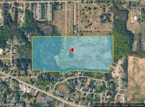
N Of Arlington Sta
Kalamazoo-Portage, MI
Bangor Heights
80-54-407-037-25
A-550-J 7-2-15 1050-89/90 1437-799 1462-412 1488-689 COM AT N 1/4 POST OF SEC, TH S 0 DEG 06'38W ALG N & S 1/4 L 165 FT, TH
Residentialacreage
Van Buren
X
Michigan
26159C0178C
38.90 AC
2024
Van Buren County
2025
West Michigan
012001
DEMOGRAPHICS near N Of Arlington Sta
1 Mile
3 Mile
5 Mile
2024 Total Population
1,834
3,652
6,351
2029 Population
1,811
3,624
6,362
Pop Growth 2024-2029
(1.25%)
(0.77%)
+ 0.17%
Average Age
37
38
39
2024 Total Households
671
1,325
2,324
HH Growth 2024-2029
(1.64%)
(0.98%)
(0.09%)
Median Household Inc
$44,391
$48,970
$52,960
Avg Household Size
2.60
2.60
2.60
2024 Avg HH Vehicles
2.00
2.00
2.00
Median Home Value
$99,999
$120,614
$134,084
Median Year Built
1964
1969
1972
Nearby Places
Map Layers
Map Styles
 Street
 Aerial
- Restaurants
- Banks
- Shops
- Fitness
- Groceries
PUBLIC TRANSPORTATION
COMMUTER RAIL
Bangor Amtrak Station (Pere Marquette - Amtrak)
DRIVE
WALK
Distance
Bangor Amtrak Station (Pere Marquette - Amtrak)
4 min
19 min
1.0 mi
AIRPORT
Kalamazoo/Battle Creek International
DRIVE
WALK
Distance
Kalamazoo/Battle Creek International
56 min
33.4 mi
Freight Ports
Port Milwaukee
DRIVE
WALK
Distance
Port Milwaukee
261 min
215.8 mi
Nearby Properties
Address
Land Use
TOTAL SIZE
Lot Size
Zoning
Address
Land Use
TOTAL SIZE
Lot Size
Zoning
6,627 SF
Address
Land Use
TOTAL SIZE
Lot Size
Zoning
Address
Land Use
TOTAL SIZE
Lot Size
Zoning
80,333 SF
26.36 AC
M-1 INDSTR
Address
Land Use
TOTAL SIZE
Lot Size
Zoning
22,424 SF
12.46 AC
I-1
Address
Land Use
TOTAL SIZE
Lot Size
Zoning
952 SF
57.94 AC
AG
Address
Land Use
TOTAL SIZE
Lot Size
Zoning
32,321 SF
9.88 AC
R3
Address
Land Use
TOTAL SIZE
Lot Size
Zoning
12,000 SF
3.96 AC
I-1
Address
Land Use
TOTAL SIZE
Lot Size
Zoning
1,572 SF
80 AC
AG
Address
Land Use
TOTAL SIZE
Lot Size
Zoning
12,000 SF
4.25 AC
I-1
Address
Land Use
TOTAL SIZE
Lot Size
Zoning
28,560 SF
2.14 AC
I-1
Address
Land Use
TOTAL SIZE
Lot Size
Zoning
3,000 SF
227 AC
AG
Address
Land Use
TOTAL SIZE
Lot Size
Zoning
1,792 SF
63.29 AC
AG
Address
Land Use
TOTAL SIZE
Lot Size
Zoning
180 AC
NO ZONI
Address
Land Use
TOTAL SIZE
Lot Size
Zoning
9,442 SF
20.01 AC
BREEDVILLE
Address
Land Use
TOTAL SIZE
Lot Size
Zoning
160 AC
NO ZONI
Address
Land Use
TOTAL SIZE
Lot Size
Zoning
24,192 SF
2.83 AC
R3
Address
Land Use
TOTAL SIZE
Lot Size
Zoning
11,250 SF
2.30 AC
C
Address
Land Use
TOTAL SIZE
Lot Size
Zoning
920 SF
20 AC
AG
Address
Land Use
TOTAL SIZE
Lot Size
Zoning
5,312 SF
57.88 AC
AG
Address
Land Use
TOTAL SIZE
Lot Size
Zoning
153 AC
NO ZONI
Address
Land Use
TOTAL SIZE
Lot Size
Zoning
40,196 SF
5.14 AC
R1
Address
Land Use
TOTAL SIZE
Lot Size
Zoning
29.13 AC
AG
Address
Land Use
TOTAL SIZE
Lot Size
Zoning
23,506 SF
1.81 AC
B2
Address
Land Use
TOTAL SIZE
Lot Size
Zoning
75.75 AC
AG
Address
Land Use
TOTAL SIZE
Lot Size
Zoning
12,096 SF
2.50 AC
R3
Address
Land Use
TOTAL SIZE
Lot Size
Zoning
9,800 SF
19.25 AC
C
Address
Land Use
TOTAL SIZE
Lot Size
Zoning
36,400 SF
6.50 AC
C
Address
Land Use
TOTAL SIZE
Lot Size
Zoning
9,644 SF
2.09 AC
I-1
Address
Land Use
TOTAL SIZE
Lot Size
Zoning
112 AC
AG
Address
Land Use
TOTAL SIZE
Lot Size
Zoning
20,736 SF
56 AC
C
The World's #1 Commercial Real Estate Marketplace
Connect with us
© 2025 CoStar Group
The information above has been obtained from sources believed reliable. While we do not doubt its accuracy we have not verified it and make no guarantee, warranty or representation about it. It is your responsibility to independently confirm its accuracy and completeness. Any projections, opinions, assumptions, or estimates used are for example only and do not represent the current or future performance of the property. The value of this transaction to you depends on tax and other factors which should be evaluated by your tax, financial, and legal advisors. You and your advisors should conduct a careful, independent investigation of the property to determine to your satisfaction the suitability of the property for your needs.