Property Record
N Preto Blvd, Venice, FL 34293
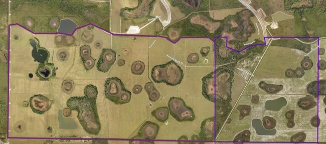

Property Detail
N Preto Blvd
0805-00-1000
ALL OF SEC 8-40-20, LESS LANDS AS DESC IN ORI 2020070402 & ORI 2020135796, ALSO LESS THAT PART OF SAID SEC 8 INCLUDED IN LANDS DESC IN IN ORI 2021097944, LESS MANASOTA BEACH
Miscellaneous
SARASOTA
V
Florida
AE The base floodplain where base flood elevations are provided. AE Zones are now used on new format FIRMs instead of A1-A30 Zones.
219.10 AC
2024
Sarasota Outlying
2025
Tampa/St Petersburg
002510
North Port-Bradenton-Sarasota, FL
NEARBY LISTINGS FOR SALE OR LEASE
DEMOGRAPHICS near N Preto Blvd
1 mile
3 mile
5 mile
2025 Total Population
1,860
12,486
54,661
2030 Population
2,091
13,922
59,313
Pop Growth 2025-2030
+ 12.42%
+ 11.50%
+ 8.51%
Average Age
64
64
60
2025 Total Households
909
6,183
27,393
HH Growth 2025-2030
+ 12.65%
+ 11.55%
+ 8.49%
Median Household Inc
$87,140
$94,250
$76,867
Avg Household Size
1.90
2.00
2.00
2025 Avg HH Vehicles
1.00
2.00
2.00
Median Home Value
$589,575
$549,010
$435,903
Median Year Built
2011
2011
1998
Nearby Places
Map Layers
Map Styles
 Street
 Aerial
Layers
 Traffic
 Biking
Places
Listings with unknown addresses are not visible on the map
- Restaurants
- Banks
- Shops
- Fitness
- Groceries
PUBLIC TRANSPORTATION
AIRPORT
Sarasota/Bradenton International
Drive
Walk
Distance
Sarasota/Bradenton International
59 min
39.5 mi
Punta Gorda
Drive
Walk
Distance
Punta Gorda
60 min
43.3 mi
Freight Ports
Port Manatee
Drive
Walk
Distance
Port Manatee
72 min
52.0 mi
Nearby Properties
Address
Land Use
TOTAL SIZE
Lot Size
Zoning
Address
Land Use
TOTAL SIZE
Lot Size
Zoning
246,789 SF
80.41 AC
V
Address
Land Use
TOTAL SIZE
Lot Size
Zoning
357,609 SF
13.52 AC
V
Address
Land Use
TOTAL SIZE
Lot Size
Zoning
318,959 SF
7.24 AC
V
Address
Land Use
TOTAL SIZE
Lot Size
Zoning
285,151 SF
26.73 AC
V
Address
Land Use
TOTAL SIZE
Lot Size
Zoning
252,890 SF
9.15 AC
V
Address
Land Use
TOTAL SIZE
Lot Size
Zoning
125,619 SF
99.87 AC
GU
Address
Land Use
TOTAL SIZE
Lot Size
Zoning
86,448 SF
11.15 AC
V
Address
Land Use
TOTAL SIZE
Lot Size
Zoning
85,177 SF
68.01 AC
RE1
Address
Land Use
TOTAL SIZE
Lot Size
Zoning
438.77 AC
SAPD
Address
Land Use
TOTAL SIZE
Lot Size
Zoning
30,565 SF
136.67 AC
GU
Address
Land Use
TOTAL SIZE
Lot Size
Zoning
304.41 AC
PUD
Address
Land Use
TOTAL SIZE
Lot Size
Zoning
11,328 SF
30 AC
V
Address
Land Use
TOTAL SIZE
Lot Size
Zoning
63,480 SF
6.22 AC
RMF3
Address
Land Use
TOTAL SIZE
Lot Size
Zoning
112,350 SF
2.84 AC
CG
Address
Land Use
TOTAL SIZE
Lot Size
Zoning
23,573 SF
69.06 AC
V
Address
Land Use
TOTAL SIZE
Lot Size
Zoning
106.85 AC
V
Address
Land Use
TOTAL SIZE
Lot Size
Zoning
51,671 SF
3.51 AC
V
Address
Land Use
TOTAL SIZE
Lot Size
Zoning
124.69 AC
V
Address
Land Use
TOTAL SIZE
Lot Size
Zoning
136.72 AC
OUC
Address
Land Use
TOTAL SIZE
Lot Size
Zoning
216.15 AC
OUE1
Address
Land Use
TOTAL SIZE
Lot Size
Zoning
29.77 AC
V
Address
Land Use
TOTAL SIZE
Lot Size
Zoning
59.62 AC
V
Address
Land Use
TOTAL SIZE
Lot Size
Zoning
94.16 AC
V
Address
Land Use
TOTAL SIZE
Lot Size
Zoning
32,819 SF
4.53 AC
V
Address
Land Use
TOTAL SIZE
Lot Size
Zoning
43,592 SF
173.68 AC
RE1
Address
Land Use
TOTAL SIZE
Lot Size
Zoning
24,206 SF
4.66 AC
V
Address
Land Use
TOTAL SIZE
Lot Size
Zoning
20,363 SF
5.57 AC
V
Address
Land Use
TOTAL SIZE
Lot Size
Zoning
81.06 AC
V
Address
Land Use
TOTAL SIZE
Lot Size
Zoning
20.36 AC
V
The World's #1 Commercial Real Estate Marketplace
Connect with us
© 2026 CoStar Group
The information above has been obtained from sources believed reliable. While we do not doubt its accuracy we have not verified it and make no guarantee, warranty or representation about it. It is your responsibility to independently confirm its accuracy and completeness. Any projections, opinions, assumptions, or estimates used are for example only and do not represent the current or future performance of the property. The value of this transaction to you depends on tax and other factors which should be evaluated by your tax, financial, and legal advisors. You and your advisors should conduct a careful, independent investigation of the property to determine to your satisfaction the suitability of the property for your needs.