Property Record
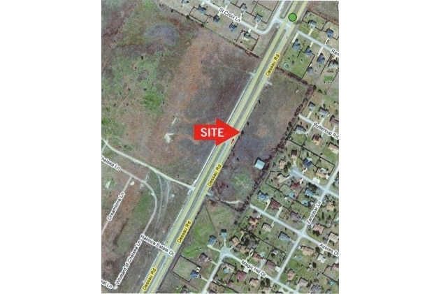
N Railroad Ave, Pflugerville, TX 78660

Property Detail
N Railroad Ave
Austin-Round Rock-San Marcos, TX
ABS 164 SUR 70 CUSHING S & ABS 791 SUR 67 VAR SURVEYS WALTERS A ACR 94.153 TOTAL ROW
263749
TRAVIS
Farms
Texas
A Areas with a 1% annual chance of flooding and a 26% chance of flooding over the life of a 30-year mortgage.
94.15 AC
0
Far Northeast
2025
Austin
042800
NEARBY LISTINGS FOR SALE OR LEASE
DEMOGRAPHICS near N Railroad Ave
1 mile
3 mile
5 mile
2025 Total Population
12,444
89,462
228,353
2030 Population
12,995
93,943
240,188
Pop Growth 2025-2030
+ 4.43%
+ 5.01%
+ 5.18%
Average Age
39
37
37
2025 Total Households
4,171
33,311
88,878
HH Growth 2025-2030
+ 5.13%
+ 5.34%
+ 5.76%
Median Household Inc
$88,509
$86,023
$92,692
Avg Household Size
2.90
2.60
2.50
2025 Avg HH Vehicles
2.00
2.00
2.00
Median Home Value
$373,412
$361,255
$399,690
Median Year Built
2005
2006
2004
Nearby Places
Map Layers
Map Styles
 Street
 Aerial
Layers
 Traffic
 Biking
Places
Listings with unknown addresses are not visible on the map
- Restaurants
- Banks
- Shops
- Fitness
- Groceries
PUBLIC TRANSPORTATION
AIRPORT
Austin-Bergstrom International
Drive
Walk
Distance
Austin-Bergstrom International
37 min
27.6 mi
Freight Ports
Calhoun Port
Drive
Walk
Distance
Calhoun Port
197 min
170.6 mi
Nearby Properties
Address
Land Use
TOTAL SIZE
Lot Size
Zoning
Address
Land Use
TOTAL SIZE
Lot Size
Zoning
3,842,019 SF
92.55 AC
Address
Land Use
TOTAL SIZE
Lot Size
Zoning
4,355 SF
263.17 AC
Address
Land Use
TOTAL SIZE
Lot Size
Zoning
491,412 SF
25.66 AC
Address
Land Use
TOTAL SIZE
Lot Size
Zoning
475,624 SF
64.73 AC
Address
Land Use
TOTAL SIZE
Lot Size
Zoning
393,550 SF
29.76 AC
Address
Land Use
TOTAL SIZE
Lot Size
Zoning
426,415 SF
50 AC
Address
Land Use
TOTAL SIZE
Lot Size
Zoning
400,695 SF
21.02 AC
Address
Land Use
TOTAL SIZE
Lot Size
Zoning
273,462 SF
47.12 AC
Address
Land Use
TOTAL SIZE
Lot Size
Zoning
541,124 SF
60.17 AC
Address
Land Use
TOTAL SIZE
Lot Size
Zoning
371,167 SF
13.18 AC
Address
Land Use
TOTAL SIZE
Lot Size
Zoning
361,440 SF
19.35 AC
Address
Land Use
TOTAL SIZE
Lot Size
Zoning
290,400 SF
42.71 AC
Address
Land Use
TOTAL SIZE
Lot Size
Zoning
377,239 SF
16.95 AC
Address
Land Use
TOTAL SIZE
Lot Size
Zoning
326,015 SF
11.11 AC
Address
Land Use
TOTAL SIZE
Lot Size
Zoning
275,550 SF
10.50 AC
Address
Land Use
TOTAL SIZE
Lot Size
Zoning
272,250 SF
15.31 AC
Address
Land Use
TOTAL SIZE
Lot Size
Zoning
344,341 SF
19.19 AC
PUD
Address
Land Use
TOTAL SIZE
Lot Size
Zoning
307,910 SF
20 AC
Address
Land Use
TOTAL SIZE
Lot Size
Zoning
349,860 SF
16.88 AC
Address
Land Use
TOTAL SIZE
Lot Size
Zoning
252,482 SF
17.43 AC
Address
Land Use
TOTAL SIZE
Lot Size
Zoning
250,376 SF
14.59 AC
Address
Land Use
TOTAL SIZE
Lot Size
Zoning
261,000 SF
17 AC
Address
Land Use
TOTAL SIZE
Lot Size
Zoning
154,420 SF
26.39 AC
Address
Land Use
TOTAL SIZE
Lot Size
Zoning
237,726 SF
13.87 AC
Address
Land Use
TOTAL SIZE
Lot Size
Zoning
239,968 SF
19.75 AC
Address
Land Use
TOTAL SIZE
Lot Size
Zoning
302,604 SF
17.04 AC
Address
Land Use
TOTAL SIZE
Lot Size
Zoning
252,984 SF
16.62 AC
Address
Land Use
TOTAL SIZE
Lot Size
Zoning
264,910 SF
13.57 AC
Address
Land Use
TOTAL SIZE
Lot Size
Zoning
364,599 SF
20.41 AC
Address
Land Use
TOTAL SIZE
Lot Size
Zoning
212,850 SF
11.26 AC
The World's #1 Commercial Real Estate Marketplace
Connect with us
© 2026 CoStar Group
The information above has been obtained from sources believed reliable. While we do not doubt its accuracy we have not verified it and make no guarantee, warranty or representation about it. It is your responsibility to independently confirm its accuracy and completeness. Any projections, opinions, assumptions, or estimates used are for example only and do not represent the current or future performance of the property. The value of this transaction to you depends on tax and other factors which should be evaluated by your tax, financial, and legal advisors. You and your advisors should conduct a careful, independent investigation of the property to determine to your satisfaction the suitability of the property for your needs.