Property Record
N River Rd, Cortland, OH 44410

Property Detail
N River Rd
Youngstown-Warren, OH
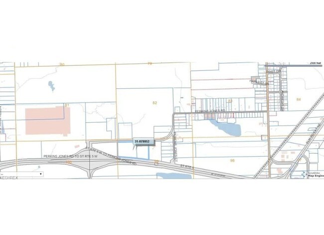
98, 99 & 100 1968.66F 99.990 A SURVEY NORTH RIVER RD
31-902212
TRUMBULL
Industrialacreage
Ohio
B and X Area of moderate flood hazard, usually the area between the limits of the 100-year and 500-year floods.
99.99 AC
2025
Trumbull County
2025
Youngstown/Warren/Boardman
930900
NEARBY LISTINGS FOR SALE OR LEASE
DEMOGRAPHICS near N River Rd
1 mile
3 mile
5 mile
2025 Total Population
562
30,301
74,339
2030 Population
563
30,484
74,486
Pop Growth 2025-2030
+ 0.18%
+ 0.60%
+ 0.20%
Average Age
46
43
42
2025 Total Households
237
13,303
31,629
HH Growth 2025-2030
0.00%
+ 0.40%
+ 0.12%
Median Household Inc
$41,250
$45,622
$47,356
Avg Household Size
2.20
2.10
2.20
2025 Avg HH Vehicles
2.00
2.00
2.00
Median Home Value
$142,168
$119,488
$129,509
Median Year Built
1958
1959
1962
Nearby Places
Map Layers
Map Styles
 Street
 Aerial
Layers
 Traffic
 Biking
Places
Listings with unknown addresses are not visible on the map
- Restaurants
- Banks
- Shops
- Fitness
- Groceries
SALE & LEASE HISTORY
LISTING DATE
SALE/LEASE

Jun 02, 2017
For Sale
Nearby Properties
Address
Land Use
TOTAL SIZE
Lot Size
Zoning
Address
Land Use
TOTAL SIZE
Lot Size
Zoning
283,853 SF
17.20 AC
Address
Land Use
TOTAL SIZE
Lot Size
Zoning
116,311 SF
9.16 AC
Address
Land Use
TOTAL SIZE
Lot Size
Zoning
101,372 SF
0.57 AC
Address
Land Use
TOTAL SIZE
Lot Size
Zoning
98,353 SF
132.90 AC
Address
Land Use
TOTAL SIZE
Lot Size
Zoning
44,600 SF
151.65 AC
Address
Land Use
TOTAL SIZE
Lot Size
Zoning
1,404,342 SF
72.77 AC
Address
Land Use
TOTAL SIZE
Lot Size
Zoning
4,798 SF
41.21 AC
Address
Land Use
TOTAL SIZE
Lot Size
Zoning
14,710 SF
18.82 AC
Address
Land Use
TOTAL SIZE
Lot Size
Zoning
1,417 SF
51.19 AC
Address
Land Use
TOTAL SIZE
Lot Size
Zoning
175,920 SF
17.34 AC
Address
Land Use
TOTAL SIZE
Lot Size
Zoning
27,241 SF
15.10 AC
Address
Land Use
TOTAL SIZE
Lot Size
Zoning
216,467 SF
23.90 AC
Address
Land Use
TOTAL SIZE
Lot Size
Zoning
49.97 AC
Address
Land Use
TOTAL SIZE
Lot Size
Zoning
49,752 SF
11.40 AC
Address
Land Use
TOTAL SIZE
Lot Size
Zoning
66,942 SF
2.07 AC
Address
Land Use
TOTAL SIZE
Lot Size
Zoning
25,067 SF
4.74 AC
Address
Land Use
TOTAL SIZE
Lot Size
Zoning
29.72 AC
Address
Land Use
TOTAL SIZE
Lot Size
Zoning
5,358 SF
15.50 AC
Address
Land Use
TOTAL SIZE
Lot Size
Zoning
160,740 SF
4.08 AC
Address
Land Use
TOTAL SIZE
Lot Size
Zoning
5,358 SF
16.39 AC
Address
Land Use
TOTAL SIZE
Lot Size
Zoning
37,053 SF
16.46 AC
Address
Land Use
TOTAL SIZE
Lot Size
Zoning
253,756 SF
16.25 AC
Address
Land Use
TOTAL SIZE
Lot Size
Zoning
106,350 SF
17.79 AC
Address
Land Use
TOTAL SIZE
Lot Size
Zoning
44,671 SF
1.83 AC
Address
Land Use
TOTAL SIZE
Lot Size
Zoning
38,752 SF
18.49 AC
Address
Land Use
TOTAL SIZE
Lot Size
Zoning
1,732 SF
47.89 AC
Address
Land Use
TOTAL SIZE
Lot Size
Zoning
13,051 SF
10.60 AC
Address
Land Use
TOTAL SIZE
Lot Size
Zoning
19,011 SF
5.37 AC
Address
Land Use
TOTAL SIZE
Lot Size
Zoning
74.93 AC
Address
Land Use
TOTAL SIZE
Lot Size
Zoning
96,480 SF
11.85 AC
The World's #1 Commercial Real Estate Marketplace
Connect with us
© 2026 CoStar Group
The information above has been obtained from sources believed reliable. While we do not doubt its accuracy we have not verified it and make no guarantee, warranty or representation about it. It is your responsibility to independently confirm its accuracy and completeness. Any projections, opinions, assumptions, or estimates used are for example only and do not represent the current or future performance of the property. The value of this transaction to you depends on tax and other factors which should be evaluated by your tax, financial, and legal advisors. You and your advisors should conduct a careful, independent investigation of the property to determine to your satisfaction the suitability of the property for your needs.