Property Record
73 N Route 73 Walk, Winslow, NJ 08095


NEARBY LISTINGS FOR SALE OR LEASE
Property Detail
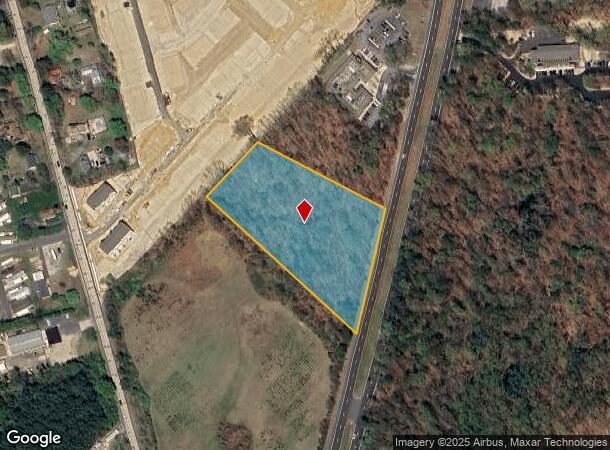
73 N Route 73 Walk
Philadelphia-Camden-Wilmington, PA-NJ-DE-MD
New Jersey State Highway Department Gene
36-02502-0000-00024-01
Camden
Vacantlandnec
New Jersey
X
24.1
34007C0145E
3.45 AC
2024
South Camden County
2025
Philadelphia
609205
DEMOGRAPHICS near 73 N Route 73 Walk
1 Mile
3 Mile
5 Mile
2024 Total Population
3,228
22,809
80,616
2029 Population
3,297
23,054
80,940
Pop Growth 2024-2029
+ 2.14%
+ 1.07%
+ 0.40%
Average Age
43
43
41
2024 Total Households
1,319
8,726
29,339
HH Growth 2024-2029
+ 2.27%
+ 1.23%
+ 0.47%
Median Household Inc
$73,935
$92,552
$91,938
Avg Household Size
2.30
2.50
2.70
2024 Avg HH Vehicles
2.00
2.00
2.00
Median Home Value
$272,189
$256,282
$255,090
Median Year Built
1991
1980
1981
Nearby Places
Map Layers
Map Styles
 Street
 Aerial
- Restaurants
- Banks
- Shops
- Fitness
- Groceries
PUBLIC TRANSPORTATION
COMMUTER RAIL
Atco (Atlantic City Line - NJ Transit Commuter Rail (NJ Transit))
DRIVE
WALK
Distance
Atco (Atlantic City Line - NJ Transit Commuter Rail (NJ Transit))
3 min
2.7 mi
Lindenwold (Njt) (Atlantic City Line - NJ Transit Commuter Rail (NJ Transit))
DRIVE
WALK
Distance
Lindenwold (Njt) (Atlantic City Line - NJ Transit Commuter Rail (NJ Transit))
12 min
9.0 mi
AIRPORT
Philadelphia International
DRIVE
WALK
Distance
Philadelphia International
41 min
27.7 mi
Atlantic City International
DRIVE
WALK
Distance
Atlantic City International
60 min
33.8 mi
Freight Ports
Broadway Terminal - Pier 5
DRIVE
WALK
Distance
Broadway Terminal - Pier 5
26 min
19.2 mi
SALE & LEASE HISTORY
LISTING DATE
SALE/LEASE

Sep 24, 2016
For Sale
Jul 28, 2017
For Sale
Apr 12, 2017
For Sale
Apr 11, 2017
For Sale
Nearby Properties
Address
Land Use
TOTAL SIZE
Lot Size
Zoning
Address
Land Use
TOTAL SIZE
Lot Size
Zoning
6,208 SF
30.73 AC
PARC
Address
Land Use
TOTAL SIZE
Lot Size
Zoning
137.33 AC
PR3
Address
Land Use
TOTAL SIZE
Lot Size
Zoning
88.36 AC
PR4
Address
Land Use
TOTAL SIZE
Lot Size
Zoning
73.95 AC
PI3
Address
Land Use
TOTAL SIZE
Lot Size
Zoning
27.18 AC
PR4
Address
Land Use
TOTAL SIZE
Lot Size
Zoning
155 AC
PI
Address
Land Use
TOTAL SIZE
Lot Size
Zoning
30.01 AC
PR2
Address
Land Use
TOTAL SIZE
Lot Size
Zoning
69,324 SF
20.26 AC
Address
Land Use
TOTAL SIZE
Lot Size
Zoning
59,361 SF
19.21 AC
INST
Address
Land Use
TOTAL SIZE
Lot Size
Zoning
22.93 AC
PC-2
Address
Land Use
TOTAL SIZE
Lot Size
Zoning
14.10 AC
RD-1
Address
Land Use
TOTAL SIZE
Lot Size
Zoning
8.56 AC
PARC
Address
Land Use
TOTAL SIZE
Lot Size
Zoning
0.42 AC
E-1
Address
Land Use
TOTAL SIZE
Lot Size
Zoning
15,950 SF
12.73 AC
C
Address
Land Use
TOTAL SIZE
Lot Size
Zoning
30 AC
PR2
Address
Land Use
TOTAL SIZE
Lot Size
Zoning
5.06 AC
PF
Address
Land Use
TOTAL SIZE
Lot Size
Zoning
15.84 AC
RPF
Address
Land Use
TOTAL SIZE
Lot Size
Zoning
1,718 SF
68.48 AC
PR2
Address
Land Use
TOTAL SIZE
Lot Size
Zoning
7.07 AC
PF
Address
Land Use
TOTAL SIZE
Lot Size
Zoning
116.11 AC
E-1
Address
Land Use
TOTAL SIZE
Lot Size
Zoning
20.99 AC
C-2
Address
Land Use
TOTAL SIZE
Lot Size
Zoning
6.20 AC
Address
Land Use
TOTAL SIZE
Lot Size
Zoning
73.95 AC
PI3
Address
Land Use
TOTAL SIZE
Lot Size
Zoning
1,341 SF
1.98 AC
PHB
Address
Land Use
TOTAL SIZE
Lot Size
Zoning
Address
Land Use
TOTAL SIZE
Lot Size
Zoning
38.85 AC
PHB
Address
Land Use
TOTAL SIZE
Lot Size
Zoning
2.26 AC
C-2
Address
Land Use
TOTAL SIZE
Lot Size
Zoning
10.72 AC
PI1
Address
Land Use
TOTAL SIZE
Lot Size
Zoning
18,934 SF
5.99 AC
C2RG
Address
Land Use
TOTAL SIZE
Lot Size
Zoning
4.67 AC
PC2
The World's #1 Commercial Real Estate Marketplace
Connect with us
© 2025 CoStar Group
The information above has been obtained from sources believed reliable. While we do not doubt its accuracy we have not verified it and make no guarantee, warranty or representation about it. It is your responsibility to independently confirm its accuracy and completeness. Any projections, opinions, assumptions, or estimates used are for example only and do not represent the current or future performance of the property. The value of this transaction to you depends on tax and other factors which should be evaluated by your tax, financial, and legal advisors. You and your advisors should conduct a careful, independent investigation of the property to determine to your satisfaction the suitability of the property for your needs.