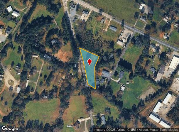
Property Record
512 N Ford Rd, Greer, SC 29651

NEARBY LISTINGS FOR SALE OR LEASE
Property Detail
512 N Ford Rd
Greenville-Anderson-Greer, SC
Survey For Scott Banta
T009.03-01-016.01
MAP T009.03; A
Warehouse
Greenville
X
South Carolina
45045C0429E
016.01
2024
1.36 AC
2024
Greer/Taylors
002505
Greenville/Spartanburg
DEMOGRAPHICS near 512 N Ford Rd
1 Mile
3 Mile
5 Mile
2024 Total Population
3,030
36,025
105,922
2029 Population
3,325
39,715
116,876
Pop Growth 2024-2029
+ 9.74%
+ 10.24%
+ 10.34%
Average Age
43
40
40
2024 Total Households
1,200
14,388
41,719
HH Growth 2024-2029
+ 9.83%
+ 10.34%
+ 10.43%
Median Household Inc
$77,150
$66,924
$69,122
Avg Household Size
2.50
2.50
2.50
2024 Avg HH Vehicles
2.00
2.00
2.00
Median Home Value
$241,296
$229,478
$239,499
Median Year Built
1991
1993
1990
Nearby Places
Map Layers
Map Styles
 Street
 Aerial
- Restaurants
- Banks
- Shops
- Fitness
- Groceries
PUBLIC TRANSPORTATION
AIRPORT
Greenville Spartanburg International
DRIVE
WALK
Distance
Greenville Spartanburg International
20 min
8.6 mi
Freight Ports
North Charleston Terminal
DRIVE
WALK
Distance
North Charleston Terminal
241 min
208.9 mi
SALE & LEASE HISTORY
LISTING DATE
SALE/LEASE

May 26, 2022
For Sale
Jul 15, 2024
For Sale
Nearby Properties
Address
Land Use
TOTAL SIZE
Lot Size
Zoning
Address
Land Use
TOTAL SIZE
Lot Size
Zoning
5.07 AC
C2
Address
Land Use
TOTAL SIZE
Lot Size
Zoning
14.20 AC
UNZONED
Address
Land Use
TOTAL SIZE
Lot Size
Zoning
13.25 AC
I1
Address
Land Use
TOTAL SIZE
Lot Size
Zoning
11.80 AC
R10
Address
Land Use
TOTAL SIZE
Lot Size
Zoning
11.30 AC
R10
Address
Land Use
TOTAL SIZE
Lot Size
Zoning
8.22 AC
I1
Address
Land Use
TOTAL SIZE
Lot Size
Zoning
1.90 AC
I1
Address
Land Use
TOTAL SIZE
Lot Size
Zoning
25.70 AC
R20
Address
Land Use
TOTAL SIZE
Lot Size
Zoning
6.81 AC
RM
Address
Land Use
TOTAL SIZE
Lot Size
Zoning
10.20 AC
S1
Address
Land Use
TOTAL SIZE
Lot Size
Zoning
41.90 AC
RMA
Address
Land Use
TOTAL SIZE
Lot Size
Zoning
14.33 AC
I1
Address
Land Use
TOTAL SIZE
Lot Size
Zoning
22.35 AC
R20
Address
Land Use
TOTAL SIZE
Lot Size
Zoning
6.90 AC
I1
Address
Land Use
TOTAL SIZE
Lot Size
Zoning
19.02 AC
RRROW
Address
Land Use
TOTAL SIZE
Lot Size
Zoning
7.12 AC
R15
Address
Land Use
TOTAL SIZE
Lot Size
Zoning
5.47 AC
RM1
Address
Land Use
TOTAL SIZE
Lot Size
Zoning
6.62 AC
I1
Address
Land Use
TOTAL SIZE
Lot Size
Zoning
4.85 AC
I1
Address
Land Use
TOTAL SIZE
Lot Size
Zoning
99.01 AC
I1
Address
Land Use
TOTAL SIZE
Lot Size
Zoning
1.03 AC
RM
Address
Land Use
TOTAL SIZE
Lot Size
Zoning
82.10 AC
S1
Address
Land Use
TOTAL SIZE
Lot Size
Zoning
9.14 AC
R75
Address
Land Use
TOTAL SIZE
Lot Size
Zoning
12 AC
RM
Address
Land Use
TOTAL SIZE
Lot Size
Zoning
3.91 AC
I1
Address
Land Use
TOTAL SIZE
Lot Size
Zoning
71.11 AC
RS
Address
Land Use
TOTAL SIZE
Lot Size
Zoning
15.40 AC
I1
Address
Land Use
TOTAL SIZE
Lot Size
Zoning
1.70 AC
R75
Address
Land Use
TOTAL SIZE
Lot Size
Zoning
14.31 AC
I1
Address
Land Use
TOTAL SIZE
Lot Size
Zoning
17.32 AC
C3
The World's #1 Commercial Real Estate Marketplace
Connect with us
© 2026 CoStar Group
The information above has been obtained from sources believed reliable. While we do not doubt its accuracy we have not verified it and make no guarantee, warranty or representation about it. It is your responsibility to independently confirm its accuracy and completeness. Any projections, opinions, assumptions, or estimates used are for example only and do not represent the current or future performance of the property. The value of this transaction to you depends on tax and other factors which should be evaluated by your tax, financial, and legal advisors. You and your advisors should conduct a careful, independent investigation of the property to determine to your satisfaction the suitability of the property for your needs.