Property Record
N Thornton Rd, Casa Grande, AZ 85122

NEARBY LISTINGS FOR SALE OR LEASE
-
-
-
-
-
SEC N Trekell Rd and E Rodeo Rd
Casa Grande, AZ 85122
$7,451,374 - $23,945,368
24.53 - 34.49 AC Lot
Land
-
-
-
View all Casa Grande listings for sale on LoopNet.com
Property Detail
N Thornton Rd
Phoenix-Mesa-Scottsdale, AZ
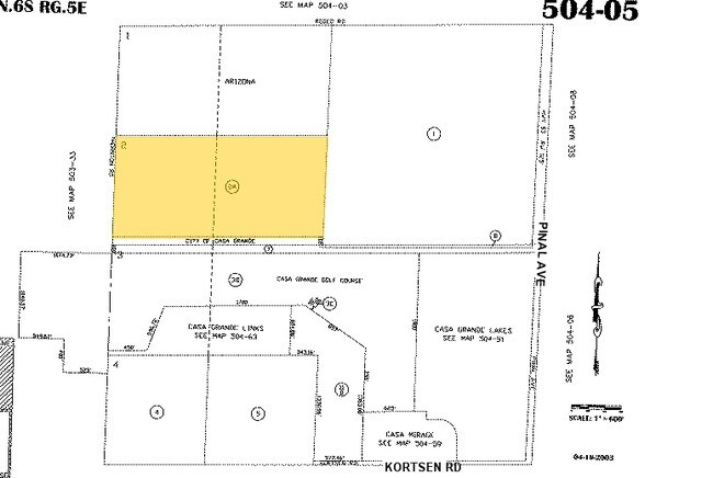
LOT 2 & THE SE NW OF SEC 7-6S-6E EXC THE S-100 THEREOF AS DEEDED TO THE CITY IN 1200/706-708 70.74 AC
504-05-002A
Pinal
Vacantlandnec
Arizona
A
2
04021C1170E
70.74 AC
2024
Pinal County
2025
Phoenix
001306
DEMOGRAPHICS near N Thornton Rd
1 Mile
3 Mile
5 Mile
2024 Total Population
3,804
36,866
63,682
2029 Population
4,855
46,847
80,680
Pop Growth 2024-2029
+ 27.63%
+ 27.07%
+ 26.69%
Average Age
43
39
40
2024 Total Households
1,498
13,235
22,830
HH Growth 2024-2029
+ 27.44%
+ 26.65%
+ 26.16%
Median Household Inc
$60,650
$59,995
$63,674
Avg Household Size
2.50
2.70
2.70
2024 Avg HH Vehicles
2.00
2.00
2.00
Median Home Value
$284,108
$238,082
$240,905
Median Year Built
2003
1998
2000
Nearby Places
Map Layers
Map Styles
 Street
 Aerial
- Restaurants
- Banks
- Shops
- Fitness
- Groceries
PUBLIC TRANSPORTATION
AIRPORT
Phoenix-Mesa Gateway
DRIVE
WALK
Distance
Phoenix-Mesa Gateway
61 min
40.2 mi
Nearby Properties
Address
Land Use
TOTAL SIZE
Lot Size
Zoning
Address
Land Use
TOTAL SIZE
Lot Size
Zoning
525,773 SF
27.24 AC
UNDESIGNAT
Address
Land Use
TOTAL SIZE
Lot Size
Zoning
223,443 SF
176.81 AC
Address
Land Use
TOTAL SIZE
Lot Size
Zoning
289,599 SF
65.03 AC
Address
Land Use
TOTAL SIZE
Lot Size
Zoning
286,759 SF
37.76 AC
UNDESIGNAT
Address
Land Use
TOTAL SIZE
Lot Size
Zoning
123,963 SF
15.43 AC
UNDESIGNAT
Address
Land Use
TOTAL SIZE
Lot Size
Zoning
162,113 SF
20 AC
Address
Land Use
TOTAL SIZE
Lot Size
Zoning
172,746 SF
14.70 AC
UNDESIGNAT
Address
Land Use
TOTAL SIZE
Lot Size
Zoning
264,993 SF
26.48 AC
Address
Land Use
TOTAL SIZE
Lot Size
Zoning
55,295 SF
12.14 AC
Address
Land Use
TOTAL SIZE
Lot Size
Zoning
107,832 SF
11.50 AC
Address
Land Use
TOTAL SIZE
Lot Size
Zoning
81,467 SF
11.96 AC
Address
Land Use
TOTAL SIZE
Lot Size
Zoning
93,477 SF
4.22 AC
UNDESIGNAT
Address
Land Use
TOTAL SIZE
Lot Size
Zoning
111,066 SF
5.04 AC
UNDESIGNAT
Address
Land Use
TOTAL SIZE
Lot Size
Zoning
395,597 SF
13.81 AC
Address
Land Use
TOTAL SIZE
Lot Size
Zoning
67,163 SF
24.27 AC
UNDESIGNAT
Address
Land Use
TOTAL SIZE
Lot Size
Zoning
840 SF
80 AC
Address
Land Use
TOTAL SIZE
Lot Size
Zoning
51,866 SF
5.88 AC
UNDESIGNAT
Address
Land Use
TOTAL SIZE
Lot Size
Zoning
48,543 SF
3.04 AC
UNDESIGNAT
Address
Land Use
TOTAL SIZE
Lot Size
Zoning
15,122 SF
114.70 AC
UNDESIGNAT
Address
Land Use
TOTAL SIZE
Lot Size
Zoning
711 SF
67.24 AC
UNDESIGNAT
Address
Land Use
TOTAL SIZE
Lot Size
Zoning
127,626 SF
19.13 AC
UNDESIGNAT
Address
Land Use
TOTAL SIZE
Lot Size
Zoning
Address
Land Use
TOTAL SIZE
Lot Size
Zoning
59.61 AC
UNDESIGNAT
Address
Land Use
TOTAL SIZE
Lot Size
Zoning
151 AC
UNDESIGNAT
Address
Land Use
TOTAL SIZE
Lot Size
Zoning
13,414 SF
2.01 AC
Address
Land Use
TOTAL SIZE
Lot Size
Zoning
303,129 SF
4.03 AC
UNDESIGNAT
Address
Land Use
TOTAL SIZE
Lot Size
Zoning
31,252 SF
2.89 AC
Address
Land Use
TOTAL SIZE
Lot Size
Zoning
87,203 SF
13.23 AC
UNDESIGNAT
The World's #1 Commercial Real Estate Marketplace
Connect with us
© 2025 CoStar Group
The information above has been obtained from sources believed reliable. While we do not doubt its accuracy we have not verified it and make no guarantee, warranty or representation about it. It is your responsibility to independently confirm its accuracy and completeness. Any projections, opinions, assumptions, or estimates used are for example only and do not represent the current or future performance of the property. The value of this transaction to you depends on tax and other factors which should be evaluated by your tax, financial, and legal advisors. You and your advisors should conduct a careful, independent investigation of the property to determine to your satisfaction the suitability of the property for your needs.