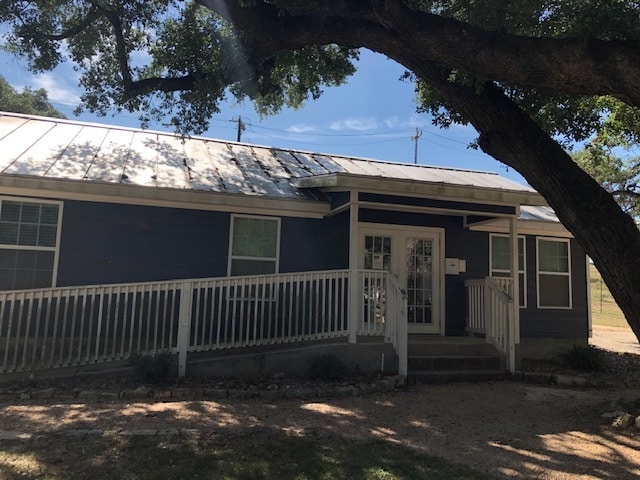
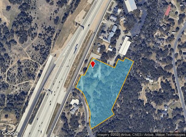
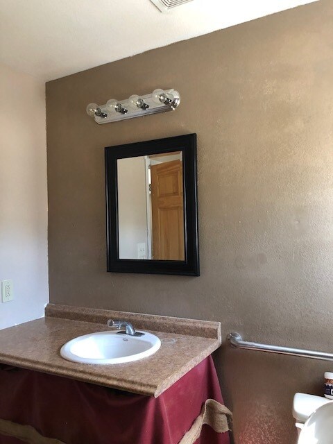
Property Record
N Us Highway 281, San Antonio, TX 78261
NEARBY LISTINGS FOR SALE OR LEASE
-
-
View all San Antonio listings for lease on LoopNet.com
Property Detail
N Us Highway 281
San Antonio
Ncb 19202 (Hill Country Square-Country P
San Antonio-New Braunfels, TX
NCB 19202 (HILL COUNTRY SQUARE-COUNTRY PLACE), BLOCK 1 LOT 7 2022- NA PER PLAT 20002/741-742 FILED 5-28-2021. ASGIS08-09-2021.
19202-001-0070
Bexar
Commercialnec
Texas
2024
7
2025
6.16 AC
121912
Far North Central
968 SF
DEMOGRAPHICS near N Us Highway 281
1 Mile
3 Mile
5 Mile
2024 Total Population
1,967
31,332
86,403
2029 Population
2,108
34,221
95,883
Pop Growth 2024-2029
+ 7.17%
+ 9.22%
+ 10.97%
Average Age
39
37
37
2024 Total Households
644
10,278
29,223
HH Growth 2024-2029
+ 7.14%
+ 9.60%
+ 11.38%
Median Household Inc
$136,582
$118,861
$118,168
Avg Household Size
3.10
3.00
2.90
2024 Avg HH Vehicles
2.00
2.00
2.00
Median Home Value
$360,970
$365,937
$389,577
Median Year Built
2010
2007
2008
Nearby Places
Map Layers
Map Styles
 Street
 Aerial
- Restaurants
- Banks
- Shops
- Fitness
- Groceries
PUBLIC TRANSPORTATION
AIRPORT
San Antonio International
DRIVE
WALK
Distance
San Antonio International
19 min
15.6 mi
Freight Ports
Calhoun Port
DRIVE
WALK
Distance
Calhoun Port
196 min
164.4 mi
SALE & LEASE HISTORY
LISTING DATE
SALE/LEASE

Jul 24, 2020
For Lease
Nearby Properties
Address
Land Use
TOTAL SIZE
Lot Size
Zoning
Address
Land Use
TOTAL SIZE
Lot Size
Zoning
310,384 SF
14.25 AC
Address
Land Use
TOTAL SIZE
Lot Size
Zoning
123,938 SF
27.21 AC
Address
Land Use
TOTAL SIZE
Lot Size
Zoning
296,413 SF
15 AC
Address
Land Use
TOTAL SIZE
Lot Size
Zoning
137,704 SF
26.31 AC
Address
Land Use
TOTAL SIZE
Lot Size
Zoning
35,888 SF
6.06 AC
Address
Land Use
TOTAL SIZE
Lot Size
Zoning
54,150 SF
3.47 AC
Address
Land Use
TOTAL SIZE
Lot Size
Zoning
28,128 SF
10.66 AC
Address
Land Use
TOTAL SIZE
Lot Size
Zoning
28.60 AC
Address
Land Use
TOTAL SIZE
Lot Size
Zoning
25.20 AC
Address
Land Use
TOTAL SIZE
Lot Size
Zoning
22.75 AC
Address
Land Use
TOTAL SIZE
Lot Size
Zoning
20.13 AC
Address
Land Use
TOTAL SIZE
Lot Size
Zoning
19,952 SF
3.32 AC
Address
Land Use
TOTAL SIZE
Lot Size
Zoning
74,320 SF
4.55 AC
Address
Land Use
TOTAL SIZE
Lot Size
Zoning
12,004 SF
3.37 AC
Address
Land Use
TOTAL SIZE
Lot Size
Zoning
76,120 SF
3.90 AC
Address
Land Use
TOTAL SIZE
Lot Size
Zoning
264.41 AC
Address
Land Use
TOTAL SIZE
Lot Size
Zoning
20.95 AC
Address
Land Use
TOTAL SIZE
Lot Size
Zoning
5,508 SF
3.50 AC
Address
Land Use
TOTAL SIZE
Lot Size
Zoning
Address
Land Use
TOTAL SIZE
Lot Size
Zoning
183.24 AC
Address
Land Use
TOTAL SIZE
Lot Size
Zoning
19.32 AC
Address
Land Use
TOTAL SIZE
Lot Size
Zoning
5,400 SF
3.24 AC
Address
Land Use
TOTAL SIZE
Lot Size
Zoning
36,419 SF
3.85 AC
Address
Land Use
TOTAL SIZE
Lot Size
Zoning
8,740 SF
6.36 AC
Address
Land Use
TOTAL SIZE
Lot Size
Zoning
65,156 SF
5.53 AC
Address
Land Use
TOTAL SIZE
Lot Size
Zoning
57,226 SF
6.95 AC
Address
Land Use
TOTAL SIZE
Lot Size
Zoning
17,000 SF
1.77 AC
Address
Land Use
TOTAL SIZE
Lot Size
Zoning
134.81 AC
Address
Land Use
TOTAL SIZE
Lot Size
Zoning
9.23 AC
Address
Land Use
TOTAL SIZE
Lot Size
Zoning
71,743 SF
6.87 AC
The World's #1 Commercial Real Estate Marketplace
Connect with us
© 2026 CoStar Group
The information above has been obtained from sources believed reliable. While we do not doubt its accuracy we have not verified it and make no guarantee, warranty or representation about it. It is your responsibility to independently confirm its accuracy and completeness. Any projections, opinions, assumptions, or estimates used are for example only and do not represent the current or future performance of the property. The value of this transaction to you depends on tax and other factors which should be evaluated by your tax, financial, and legal advisors. You and your advisors should conduct a careful, independent investigation of the property to determine to your satisfaction the suitability of the property for your needs.