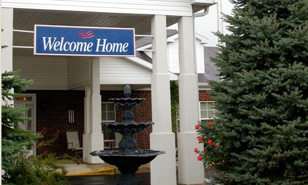
Property Record
N Woods Dr, Kokomo, IN 46901
NEARBY LISTINGS FOR SALE OR LEASE
-
-
View all Kokomo listings for sale on LoopNet.com
Property Detail
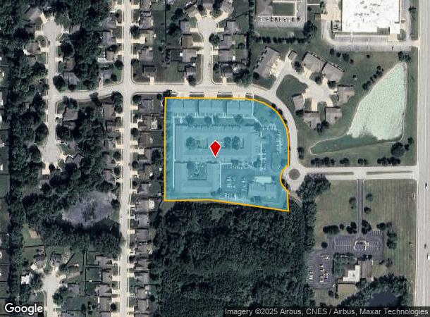
N Woods Dr
Kokomo, IN
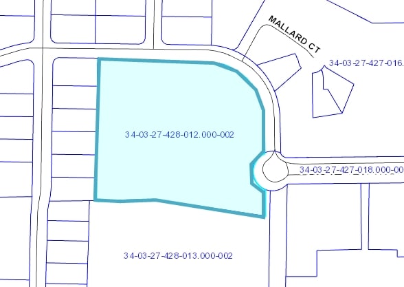
North Woods Commons Minor Sub
34-03-27-428-012.000-002
NORTH WOODS COMMONS MINOR S/D SEC 1 LOT 1 5.03 AC
Commercialnec
Howard
X
Indiana
18067C0206C
1
2024
5.03 AC
2025
Lafayette/Kokomo
000400
Other Market Areas
22,094 SF
DEMOGRAPHICS near N Woods Dr
1 Mile
3 Mile
5 Mile
2024 Total Population
5,416
40,089
60,921
2029 Population
5,273
40,370
61,029
Pop Growth 2024-2029
(2.64%)
+ 0.70%
+ 0.18%
Average Age
45
41
41
2024 Total Households
2,320
17,371
26,667
HH Growth 2024-2029
(3.10%)
+ 0.67%
+ 0.13%
Median Household Inc
$56,442
$48,269
$51,528
Avg Household Size
2.10
2.20
2.20
2024 Avg HH Vehicles
2.00
2.00
2.00
Median Home Value
$144,109
$104,896
$129,063
Median Year Built
1969
1959
1965
Nearby Places
Map Layers
Map Styles
 Street
 Aerial
- Restaurants
- Banks
- Shops
- Fitness
- Groceries
Nearby Properties
Address
Land Use
TOTAL SIZE
Lot Size
Zoning
Address
Land Use
TOTAL SIZE
Lot Size
Zoning
1,642,721 SF
83.45 AC
Address
Land Use
TOTAL SIZE
Lot Size
Zoning
27,882 SF
23.48 AC
Address
Land Use
TOTAL SIZE
Lot Size
Zoning
38,390 SF
1.97 AC
Address
Land Use
TOTAL SIZE
Lot Size
Zoning
123,984 SF
24.89 AC
Address
Land Use
TOTAL SIZE
Lot Size
Zoning
11,936 SF
1.18 AC
Address
Land Use
TOTAL SIZE
Lot Size
Zoning
42,614 SF
16.34 AC
Address
Land Use
TOTAL SIZE
Lot Size
Zoning
60,046 SF
11.36 AC
Address
Land Use
TOTAL SIZE
Lot Size
Zoning
45,174 SF
7.77 AC
Address
Land Use
TOTAL SIZE
Lot Size
Zoning
215,028 SF
65.23 AC
Address
Land Use
TOTAL SIZE
Lot Size
Zoning
72,476 SF
3.87 AC
Address
Land Use
TOTAL SIZE
Lot Size
Zoning
28,188 SF
13.49 AC
Address
Land Use
TOTAL SIZE
Lot Size
Zoning
26,632 SF
5.80 AC
Address
Land Use
TOTAL SIZE
Lot Size
Zoning
12,120 SF
19.93 AC
Address
Land Use
TOTAL SIZE
Lot Size
Zoning
1,386 SF
1.48 AC
Address
Land Use
TOTAL SIZE
Lot Size
Zoning
15,378 SF
2.26 AC
Address
Land Use
TOTAL SIZE
Lot Size
Zoning
3,920 SF
24.97 AC
Address
Land Use
TOTAL SIZE
Lot Size
Zoning
8,526 SF
4 AC
Address
Land Use
TOTAL SIZE
Lot Size
Zoning
114,512 SF
11.38 AC
Address
Land Use
TOTAL SIZE
Lot Size
Zoning
326,986 SF
49.85 AC
Address
Land Use
TOTAL SIZE
Lot Size
Zoning
51,675 SF
10.39 AC
Address
Land Use
TOTAL SIZE
Lot Size
Zoning
186,518 SF
0.44 AC
Address
Land Use
TOTAL SIZE
Lot Size
Zoning
13,126 SF
0.59 AC
Address
Land Use
TOTAL SIZE
Lot Size
Zoning
21,676 SF
12.93 AC
Address
Land Use
TOTAL SIZE
Lot Size
Zoning
65,675 SF
7.60 AC
Address
Land Use
TOTAL SIZE
Lot Size
Zoning
20,408 SF
6.69 AC
Address
Land Use
TOTAL SIZE
Lot Size
Zoning
13,440 SF
0.91 AC
Address
Land Use
TOTAL SIZE
Lot Size
Zoning
22,082 SF
5.28 AC
Address
Land Use
TOTAL SIZE
Lot Size
Zoning
61.23 AC
Address
Land Use
TOTAL SIZE
Lot Size
Zoning
61.70 AC
The World's #1 Commercial Real Estate Marketplace
Connect with us
© 2026 CoStar Group
The information above has been obtained from sources believed reliable. While we do not doubt its accuracy we have not verified it and make no guarantee, warranty or representation about it. It is your responsibility to independently confirm its accuracy and completeness. Any projections, opinions, assumptions, or estimates used are for example only and do not represent the current or future performance of the property. The value of this transaction to you depends on tax and other factors which should be evaluated by your tax, financial, and legal advisors. You and your advisors should conduct a careful, independent investigation of the property to determine to your satisfaction the suitability of the property for your needs.