Property Record
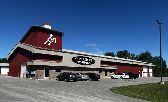
N1213 Mayflower Dr, Greenville, WI 54942

NEARBY LISTINGS FOR SALE OR LEASE
Property Detail
N1213 Mayflower Dr
11-1-0856-02
COM NE COR SE NE N59.20FT TO BEG W154.5FT S24D W120FT HY 76 N65D W ON HY 292.75FT N18D E170FT N65D W62.11FT N248.38FT E473FT S445.95FT BEG PRT NE NE & PRT SENE SEC24 T21N R16E
Commercialnec
Outagamie
X
Wisconsin
55087C0311E
5.08 AC
2024
Outagamie County
2024
Green Bay
012604
Appleton, WI
DEMOGRAPHICS near N1213 Mayflower Dr
1 Mile
3 Mile
5 Mile
2024 Total Population
2,639
25,301
81,787
2029 Population
2,676
25,924
84,006
Pop Growth 2024-2029
+ 1.40%
+ 2.46%
+ 2.71%
Average Age
39
40
40
2024 Total Households
1,154
10,563
34,006
HH Growth 2024-2029
+ 1.73%
+ 2.66%
+ 2.76%
Median Household Inc
$88,940
$84,227
$73,026
Avg Household Size
2.30
2.30
2.30
2024 Avg HH Vehicles
2.00
2.00
2.00
Median Home Value
$264,221
$266,634
$226,559
Median Year Built
1999
1991
1980
Nearby Places
Map Layers
Map Styles
 Street
 Aerial
- Restaurants
- Banks
- Shops
- Fitness
- Groceries
PUBLIC TRANSPORTATION
AIRPORT
Appleton International
DRIVE
WALK
Distance
Appleton International
13 min
6.7 mi
Green Bay/Austin Straubel International
DRIVE
WALK
Distance
Green Bay/Austin Straubel International
39 min
30.1 mi
Freight Ports
Port Milwaukee
DRIVE
WALK
Distance
Port Milwaukee
128 min
108.9 mi
SALE & LEASE HISTORY
LISTING DATE
SALE/LEASE

Sep 25, 2016
For Lease
Jul 28, 2022
For Lease
Jul 08, 2020
For Lease
Aug 02, 2019
For Lease
Nearby Properties
Address
Land Use
TOTAL SIZE
Lot Size
Zoning
Address
Land Use
TOTAL SIZE
Lot Size
Zoning
645,392 SF
25.87 AC
Address
Land Use
TOTAL SIZE
Lot Size
Zoning
Address
Land Use
TOTAL SIZE
Lot Size
Zoning
267,069 SF
26.76 AC
Address
Land Use
TOTAL SIZE
Lot Size
Zoning
18.34 AC
Address
Land Use
TOTAL SIZE
Lot Size
Zoning
278,801 SF
20.94 AC
Address
Land Use
TOTAL SIZE
Lot Size
Zoning
23.68 AC
Address
Land Use
TOTAL SIZE
Lot Size
Zoning
37,900 SF
0.67 AC
Address
Land Use
TOTAL SIZE
Lot Size
Zoning
148,743 SF
17.58 AC
Address
Land Use
TOTAL SIZE
Lot Size
Zoning
15.06 AC
Address
Land Use
TOTAL SIZE
Lot Size
Zoning
81,252 SF
8.32 AC
Address
Land Use
TOTAL SIZE
Lot Size
Zoning
34,232 SF
18.18 AC
Address
Land Use
TOTAL SIZE
Lot Size
Zoning
249,444 SF
18.81 AC
Address
Land Use
TOTAL SIZE
Lot Size
Zoning
30.16 AC
Address
Land Use
TOTAL SIZE
Lot Size
Zoning
82,199 SF
6.97 AC
Address
Land Use
TOTAL SIZE
Lot Size
Zoning
194,738 SF
19.73 AC
Address
Land Use
TOTAL SIZE
Lot Size
Zoning
22.26 AC
Address
Land Use
TOTAL SIZE
Lot Size
Zoning
25.59 AC
Address
Land Use
TOTAL SIZE
Lot Size
Zoning
39,510 SF
7.73 AC
Address
Land Use
TOTAL SIZE
Lot Size
Zoning
189,722 SF
21.52 AC
Address
Land Use
TOTAL SIZE
Lot Size
Zoning
97,355 SF
7.99 AC
Address
Land Use
TOTAL SIZE
Lot Size
Zoning
14.03 AC
Address
Land Use
TOTAL SIZE
Lot Size
Zoning
42,402 SF
3.39 AC
Address
Land Use
TOTAL SIZE
Lot Size
Zoning
23.80 AC
Address
Land Use
TOTAL SIZE
Lot Size
Zoning
6.74 AC
Address
Land Use
TOTAL SIZE
Lot Size
Zoning
166,336 SF
8.94 AC
Address
Land Use
TOTAL SIZE
Lot Size
Zoning
348,970 SF
17.82 AC
Address
Land Use
TOTAL SIZE
Lot Size
Zoning
46,610 SF
4.85 AC
Address
Land Use
TOTAL SIZE
Lot Size
Zoning
30,716 SF
4.02 AC
Address
Land Use
TOTAL SIZE
Lot Size
Zoning
134,379 SF
6.57 AC
Address
Land Use
TOTAL SIZE
Lot Size
Zoning
48.13 AC
The World's #1 Commercial Real Estate Marketplace
Connect with us
© 2026 CoStar Group
The information above has been obtained from sources believed reliable. While we do not doubt its accuracy we have not verified it and make no guarantee, warranty or representation about it. It is your responsibility to independently confirm its accuracy and completeness. Any projections, opinions, assumptions, or estimates used are for example only and do not represent the current or future performance of the property. The value of this transaction to you depends on tax and other factors which should be evaluated by your tax, financial, and legal advisors. You and your advisors should conduct a careful, independent investigation of the property to determine to your satisfaction the suitability of the property for your needs.